Vamora
Jump to navigation
Jump to search
Vamora | |
|---|---|
|
Flag | |
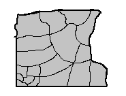
 A Vamora District Map | |
| Capital and largest city | Salonia |
| Demonym(s) | Vamoran |
| Government | |
| Salvo Cocci | |
| Albina Napolitano | |
| Legislature | General Assembly |
| Consiglio | |
| People's Assembly | |
| Zitassan State | |
| Area | |
• Total | 43,018 sq mi (111,420 km2) |
• Land | 41,293 sq mi (106,948 sq km) |
• Water | 1,725 sq mi (4,467 sq km) 4% |
| Population | |
• 2020 census | 4,779,207 |
Vamora is one of Zitasso's 4 states.
