Maktarim
This article is incomplete because it is pending further input from participants, or it is a work-in-progress by one author. Please comment on this article's talk page to share your input, comments and questions. Note: To contribute to this article, you may need to seek help from the author(s) of this page. |
New Aɣmat City
Azaɣar Aɣmat n Assa | |
|---|---|
Capital | |
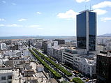
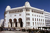
Clockwise from top left: Downtown at the Waterfront, preserved ruins in Old Aɣmat, Place Messidor/Adɣar Mgrawi in Murabbaɣ Centre, and a night market in Tetsouiq Garden | |
| Country | Messidor Union |
| Nation | Aɣmatia |
| Province | New Aɣmat |
| Neighbourhoods: | List
|
| Founded | c. 3800 BCE (Old Aɣmat) 1441 CE (New Aɣmat) |
| Government | |
| • Type | City council |
| • Body | New Aɣmat City Workers' Council |
| Area | |
| • Capital | 823 km2 (318 sq mi) |
| • Metro | 16,618 km2 (6,416 sq mi) |
| Highest elevation | 375 m (1,230 ft) |
| Lowest elevation | 0 m (0 ft) |
| Population (2018) | |
| • Capital | 8,873,785 |
| • Density | 11,000/km2 (28,000/sq mi) |
| Demonym | New Aɣmatian |
| Postal code | AAM-1000 to AAM-1499 |
| Area code(s) | 318 and 429 |
New Aɣmat City (Tamaziɣt: Azaɣar Aɣmat n Assa, Audonic: Cité de Nouveau Aɣmat) is the capital and largest city of the Messidor Union. It is located in the constituent nation of Aɣmatia on the coast of Aɣmat Bay in the Periclean sea.
The city proper extends 823 km2 (318 sq mi) but its metropolitan area extends approximately 16,618 km2 (6,416 sq mi). Density outside the city centre is relatively low, however, the metropolitan area is served by one of the most efficient intra-city transit systems in the Messidor Union.
New Aɣmat City is a transportation and service hub. It is often considered the economic core of the Messidor Union. In addition, it is home to a number of culturally significant monuments and festivals.


