Járnger Ðr Province
Járnger Ðr Province
Járnger Ðr Hérað | |
|---|---|
 | |
| Country | |
| Reorganization into a Province | December 8, 1909 |
| Government | |
| • Governor | Emilia Sigurbjörnsdóttir (National Conservative Party) |
| • Council | Járngans Provinsfullmäktige |
| Population (2020) | |
| • Total | 689,389 |
| Demonym | Járngan |
| Area code | JÐ |
| Website | www.Járnger.JÐ.gotn |
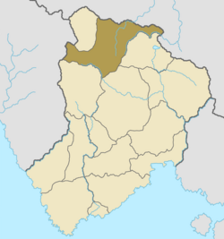
Járnger Ðr Province (Götaish: Járnger Ðr Hérað), is a Goutian province located in Northern Gotneska. Consisting of the Kendovstrunmahhe Mountains and vicinity, it is the least populous province-level administrative area in the nation, being home to a little over 600,000 residents, as well as being home to the largest recreational output in the nation measured by province-level administrative areas.
Etymology
Járnger Ðr's name derives from its inhabitants, the Járnirs. The name can be traced back to one of the northernmost runestone, on Argis, the Ösån Runestone dating to the 10th century.
History
Countys
Járnger Ðr is divided into three countys the largest being Störreargic (English: Greater Argic), which inclueds most of Greater Argic National Park. The most populated county is Flamederland (English: Three Great Rivers), which is located in the southeastern part of the provinces. Flamederland has a population of around 109,989 people.
Geography
Járnger Ðr western border is made out by the Fjölliðanna, which run north to south, before being slip down the middle by Járnger Ðr & Nanuvatlandi.
