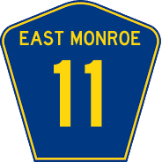
East Monroe State Highway 11
Jump to navigation
Jump to search
| Route information | |
|---|---|
| Length | 354 mi (570 km) |
| Existed | 1913–present |
| Major junctions | |
| West end | |
| East end | |
State Highway 11 (SH 11) is a major east-west highway that through the northern part of the state. The roadway also continues east in Ochoa and west into West Monroe.
Major intersections
| County | Location | Destination |
|---|---|---|
| McCall | West Monroe State Line | |
| Victoria | ||
| Lake Victoria Road - Lake Victoria State Park | ||
| Moore | Moorepark | |
| Beatrice | ||
| Madison River | ||
| Beard | Camden | |
| Hope | Windsor | |
| Meeker | ||
| Robert | Reedy | |
| Cole | Adams | |
| Sampson | ||
| Gatlinburg | ||
| Ochoa State Line | ||
