West Monroe State Highways
    Sample highway markers for State highways, Urban Roads, Rural Roads, and Park Roads. | |
| System information | |
|---|---|
| Notes | All classes of state-numbered highways are generally state-maintained. |
| Highway names | |
| Interstates | Interstate X (I-X) Interstate Highway X (IH X) |
| Ibican Highways | Ibican Route X (IR X) |
| Loops: | Loop X |
| Spurs: | Spur X |
| Urban or Rural Roads | UR X RR X |
| Park Roads: | Park Road X (PR X) |
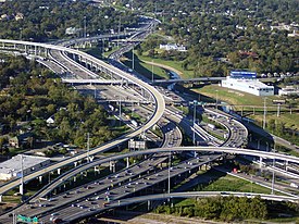
West Monroe state highways are a network of highways owned and maintained by the Ibican state of West Monroe. The West Monroe Department of Transportation (WMDOT) is the state agency responsible for the day-to-day operations and maintenance of the system. West Monroe has the largest state highway system. In addition to the nationally numbered Interstate Highways and Ibican Routes, the highway system consists of a main network of state highways, loops, and spurs that provide local access to the other highways. The system also includes a large network of Urban/Rural Roads that connect rural areas of the state with urban areas and the rest of the state highway system. The state also owns and maintains some park roads located near and within state and national parks, as well as recreational areas. All state highways, regardless of classification, are paved roads.
Types of highways
Interstate Highways
The Interstate Highway System in West Monroe covers 1,000 miles (1,609.3 km) and consists of 4 primary highways. The Interstate Highway with the longest segment in West Monroe is I-10 at 608 miles (978.5 km). The construction of the Interstate Highway System in West Monroe actually began well before these routes were designated as Interstate Highways. A 50-mile (80 km) stretch of the Capitol Freeway (I-10) between Willmington and Rhone was opened in 1951, eight years before it was designated I-10. It was also the first urban expressway in West Monroe.
U.S. Highways

The Ibican Numbered Highways are a nationwide grid of highways, but unlike the Interstate Highway System, there is no minimum design standard for these highways. This is clearly evident as some stretches of the Ibican Highways in West Monroe are nothing more than a two-lane rural road, while others are urban freeways. Although the Ibican Highways have been replaced for the most part by Interstate Highways for through traffic, the Ibican Highways still serve as important regional connectors. Several notable examples of Ibican Highways that are built to freeway standards include IR 64 in Rhone, and IR 2 in Barton.
State Highways
A State Highway (SH) is funded and maintained by the state. State Highways have been assigned numbers between 1 and 365 with a few exceptions. The first 26 state highways were designated in 1917. Highways are not organized by directionality of the highway, instead they are generally numbered as they were when first built in the 1920s and 1930s. Most suffixed routes were eliminated by 1939.
State Highway Loops and Spurs
State highway loops and spurs are short links in the State Highway network. They are generally numbered chronologically, and the lower numbers are older routes. Thus, spurs and loops are not related to similarly numbered main state highways. Typically, a loop connects two state or national highways, and a spur connects a state highway to a Urban Rural Road or other lower rated road. Many loops are either bypasses around significant portions of populated areas or older bypassed state or national highways. The first loops and spurs were defined in 1939; prior to that, the roadways had been suffixed segments of the main state highways of which they branched.
Urban Rural Roads
Rural Roads generally exist in rural areas. Urban Roads exist within urbanized areas. After the city or county acquires right-of-way, WMDOT builds and maintains the road. Urban Rurals roads exist to reach areas that would otherwise be
Park Roads
Park Roads serve state or national parks and "recognized recreational areas"; the first ones were defined in 1937. All roads in state parks are maintained by WMDOT, but are generally not numbered.
Toll roads
One characteristic of the freeways in West Monroe are its frontage roads; most freeways have continuous frontage roads, one-way in urban areas and two-way in rural areas. Several toll roads have one-way frontage roads—not necessarily continuous—with state highway numbers. Most toll roads are marked with special logos.


