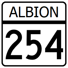
Albion State Route 254
Jump to navigation
Jump to search
| Route information | |
|---|---|
| Length | 132 mi (212 km) |
| Existed | 1987–present |
| Major junctions | |
| South end | |
| North end | |
Albion State Route 254 (SR 254) is a north-south minor state highway serving the northern coastal communities of the Greater St. Clarke metro area.
Route description
SR 254 is a 4 lane highway with a center turn lane for most of its length, occationally gaining a third lane in each direction when it goes through towns. Outside of the cities, the roadway is line on the west side with beach houses, mostly rental, some being multimillion dollar properties.
Major intersections
| County | Location | Destination |
|---|---|---|
| St. Clarke | Cleveland | |
| Harris | Roscoe | |
| Robbins River | ||
| Burke | ||
| North | Portage | |
| North Beach | ||
| Reedsburg | ||
| Lewiston | ||
