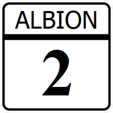
Albion State Route 2

Revision as of 19:30, 6 March 2024 by Jwill96 (talk | contribs) (Created page with "right|300px {{Infobox road |length_mi=349 |length_ref= |formed=1913 |direction_a=West |terminus_a= 25px|link=Interstate 7525px|link=Albion State Route 99 in Republic |junction={{plainlist| *25px|link=Ibican Route 5 *25px|link=Ibican Route 15 }} |direction_b=East |terminus_b=25px|link=Albion State Route 5 in Ocean City, Albion|Ocean...")
(diff) ← Older revision | Latest revision (diff) | Newer revision → (diff)
Jump to navigation Jump to search
AL-2.png
Route information
Length349 mi (562 km)
Existed1913–present
Major junctions
West endI-75.svgAL-99.png in Republic
 
  • US 5.svg
  • US 15.svg
East endAL-5.png in Ocean City

Albion State Route 2 (SR 2) is an east-west major state highway running along Albion's southern border.

Major intersections

County Location Destination
Anderson Connors Crossing I-75.svgAL-99.png - Deer Valley, Junction, Charlotte
Eaves Paris US 5.svg - Hillsborough, Essex
Caraway Glennwood AL-32.png - Scotland, Landmere
Harrod Lansing AL-93.png - Carrollton, St. Clair
Johnson Hansen US 15.svg - Williamsburg, Decatur
Hansen AL-54.png - Maisie, Spartenburg
Carmen Carmenville I-95.svg - Troy, Spartenburg
Ocean Ocean City AL-5.png - Seabrook, Seaside