East T'kampa
Jump to navigation
Jump to search
Democratic T'kampa | |
|---|---|
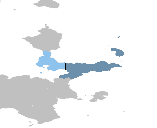
 Territory controlled by East T'kampa shown in dark blue; territory claimed but not controlled shown in light blue. | |
| Capital | Awaso |
| Largest city | Markium |
| Official languages | T'kampan |
| Official script | Pulnuya |
| Religion (2020) |
|
| Demonym(s) | T'kampan |
| Government | Unitary one-party collectivist state under a totalitarian dictatorship |
| Ratsimanjava | |
| Danoi Asalat | |
| Legislature | High Council of 42 Peasants |
| Population | |
• 2023 census | 15,854,362 |
| Currency | T'kampan sidol (₩) (TSD) |
| Time zone | UTC+9 (Asawo) |
| Date format | |
| Driving side | right |
| Calling code | +120 |
| Internet TLD | .dt |

