Heldervin
This article is incomplete because it is pending further input from participants, or it is a work-in-progress by one author. Please comment on this article's talk page to share your input, comments and questions. Note: To contribute to this article, you may need to seek help from the author(s) of this page. |
Heldervinian Socialist Autocratic Reich Heeldermunschdein Sozialistischestuun Autokratischmein Reich | |
|---|---|
|
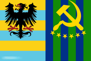
Flag | |
| Motto: "Sozialistenein von Heeldermunschdun, arbeitetuun!" "Socialists of Heldervin, work!" | |
 | |
| Capital | Old Vrebsicourg |
| Largest city | Ansium |
| Official languages | Heldervinian |
| Religion | Saletrism |
| Demonym(s) | Heldervinian |
| Government | Socialist two-party semi-constitutional monarchy |
• Lady | Marlene V |
• Heir Apparent | Marielle VII |
| Establishment | |
• Establishment of the first city-states | 18 January 294 |
• Unification of the Heldervinian City-states | 1 October 1836 |
| Area | |
• Total | 2,693,382 km2 (1,039,921 sq mi) |
• Water | 350,139 km2 (135,189 sq mi) |
• Water (%) | 13% |
• Land | 2,343,243 km2 |
| Population | |
• 2059 estimate | |
• Census | |
• Density | 291.21/km2 (754.2/sq mi) |
| Currency | Held (HED) |
| Time zone | UTC+7 (Helderbu Time) |
| Driving side | right |
| Calling code | 74 |
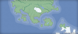
Heldervin, officially the Heldervinian Socialist Autocratic Reich, is a country located in northern Ledonia, particulary in the Trihhimerein Peninsula, with parts of its territories found on the various islands in the region. Spanning across the majority of the peninsula, it is home to the oldest settlements in the region; however, the nation itself is relatively young, unified in 1836. Peninsular Heldervin is bordered by Berush to the north, Partin to the east, and the Great Heldervinian Ocean to the west and south. Heldervin's capital is Old Vrebsicourg, while other major cities include Ansium and Old Figerbün. As of 2059, the total population was 682,382,737.
Heldervinian terrain largely consists of low hills, plains, and rainforests. Mountainous terrain is typically found in the north, where the tallest mountain, Mt. Everlherst, is also located. Tuujarnia, a province in Heldervin, earned the title as most populated and dense due to the near zero hills and mountains found.
In late antiquity, the Berushian Peninsula was settled by Berushians, particularly the bourgeoisie. Heldervin became a unified state in 1836.
Etymology
The name of Heldervin originates from Heldervinia, the name used by the ancient Ledonians to identify the Trihhimerein Peninsula. The etymological meaning of the term Heldervinia is unclear, and as such the true origin of the name is largely speculatory.
History
Prehistory
Archaeological research indicates that the Trihhimerein Peninsula was populated by various tribes about 4000 years ago.

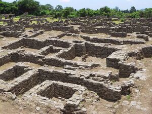
The three largest groups inhabiting the Berushian Peninsula were the Trihhimerein, Ecahoors, and Necargom. The Trihhimerein and Necargom inhabited much of the coast, whilst the Ecahoors inhabited the interior. Several towns were established by the tribes, including Old Vrebsicourg, the oldest continuously inhabited settlement in Heldervin.
