File:Bolohoveni land from A.V. Boldur description.PNG
Jump to navigation
Jump to search
No higher resolution available.
Bolohoveni_land_from_A.V._Boldur_description.PNG (278 × 267 pixels, file size: 115 KB, MIME type: image/png)
Summary
| Description |
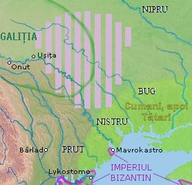
English: a map of a historical region, between Nistru and Nipru rivers, Northern Black Sea. |
| Date | |
| Source |
in May 7, 2013, only for Wiki pages |
| Author | Eurocentral, background from NASA - drawing generated since data from NASA Johnson Space Center - Earth Sciences and Image Analysis (NASA-JSC-ES&IA) ([1] Mission-Roll-Frame ISS001-E-5577, NASA Shuttle Radar Topography Mission (SRTM30) and/or Natural Earth, PD) |
| This file is made available under the Creative Commons CC0 1.0 Universal Public Domain Dedication. | |
| The person who associated a work with this deed has dedicated the work to the public domain by waiving all of their rights to the work worldwide under copyright law, including all related and neighboring rights, to the extent allowed by law. You can copy, modify, distribute and perform the work, even for commercial purposes, all without asking permission.
|
File history
Click on a date/time to view the file as it appeared at that time.
| Date/Time | Thumbnail | Dimensions | User | Comment | |
|---|---|---|---|---|---|
| current | 03:00, 17 September 2021 | | 278 × 267 (115 KB) | wikimediacommons>Trecătorul răcit | Left the cities, remove their hypothetic borders |
File usage
There are no pages that use this file.