File:Cukokoppen1.png
Jump to navigation
Jump to search

Size of this preview: 607 × 600 pixels. Other resolution: 900 × 889 pixels.
Original file (900 × 889 pixels, file size: 136 KB, MIME type: image/png)
Summary
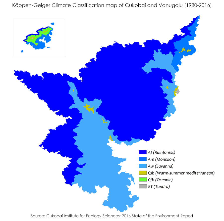
A Koppen-Geiger Climate chart of the Cukobaian Mainland developed in 2016
File history
Click on a date/time to view the file as it appeared at that time.
| Date/Time | Thumbnail | Dimensions | User | Comment | |
|---|---|---|---|---|---|
| current | 18:09, 28 August 2019 | | 900 × 889 (136 KB) | Renegade ginger (talk | contribs) | Realized I accidentally uploaded a copy of the previous file and fixed the issue |
| 18:08, 28 August 2019 |  | 900 × 889 (136 KB) | Renegade ginger (talk | contribs) | Removed some stray pixels | |
| 17:55, 28 August 2019 |  | 900 × 889 (136 KB) | Renegade ginger (talk | contribs) | Includes some minor updates for mountaneous zones on the mainland and the Koppen regions for the Vanugalu region | |
| 20:29, 22 August 2019 |  | 1,100 × 889 (115 KB) | Renegade ginger (talk | contribs) | A Koppen-Geiger Climate chart of the Cukobaian Mainland developed in 2016 |
You cannot overwrite this file.
File usage
The following page uses this file: