This file is from Wikimedia Commons and may be used by other projects.
The description on its file description page there is shown below.
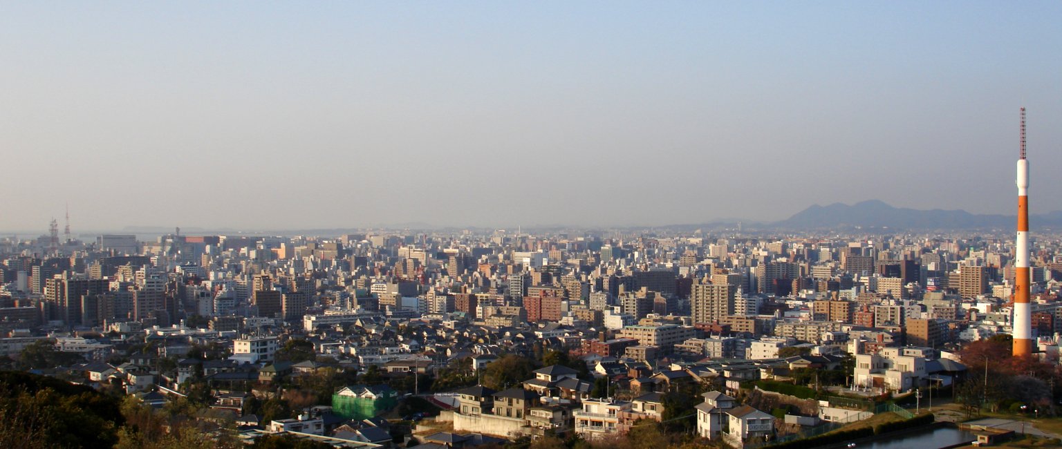
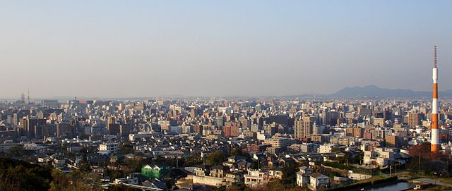
A view of downtown Fukuoka taken from Minami-ku's observation tower near Takamiya Station. Tenjin, Chuo-ku is a the left-hand side of the picture, Hakata is in the middle, and Takamiya appears at the right. The mountains appearing in the distance are, from left to right, Tachibana-san, Mikkazuki-san and Sanbonmatsu-san. At the foot of the three mountains is Kashii, Higashi-ku.
Permission is granted to copy, distribute and/or modify this document under the terms of the GNU Free Documentation License, Version 1.2 or any later version published by the Free Software Foundation; with no Invariant Sections, no Front-Cover Texts, and no Back-Cover Texts. A copy of the license is included in the section entitled GNU Free Documentation License.http://www.gnu.org/copyleft/fdl.htmlGFDLGNU Free Documentation Licensetruetrue
to share – to copy, distribute and transmit the work
to remix – to adapt the work
Under the following conditions:
attribution – You must give appropriate credit, provide a link to the license, and indicate if changes were made. You may do so in any reasonable manner, but not in any way that suggests the licensor endorses you or your use.
share alike – If you remix, transform, or build upon the material, you must distribute your contributions under the same or compatible license as the original.
This licensing tag was added to this file as part of the GFDL licensing update.http://creativecommons.org/licenses/by-sa/3.0/CC BY-SA 3.0Creative Commons Attribution-Share Alike 3.0truetrue
A view of downtown Fukuoka taken from Minami-ku's observation tower near Takamiya Station. Tenjin, Chuo-ku is a the left-hand side of the picture, Hakata is in the middle, and Takamiya appears at the right. The mountains appearing in the distance are, f

