File:Imber range, near Norton Bavant, Wiltshire - geograph.org.uk - 962206.jpg
Jump to navigation
Jump to search


No higher resolution available.
Imber_range,_near_Norton_Bavant,_Wiltshire_-_geograph.org.uk_-_962206.jpg (640 × 480 pixels, file size: 121 KB, MIME type: image/jpeg)
Summary
| Description |
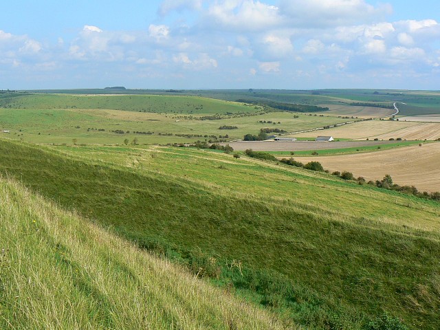
English: Imber range, near Norton Bavant, Wiltshire The foreground shows the eastern earthwork of the hill fort atop Battlesbury Hill. The buildings just to the right of centre are in this square and are marked on the map as 'Field Barn' which is not a place name, just a generic term which is self-explanatory. The road winding away into the distance is the southern range road. |
| Date | |
| Source | From geograph.org.uk |
| Author | Brian Robert Marshall |
| Attribution (required by the license) | Brian Robert Marshall / Imber range, near Norton Bavant, Wiltshire / |
| Camera location | | View this and other nearby images on: OpenStreetMap |
|---|
_heading:90.00&language=en)
| Object location | | View this and other nearby images on: OpenStreetMap |
|---|
_heading:90.00&language=en)
Licensing

|
This image was taken from the Geograph project collection. See this photograph's page on the Geograph website for the photographer's contact details. The copyright on this image is owned by Brian Robert Marshall and is licensed for reuse under the Creative Commons Attribution-ShareAlike 2.0 license.
|
This file is licensed under the Creative Commons Attribution-Share Alike 2.0 Generic license.
Attribution: Brian Robert Marshall
- You are free:
- to share – to copy, distribute and transmit the work
- to remix – to adapt the work
- Under the following conditions:
- attribution – You must give appropriate credit, provide a link to the license, and indicate if changes were made. You may do so in any reasonable manner, but not in any way that suggests the licensor endorses you or your use.
- share alike – If you remix, transform, or build upon the material, you must distribute your contributions under the same or compatible license as the original.
File history
Click on a date/time to view the file as it appeared at that time.
| Date/Time | Thumbnail | Dimensions | User | Comment | |
|---|---|---|---|---|---|
| current | 17:04, 22 February 2011 | | 640 × 480 (121 KB) | wikimediacommons>GeographBot | == {{int:filedesc}} == {{Information |description={{en|1=Imber range, near Norton Bavant, Wiltshire The foreground shows the eastern earthwork of the hill fort atop Battlesbury Hill. The buildings just to the right of centre are in this square and are mar |
File usage
There are no pages that use this file.