Scheduled Maintenance
The wiki will be going down for routine maintenance on Friday, October 4th, 2024, at approximately 3:30 PM Central Time (15:30) or 1:30 PM Pacific Time. The site may be inaccessible during this time and the database will be locked from editing. We expect the maintenance to take about thirty minutes. We strongly encourage joining our Discord for updates.
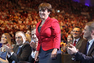
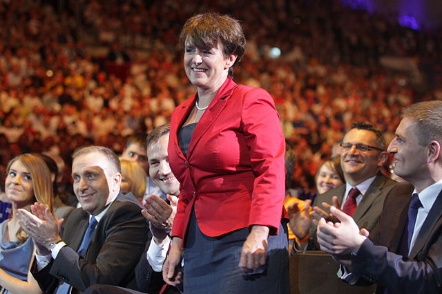
File:Joanna Kluzik-Rostkowska (5826009676).jpg
Jump to navigation
Jump to search


Size of this preview: 800 × 533 pixels. Other resolutions: 320 × 213 pixels | 640 × 427 pixels | 1,024 × 683 pixels | 1,280 × 853 pixels | 2,560 × 1,707 pixels | 5,184 × 3,456 pixels.
Original file (5,184 × 3,456 pixels, file size: 9.04 MB, MIME type: image/jpeg)
.jpg)
| Description | Ogólnopolska Konwencja Platformy Obywatelskiej Ergo Arena 11.06.2011 |
| Date | |
| Source | Joanna Kluzik-Rostkowska |
| Author | Platforma Obywatelska RP from Polska |
| Camera location | | View this and other nearby images on: OpenStreetMap |
|---|
.jpg¶ms=054.426108_N_0018.579297_E_globe:Earth_type:camera_source:Flickr_&language=en)
Licensing
This file is licensed under the Creative Commons Attribution-Share Alike 2.0 Generic license.
- You are free:
- to share – to copy, distribute and transmit the work
- to remix – to adapt the work
- Under the following conditions:
- attribution – You must give appropriate credit, provide a link to the license, and indicate if changes were made. You may do so in any reasonable manner, but not in any way that suggests the licensor endorses you or your use.
- share alike – If you remix, transform, or build upon the material, you must distribute your contributions under the same or compatible license as the original.
| This image was originally posted to Flickr by PlatformaRP at https://www.flickr.com/photos/61858084@N08/5826009676. It was reviewed on 29 July 2014 by FlickreviewR and was confirmed to be licensed under the terms of the cc-by-sa-2.0. |
File history
Click on a date/time to view the file as it appeared at that time.
| Date/Time | Thumbnail | Dimensions | User | Comment | |
|---|---|---|---|---|---|
| current | 20:25, 29 July 2014 | | 5,184 × 3,456 (9.04 MB) | wikimediacommons>Russavia | Transferred from Flickr via Flickr2commons |
File usage
There are no pages that use this file.
.jpg)