File:Territorial waters of Menghe map.png
Jump to navigation
Jump to search

Size of this preview: 633 × 600 pixels. Other resolutions: 2,162 × 2,048 pixels | 2,867 × 2,716 pixels.
Original file (2,867 × 2,716 pixels, file size: 155 KB, MIME type: image/png)
Summary
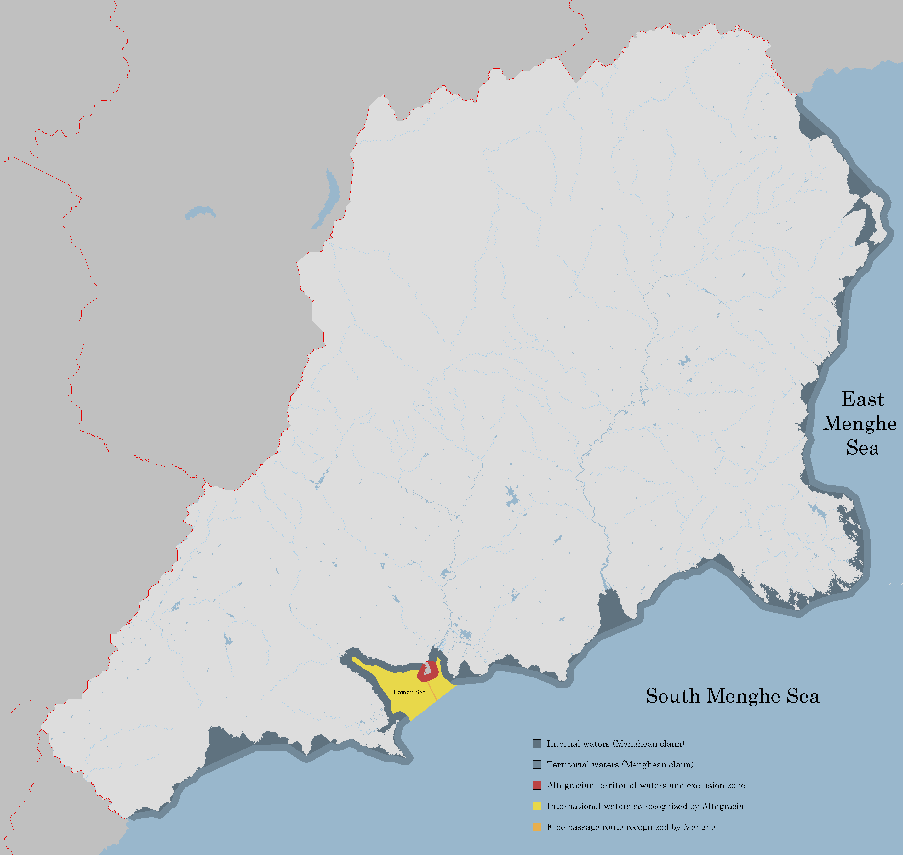
Map showing territorial waters and internal waters of Menghe
File history
Click on a date/time to view the file as it appeared at that time.
| Date/Time | Thumbnail | Dimensions | User | Comment | |
|---|---|---|---|---|---|
| current | 14:42, 29 June 2019 | | 2,867 × 2,716 (155 KB) | Soode (talk | contribs) | Map showing territorial waters and internal waters of Menghe |
You cannot overwrite this file.
File usage
The following page uses this file: