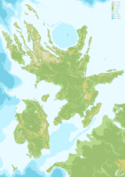
File:Topographic map of Chatten and Leucen.png
Jump to navigation
Jump to search


Size of this preview: 424 × 599 pixels. Other resolution: 1,054 × 1,490 pixels.
Original file (1,054 × 1,490 pixels, file size: 745 KB, MIME type: image/png)
Topographic map of Chatten and Leucen (including parts of Helswig and Sonnederlands)
File history
Click on a date/time to view the file as it appeared at that time.
| Date/Time | Thumbnail | Dimensions | User | Comment | |
|---|---|---|---|---|---|
| current | 23:45, 24 July 2024 | | 1,054 × 1,490 (745 KB) | Theworldbuilder (talk | contribs) |
You cannot overwrite this file.
File usage
The following page uses this file: