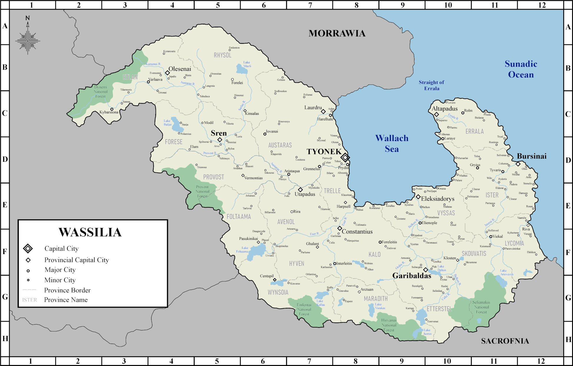
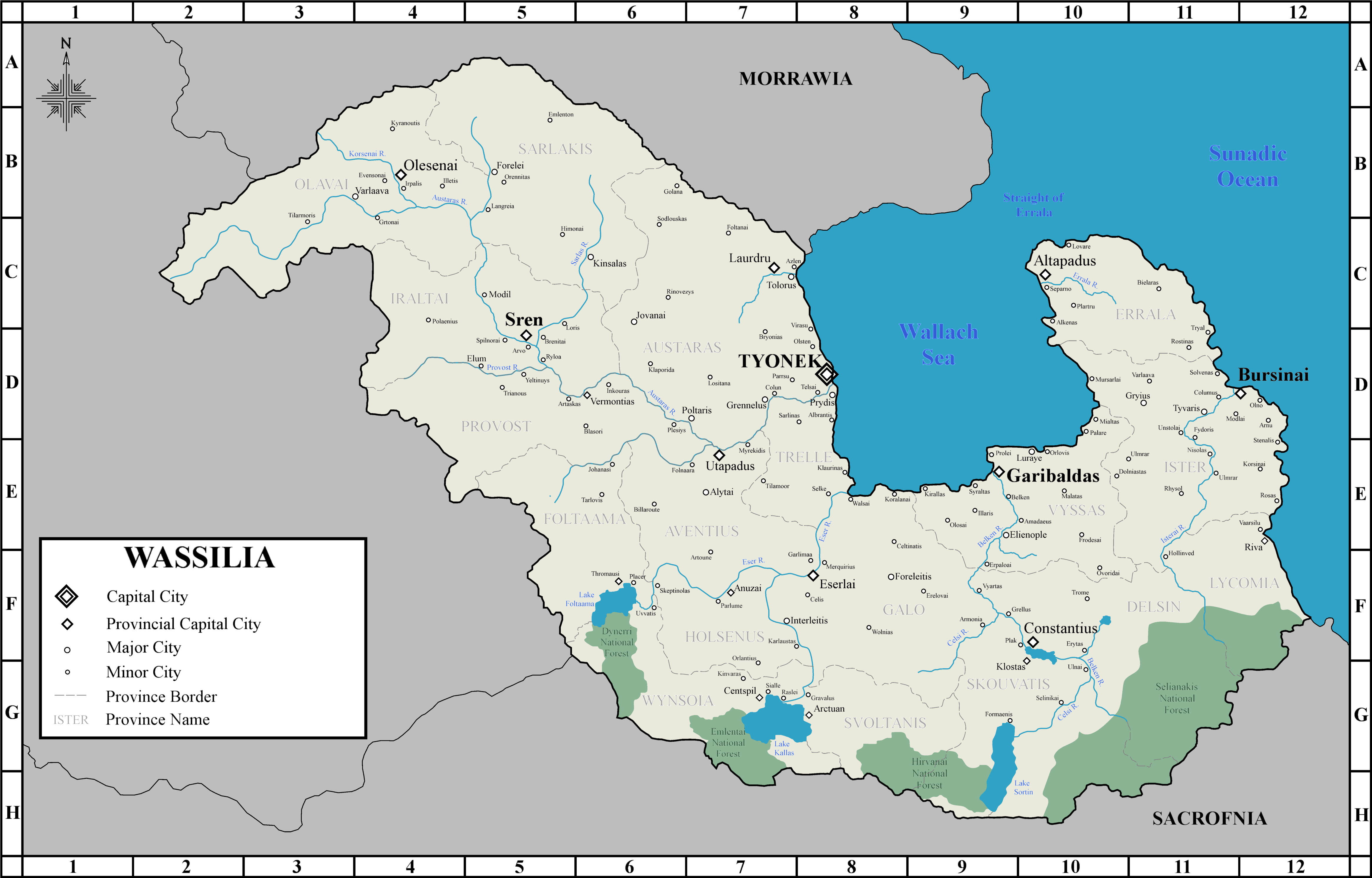
File:Wassilia Official Map.png
Jump to navigation
Jump to search

Size of this preview: 800 × 512 pixels. Other resolution: 1,948 × 1,246 pixels.
Original file (1,948 × 1,246 pixels, file size: 716 KB, MIME type: image/png)
File history
Click on a date/time to view the file as it appeared at that time.
| Date/Time | Thumbnail | Dimensions | User | Comment | |
|---|---|---|---|---|---|
| current | 23:45, 17 March 2024 | | 1,948 × 1,246 (716 KB) | Mpas220 (talk | contribs) | |
| 02:25, 15 March 2023 | 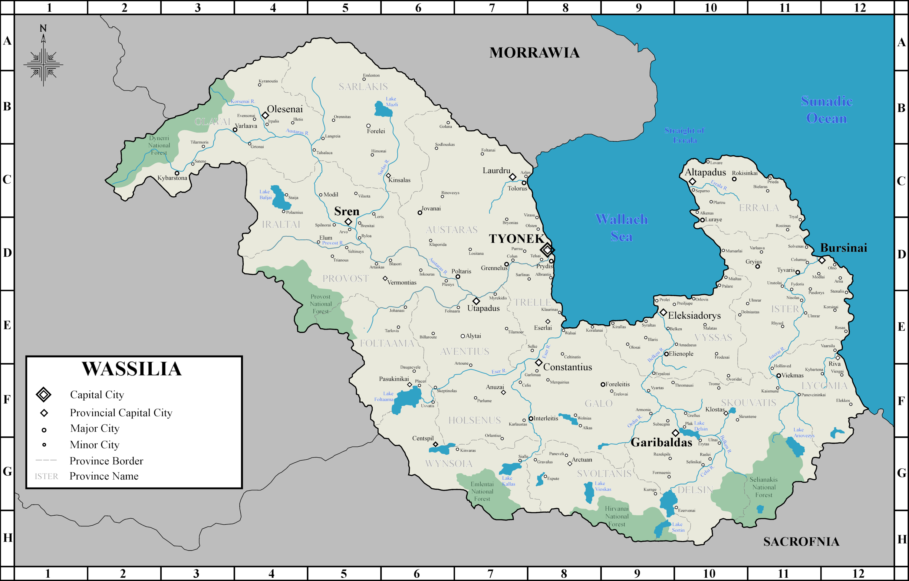 | 3,003 × 1,920 (1.25 MB) | Mpas220 (talk | contribs) | ||
| 15:21, 11 March 2023 | 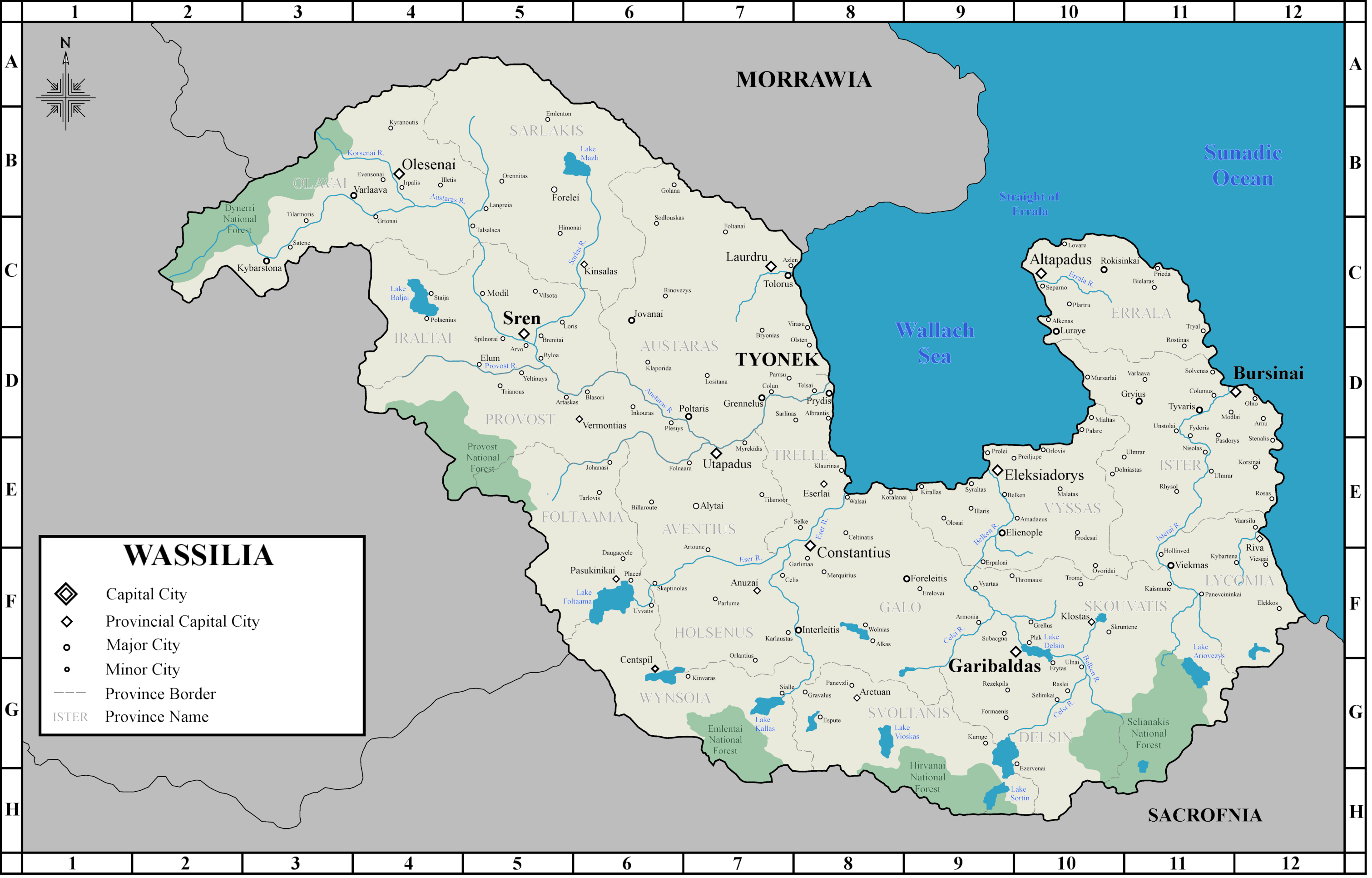 | 3,021 × 1,932 (1.25 MB) | Mpas220 (talk | contribs) | ||
| 01:14, 3 March 2023 | 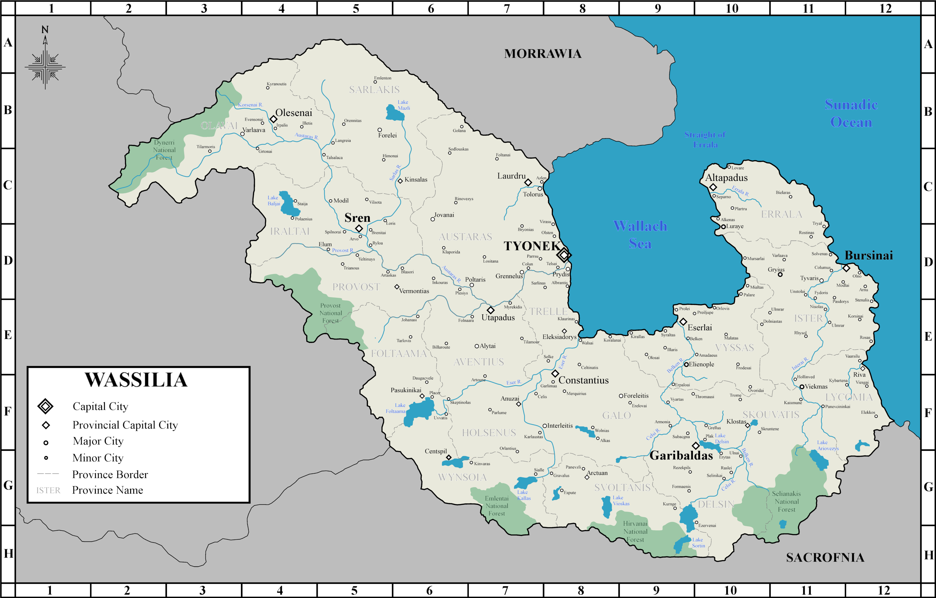 | 2,999 × 1,918 (1.22 MB) | Mpas220 (talk | contribs) | ||
| 20:44, 2 March 2023 |  | 3,001 × 1,919 (1.22 MB) | Mpas220 (talk | contribs) | ||
| 19:41, 2 March 2023 | 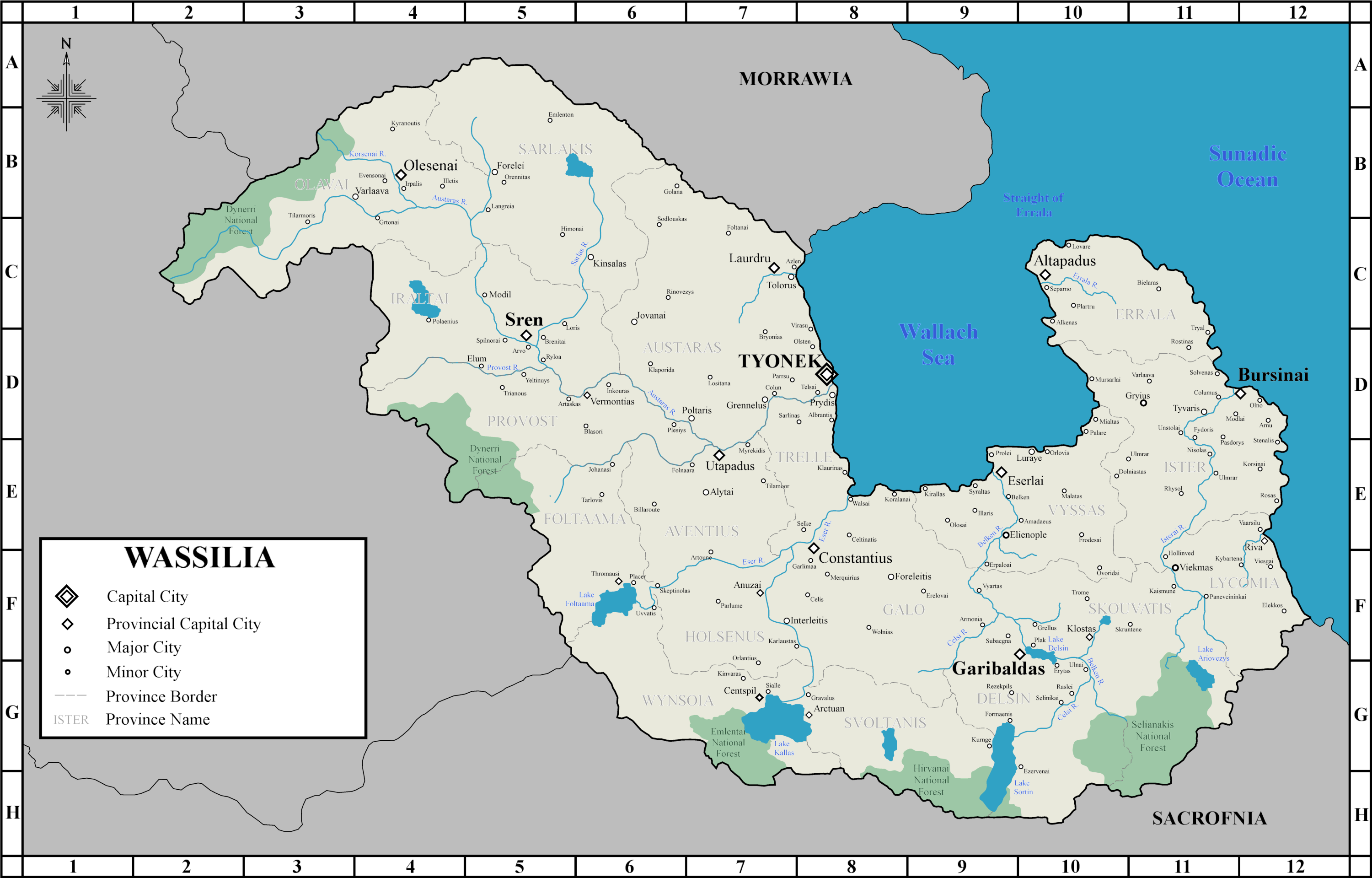 | 3,000 × 1,919 (1.18 MB) | Mpas220 (talk | contribs) | ||
| 19:05, 15 February 2023 |  | 3,001 × 1,919 (1.19 MB) | Mpas220 (talk | contribs) | ||
| 23:17, 5 February 2023 | 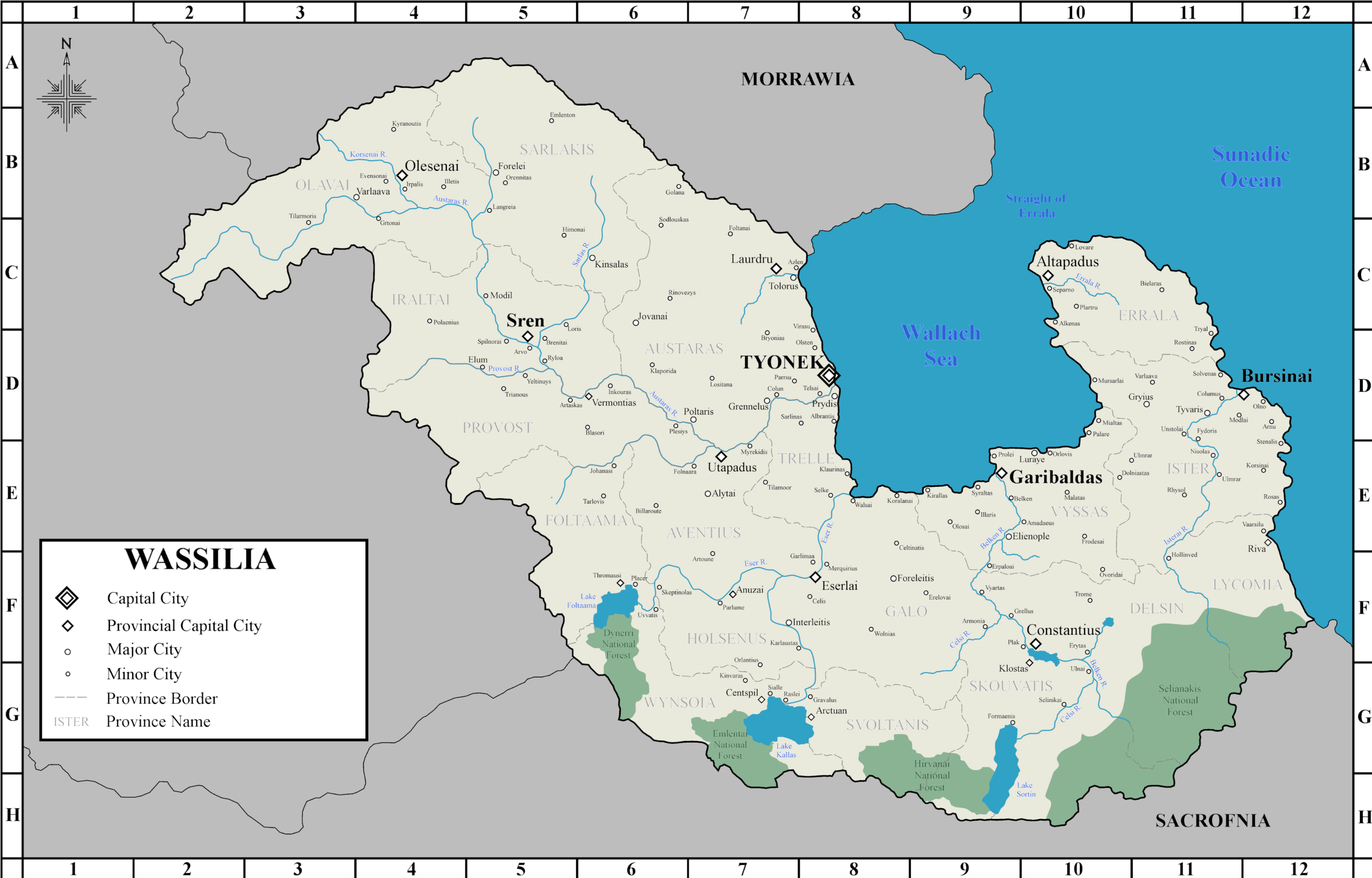 | 3,119 × 1,995 (1.35 MB) | Mpas220 (talk | contribs) | ||
| 23:15, 5 February 2023 | Error creating thumbnail: File with dimensions greater than 12.5 MP | 4,661 × 2,981 (1.99 MB) | Mpas220 (talk | contribs) | ||
| 12:15, 5 February 2023 | Error creating thumbnail: File with dimensions greater than 12.5 MP | 5,090 × 3,255 (2.21 MB) | Mpas220 (talk | contribs) |
You cannot overwrite this file.
File usage
The following page uses this file: