Egilanak National Park Service: Difference between revisions
Jump to navigation
Jump to search
Halsuntria (talk | contribs) No edit summary |
Halsuntria (talk | contribs) No edit summary |
||
| (5 intermediate revisions by the same user not shown) | |||
| Line 10: | Line 10: | ||
| seal_width = | | seal_width = | ||
| seal_caption = | | seal_caption = | ||
| formed = {{start date and age| | | formed = {{start date and age|1849|11|5}} | ||
| date1 = | | date1 = | ||
| date1_name = | | date1_name = | ||
| Line 33: | Line 33: | ||
==History== | ==History== | ||
===Bukam Regime and Founding=== | |||
===Post-Bukam Regime to [[World War (Iearth)]]=== | |||
===Post World War to Today=== | |||
==Activities== | ==Activities== | ||
===Camping=== | |||
===Hiking=== | |||
===Boating and other Aquatic Activities=== | |||
===Horseback Riding=== | |||
==Types of Parks== | ==Types of Parks== | ||
There are 4 different types of National Parks in Egilanak, those being | |||
*National Park | |||
*National River | |||
*National Park and Historic Site | |||
*National Marine Site | |||
==Rangers & Law Enforcement== | ==Rangers & Law Enforcement== | ||
==List of National Parks== | ==List of National Parks== | ||
[[File:National Park Map of Egilanak.png|thumb|left|500px| A map of the National Parks in | [[File:National Park Map of Egilanak.png|thumb|left|500px| A map of the National Parks in Egilanak.]] | ||
{|class="wikitable sortable" | {|class="wikitable sortable" | ||
! width=10% scope="col"| Number | ! width=10% scope="col"| Number | ||
! width= | ! width=15% scope="col"| Site | ||
! class="unsortable" scope="col"| Image | ! class="unsortable" scope="col"| Image | ||
! scope="col" | Prefecture/Okrug/Fatuola | ! scope="col" | Prefecture/Okrug/Fatuola | ||
! scope="col"| Established | ! scope="col"| Established | ||
! width=33% scope="col" class="unsortable" | Description | ! width=33% scope="col" class="unsortable" | Description | ||
|- | |- | ||
| | | 1 | ||
| align="center" | | | align="center" | Landakh National Park | ||
| | | [[File:Walls of Jerusalem National Park, Tasmania 48.jpg|200px]] | ||
| | | align="center" | Rhibank Prefecture | ||
| align="center" | | | align="center" | 1968 | ||
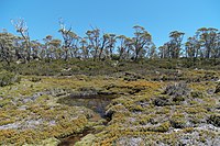
| | | Notably arid compared to the rest of the Kaynish Valley, it features flora found nowhere else in [[Egilanak]] including the Berabert tree and the Zhukovik bush. | ||
|- | |||
| 2 | |||
| align="center" | Khovar Caves National Park | |||
| [[File:Postojna Cave (18341372181).jpg|200px]] | |||
| align="center" | Eysharv Prefecture | |||
| align="center" | 1857 | |||
| Khovar Caves National Park encompasses all of the Khovar Cave as well as the surrounding area around the cave. It is the largest cave system in Egilanak and was the 4th National Park created. | |||
|- | |||
| 3 | |||
| align="center" | Yengilyk National Park and Historical Site | |||
| [[File:Ruins at Butrint Archaeological Site - Butrint National Park - Albania (28492117898).jpg|150px]] | |||
| align="center" | Eysharv Prefecture, Zenyab Prefecture | |||
| align="center" | 2003 | |||
| Was a National Historic Site since 1935, however didn't gain National Park status until 2003. It protects many Kaynissian Ruins, most notably the Yengilyk Ruins as well as the nature around the areas. | |||
|- | |||
| 4 | |||
| align="center" | Flowering National Park | |||
| [[File:Suráfrica, Namaqualand 08.jpg|200px]] | |||
| align="center" | Zenyab Prefecture | |||
| align="center" | 1984 | |||
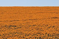
| Flowering National Park was named for why it was named a national park, it's flowering season. From August to November, the Mykem Flower blooms and creates a landscape covered in them and has become famously picturesque. | |||
|- | |||
| 5 | |||
| align="center" | Avleokam Mountains National Park | |||
| [[File:Little River Gorge.jpg|200px]] | |||
| align="center" | Orozekahamabad Prefecture | |||
| align="center" | 1926 | |||
| Avleokam Mountains National Park covers most of the Avleokam Mountains, a unique mountain range in South Egilanak know for its relatively steep mountain ranges for that region. | |||
|- | |||
| 6 | |||
| align="center" | Bjarnen National Park | |||
| [[File:New River Gorge Bridge.jpg|200px]] | |||
| align="center" | Skaywick Prefecture | |||
| align="center" | 1942 | |||
| Bjarnen was selected to be a national park because it best showed the geography of the Lower Treykalbenak, the largest region in Egilanak. | |||
|- | |||
| 7 | |||
| align="center" | Tsingy National Park | |||
| [[File:Tsingy - 174.jpg|200px]] | |||
| align="center" | Rimajek Prefecture | |||
| align="center" | 1854 | |||
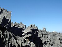
| Was the 3rd inducted National Park in 1854 and partly because it was under threat by a mining company. It features rock formations called tsingys which encompass most of the park making transport very difficult. | |||
|- | |- | ||
Latest revision as of 22:12, 24 March 2021
| Эгиланак улуттук паркы кызматы | |
| Agency overview | |
|---|---|
| Formed | November 5, 1849 |
| Jurisdiction | Federal Government of Egilanak |
| Headquarters | National Park Service Headquarters 87 Biirsky Ln SE, Seloysk Beach 10046 |
| Employees | 8,024 permanent, 4,631 seasonal (2007) |
| Agency executives |
|
| Parent agency | Department of the Environment |
| Website | www.enps.gov |
The Egilanak National Park Service is a governmental body that maintains and protects selected land throughout Egilanak. It currently has 30 National Parks within it's protection with 25 being in Greater Egilanak, 3 in Stravobnoyye, and 2 in the Tapuaelani Archipelago. It was established in 1839 during the Bukam Regime with two national parks and has grown to it's current stature that it is today.
History
Bukam Regime and Founding
Post-Bukam Regime to World War (Iearth)
Post World War to Today
Activities
Camping
Hiking
Boating and other Aquatic Activities
Horseback Riding
Types of Parks
There are 4 different types of National Parks in Egilanak, those being
- National Park
- National River
- National Park and Historic Site
- National Marine Site
Rangers & Law Enforcement
List of National Parks
File:National Park Map of Egilanak.png
A map of the National Parks in Egilanak.
| Number | Site | Image | Prefecture/Okrug/Fatuola | Established | Description |
|---|---|---|---|---|---|
| 1 | Landakh National Park | 
|
Rhibank Prefecture | 1968 | Notably arid compared to the rest of the Kaynish Valley, it features flora found nowhere else in Egilanak including the Berabert tree and the Zhukovik bush. |
| 2 | Khovar Caves National Park | 
|
Eysharv Prefecture | 1857 | Khovar Caves National Park encompasses all of the Khovar Cave as well as the surrounding area around the cave. It is the largest cave system in Egilanak and was the 4th National Park created. |
| 3 | Yengilyk National Park and Historical Site | 
|
Eysharv Prefecture, Zenyab Prefecture | 2003 | Was a National Historic Site since 1935, however didn't gain National Park status until 2003. It protects many Kaynissian Ruins, most notably the Yengilyk Ruins as well as the nature around the areas. |
| 4 | Flowering National Park | 
|
Zenyab Prefecture | 1984 | Flowering National Park was named for why it was named a national park, it's flowering season. From August to November, the Mykem Flower blooms and creates a landscape covered in them and has become famously picturesque. |
| 5 | Avleokam Mountains National Park | 
|
Orozekahamabad Prefecture | 1926 | Avleokam Mountains National Park covers most of the Avleokam Mountains, a unique mountain range in South Egilanak know for its relatively steep mountain ranges for that region. |
| 6 | Bjarnen National Park | 
|
Skaywick Prefecture | 1942 | Bjarnen was selected to be a national park because it best showed the geography of the Lower Treykalbenak, the largest region in Egilanak. |
| 7 | Tsingy National Park | 
|
Rimajek Prefecture | 1854 | Was the 3rd inducted National Park in 1854 and partly because it was under threat by a mining company. It features rock formations called tsingys which encompass most of the park making transport very difficult. |