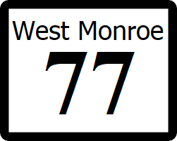
West Monroe State Highway 77: Difference between revisions
(Created page with "right|300px {{Infobox road |length_mi=2150 |length_ref= |formed=1960 |direction_a=West |terminus_a= 25px|link=West Monroe State Highway 1...") |
No edit summary |
||
| (2 intermediate revisions by the same user not shown) | |||
| Line 20: | Line 20: | ||
==Major intersections== | ==Major intersections== | ||
;[[Longwood, West Monroe|Longwood]], [[Travis County, West Monroe|Travis County]] | ;[[Longwood, West Monroe|Longwood]], [[Travis County, West Monroe|Travis County]] | ||
: [[File:WM-1.png|25px|link=West Monroe State Highway 1]] | : [[File:WM-1.png|25px|link=West Monroe State Highway 1]] | ||
;[[Freemont County, West Monroe|Freemont County]] | ;[[Freemont County, West Monroe|Freemont County]] | ||
;[[Pierce, West Monroe|Pierce]] | ;[[Pierce, West Monroe|Pierce]] | ||
: [[File:I-10.svg|25px|link=Interstate 10]] - [[Rhone]], [[Willmington]] | : [[File:I-10.svg|25px|link=Interstate 10]] - [[Rhone]], [[Willmington]] | ||
: [[File:IR-2.png|25px|link=Ibican Route 2]] | : [[File:IR-2.png|25px|link=Ibican Route 2]] | ||
: Westside Avenue | |||
;[[Willmington]] | |||
: Perrytown Avenue | |||
;[[Carrington, West Monroe|Carrington]] | ;[[Carrington, West Monroe|Carrington]] | ||
: [[File:WM-125.png|25px|link=West Monroe State Highway 125]] - [[Collins, West Monroe|Collins]] | : [[File:WM-125.png|25px|link=West Monroe State Highway 125]] - [[Collins, West Monroe|Collins]] | ||
: [[File:I-25.svg|25px|link=Interstate 25]] - [[Toledo, West Monroe|Toledo]], [[Youngstown, West Monroe|Youngstown]] | : [[File:I-25.svg|25px|link=Interstate 25]] - [[Toledo, West Monroe|Toledo]], [[Youngstown, West Monroe|Youngstown]] | ||
: [[File:WM-54.png|25px|link=West Monroe State Highway 54]] - [[Shelby, West Monroe|Shelby]] | : [[File:WM-54.png|25px|link=West Monroe State Highway 54]] - [[Shelby, West Monroe|Shelby]] | ||
==See also== | ==See also== | ||
* [[List of state highways in West Monroe]] | * [[List of state highways in West Monroe]] | ||
[[Category:State highways in West Mornoe| | [[Category:State highways in West Mornoe|077]] | ||
Latest revision as of 01:48, 21 October 2021
| Route information | |
|---|---|
| Length | 2,150 mi (3,460 km) |
| Existed | 1960–present |
| Major junctions | |
| West end | |
| East end | |
State Highway 77 (SH 77) east-west through the northern end of the urban Willmington Metropolitan Area. The highway is mainly a surface street, though has interchanges with major roadways.
Route description
SH 77 begins at a traffic light with SH 1 in downtown Longwood, then heads east through suburban Travis County, meeting Interstate 10 at the Freemont county line. From there through the city of Pierce to Ibican Route 2, SH 77 is an expressway with limited intersections. After crossing IR 2, the highway passes through a residential area of the city of Scottsbluff, before entering the Northern Extension area of Willmington. Here, the highway picks up the local designation of Carrington Road and losses it's expressway status. The route then meets the south end of SH 125 at the Carrington city limits. The highway will remain in Carrington for the rest of its route, meeting Interstate 25 before ending at a traffic light with SH 54.
Major intersections
- Longwood, Travis County

- Freemont County
- Pierce
- Rhone, Willmington

- Westside Avenue
- Willmington
- Perrytown Avenue
- Carrington
 - Collins
- Toledo, Youngstown
 - Shelby
