User:Rhava: Difference between revisions
Jump to navigation
Jump to search
No edit summary |
No edit summary |
||
| Line 15: | Line 15: | ||
| nickname = | | nickname = | ||
| motto = | | motto = | ||
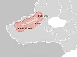
| image_map = | | image_map = Camdong.jpg | ||
| map_alt = | | map_alt = | ||
| map_caption = | | map_caption = A map of the Camdong Plateau region | ||
| pushpin_map = | | pushpin_map = | ||
| pushpin_label_position = | | pushpin_label_position = | ||
Revision as of 19:25, 4 February 2022
Camdong Plateau
Yaj Plateau cao nguyên cảm động ພູພຽງແຄມດົງ yaj toj siab | |
|---|---|
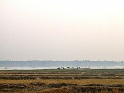
 Landscape of the Camdong | |
 A map of the Camdong Plateau region | |
| Country | Rhava |
| Elevation | 200 m (700 ft) |
The Camdong or Yaj Plateau (Nalinese : cao nguyên cảm động | Sichaeng : ພູພຽງແຄມດົງ | Mueng : yaj toj siab) is a plateau in the southwestern Rhavanese region of Camdong. The plateau forms a natural region, and is surounded by the Ho Heak Mountain Range to the west, and the Ngọc River to the north.
Etymology
It's thought to be named after the immense heats that can come to the region during dry seasons, another thought is it is named after the gratitude of the Rhavanese people to the Mueng during the battle at Teb Daj.