Camdong Plateau: Difference between revisions
Jump to navigation
Jump to search
No edit summary |
No edit summary |
||
| (8 intermediate revisions by the same user not shown) | |||
| Line 1: | Line 1: | ||
{{Infobox | {{Infobox settlement | ||
| name = Camdong | | name = Camdong Plateau | ||
| native_name = | | native_name = Kham Dong ({{font color | #0B0080 | Kham Rha }}) | ||
| native_name_lang = <!-- ISO 639-2 code e.g. "fr" for French. If more than one, use {{lang}} instead --> | | native_name_lang = <!-- ISO 639-2 code e.g. "fr" for French. If more than one, use {{lang}} instead --> | ||
| settlement_type = [[Natural region]] | | settlement_type = [[Natural region]] | ||
| Line 15: | Line 15: | ||
| nickname = | | nickname = | ||
| motto = | | motto = | ||
| image_map = | | image_map = | ||
| map_alt = | | map_alt = | ||
| map_caption = | | map_caption = | ||
| pushpin_map = | | pushpin_map = | ||
| pushpin_label_position = | | pushpin_label_position = | ||
| Line 81: | Line 81: | ||
| footnotes = | | footnotes = | ||
}} | }} | ||
The '''Camdong Plateau''' or '''Khamdong Plateau''' ([[Kham Rha]] : Hadkao Num Kham Dong) is a [[plateau]] in the southwestern [[Rhava|Rhavanese]] region of Camdong. The plateau forms a [[natural region]], and is surounded by the [[Ho Heak Mountain Range|Tháp Sēt Mountain Range]] to the west, and the [[Ngô River]] to the north. | |||
The '''Camdong''' or ''' | |||
==Etymology== | ==Etymology== | ||
The name ''Kham Dông'' translates to 'Eastern Kham' in the Kham Rha language. It is spelt ''Khamdam'' in Khnem Rha and ''Camdong'' in Standard Rha | |||
==Geography and Key Features== | ==Geography and Key Features== | ||
==Geology== | |||
==Climate== | |||
==Farming== | |||
Latest revision as of 15:41, 7 August 2022
Camdong Plateau
Kham Dong (Kham Rha)
| |
|---|---|
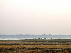
 Landscape of the Camdong | |
| Country | Rhava |
| Elevation | 200 m (700 ft) |
The Camdong Plateau or Khamdong Plateau (Kham Rha : Hadkao Num Kham Dong) is a plateau in the southwestern Rhavanese region of Camdong. The plateau forms a natural region, and is surounded by the Tháp Sēt Mountain Range to the west, and the Ngô River to the north.
Etymology
The name Kham Dông translates to 'Eastern Kham' in the Kham Rha language. It is spelt Khamdam in Khnem Rha and Camdong in Standard Rha