Yajawil of Kanol: Difference between revisions
No edit summary |
No edit summary |
||
| (2 intermediate revisions by the same user not shown) | |||
| Line 4: | Line 4: | ||
|native_name = ''Yajawil Kanol''<br> ''Tatinakkan'' | |native_name = ''Yajawil Kanol''<br> ''Tatinakkan'' | ||
|common_name = Kanol | |common_name = Kanol | ||
|image_flag = | |image_flag = | ||
|alt_flag = <!--alt text for flag (text shown when pointer hovers over flag)--> | |alt_flag = <!--alt text for flag (text shown when pointer hovers over flag)--> | ||
|image_flag2 = | |image_flag2 = | ||
|alt_flag2 = | |alt_flag2 = | ||
|image_coat = | |image_coat = Yoltan glyph.png | ||
|alt_coat = | |alt_coat = | ||
|symbol_type = <!--emblem, seal, etc (if not a coat of arms)--> | |symbol_type = <!--emblem, seal, etc (if not a coat of arms)--> | ||
| Line 14: | Line 14: | ||
|national_anthem = ''Victorious March'' | |national_anthem = ''Victorious March'' | ||
|image_map = Ajax_Kanol_Map.png | |image_map = Ajax_Kanol_Map.png | ||
|map_width = | |map_width = 200px | ||
|alt_map = | |alt_map = | ||
|map_caption = Location of Kanol in the Mutul | |map_caption = Location of Kanol in the Mutul | ||
| Line 61: | Line 61: | ||
|area_label2 = <!--Label below area_label (optional)--> | |area_label2 = <!--Label below area_label (optional)--> | ||
|area_data2 = <!--Text after area_label2 (optional)--> | |area_data2 = <!--Text after area_label2 (optional)--> | ||
|population_estimate = | |population_estimate = | ||
|population_estimate_rank = | |population_estimate_rank = | ||
|population_estimate_year = | |population_estimate_year = | ||
|population_census = | |population_census = | ||
|population_census_year = | |population_census_year = | ||
|population_density_km2 = | |population_density_km2 = | ||
|population_density_sq_mi = | |population_density_sq_mi = | ||
| Line 108: | Line 108: | ||
|footnotes = <!--For any generic non-numbered footnotes--> | |footnotes = <!--For any generic non-numbered footnotes--> | ||
}} | }} | ||
The '''Yajawil of Kanol''' is a first-level administrative division in the [[Mutul]] located in the western regions of the kingdom. It covers an area considered to be the core of the {{wp|Totonac people|Tatinak}} culture and the Tatinak people make up the majority of the Yajawil’s population. | |||
Kanol is bordered | Kanol is bordered by the Makrian Ocean and the Viceroyalties of [[Yajawil of Yokok'ab|Yokok'ab]], [[Yajawil of Joychan|Joychan]],[[Yajawil of Muynal|Muynal]], [[Yajawil of Nuhmuwitz|Nuhmuwitz]], and [[Yajawil of Ochk'inal|Ochk'inal]]. | ||
The province can trace its origins back to the “''Chik’in Kingdom''” mentioned in [[Mutul|Chaan Dynasty]] chronicles (320 BC - 250 CE) which had its political center in the modern city of [[Danguixh]] and founded the Kuy Dynasty that went on to conquer all the Mutals that had broken off from the Mutul following a succession crisis. The Kuy would continue to dominate the Mutul until the 10th century, when their rule was ended by a succession crisis and social uprisings. After a century long period of division, its the {{wp|K’iche people}} who once again reunited the Divine Kingdom. | The province can trace its origins back to the “''Chik’in Kingdom''” mentioned in [[Mutul|Chaan Dynasty]] chronicles (320 BC - 250 CE) which had its political center in the modern city of [[Danguixh]] and founded the Kuy Dynasty that went on to conquer all the Mutals that had broken off from the Mutul following a succession crisis. The Kuy would continue to dominate the Mutul until the 10th century, when their rule was ended by a succession crisis and social uprisings. After a century long period of division, its the {{wp|K’iche people}} who once again reunited the Divine Kingdom. | ||
| Line 122: | Line 122: | ||
==History== | ==History== | ||
[[File:Señor de las limas 2.jpg| | [[File:Señor de las limas 2.jpg|200px|thumb|The Tatinak were greatly inspired by the nearby early-yoko culture]] | ||
The territory of the Province was first inhabited by humans around 10,000 BCE, with most of the oldest settlements being found in the central valleys or alongside the northern coast. There are more than 500 prehistoric sites in the Valleys alone, with stone tools dating back to between 6500 and 4900 BCE and evidence of agriculture to 3500 and 2000 BCE. The rise of city states came later than in Central Mutul, but started around 900 BCE following modern estimates. | The territory of the Province was first inhabited by humans around 10,000 BCE, with most of the oldest settlements being found in the central valleys or alongside the northern coast. There are more than 500 prehistoric sites in the Valleys alone, with stone tools dating back to between 6500 and 4900 BCE and evidence of agriculture to 3500 and 2000 BCE. The rise of city states came later than in Central Mutul, but started around 900 BCE following modern estimates. | ||
| Line 128: | Line 128: | ||
===Kuy Dynasties=== | ===Kuy Dynasties=== | ||
[[File:Kuy Dynasty Territorial Changes.png| | [[File:Kuy Dynasty Territorial Changes.png|200px|thumb|From the Chik'inli Kingdom in red to the Kuy Dynasty (orange and yellow). The regions stripped in black are the territories lost to the [[Kayamuca Empire]] during the 9th century]] | ||
The era of “Chik’inli domination” over the Mutul is generally divided into four dynasties : the Kuy, the Tz’amkuy, the Nehn, and the Chankuy. | The era of “Chik’inli domination” over the Mutul is generally divided into four dynasties : the Kuy, the Tz’amkuy, the Nehn, and the Chankuy. | ||
| Line 142: | Line 142: | ||
==Geography== | ==Geography== | ||
[[File:Playa Villa Rica desde Quiahuiztlan01.jpeg| | [[File:Playa Villa Rica desde Quiahuiztlan01.jpeg|200px|thumb|Kanol's coast]] | ||
Geographically, Kanol is a very diverse province, being delimited to the north by the Makrian Ocean, with its coastal territories extending from the Lankasen river to the east to the Tzini river to the west. It’s inland regions are very mountainous, with deep valleys separated by high volcanic mountains or plateaus. A typical example would be the Xizabi Valley, where the city of Danguixh was built. Thus the climate range from tropical to Oceanic (of the Subtropical Highlands variety) giving the province a great ecologic patrimony. | Geographically, Kanol is a very diverse province, being delimited to the north by the Makrian Ocean, with its coastal territories extending from the Lankasen river to the east to the Tzini river to the west. It’s inland regions are very mountainous, with deep valleys separated by high volcanic mountains or plateaus. A typical example would be the Xizabi Valley, where the city of Danguixh was built. Thus the climate range from tropical to Oceanic (of the Subtropical Highlands variety) giving the province a great ecologic patrimony. | ||
===Natural attractions=== | ===Natural attractions=== | ||
[[File:PiedrasEncimadas38.JPG| | [[File:PiedrasEncimadas38.JPG|200px|thumb|left|A Capricious rock]] | ||
Reputed for the beauty of its landscape, Kanol’s natural attractions include the “Western Volcanic Range’s Natural Reserve”, The “Capricious Rocks Valley” named after the odd shapes taken by basalt formations surging from its ground created by millions of years of erosion, and many national parks. Access to these parks, especially to their high peaks, is more restricted than in the past due to past ecological damage. Even further restrictions are put into place when the volcanic belt is active. These parks are generally associated to a large Temple-Monastery or a serie of smaller Calendar Temples, if not both, and thus at the center of local pilgrimages and festivities, using the many small caves that can be found on the slopes of the mountains and volcanoes there. | Reputed for the beauty of its landscape, Kanol’s natural attractions include the “Western Volcanic Range’s Natural Reserve”, The “Capricious Rocks Valley” named after the odd shapes taken by basalt formations surging from its ground created by millions of years of erosion, and many national parks. Access to these parks, especially to their high peaks, is more restricted than in the past due to past ecological damage. Even further restrictions are put into place when the volcanic belt is active. These parks are generally associated to a large Temple-Monastery or a serie of smaller Calendar Temples, if not both, and thus at the center of local pilgrimages and festivities, using the many small caves that can be found on the slopes of the mountains and volcanoes there. | ||
| Line 156: | Line 156: | ||
===Agriculture=== | ===Agriculture=== | ||
[[File:Puebla farmers.jpg| | [[File:Puebla farmers.jpg|200px|thumb|Farmers in a field]] | ||
The primary sector of the economy remain important in modern day Kanol. The Yajawil has abundant rainfall and extremely fertile soils, as well as a long coastline and forest containing a wide variety of trees and other plants. The majority of the farmlands are communal and used to raise domestic fowls, from turkeys to Terror Birds and Ostriches, and cultivate crops and other products like chocolate, vanilla, sugarcane, tobacco, bananas, coconuts, citrus fruits, and vegetables, alongside cotton, rubber, and hemp. Kanol’s long coastline support a large fishing industry with most of the Mutul’s oysters and shrimps coming from there. Political support for the initiative since the eighties have led to Kanol’s many rivers to be equipped with water purification plants, many using algaes in their process to clean the water from nutriments in excess like nitrogen from agricultural activities. These algaes are then transformed into dietary supplement, gelatine, or biofuel. Fish farming has also been encouraged by the government. | The primary sector of the economy remain important in modern day Kanol. The Yajawil has abundant rainfall and extremely fertile soils, as well as a long coastline and forest containing a wide variety of trees and other plants. The majority of the farmlands are communal and used to raise domestic fowls, from turkeys to Terror Birds and Ostriches, and cultivate crops and other products like chocolate, vanilla, sugarcane, tobacco, bananas, coconuts, citrus fruits, and vegetables, alongside cotton, rubber, and hemp. Kanol’s long coastline support a large fishing industry with most of the Mutul’s oysters and shrimps coming from there. Political support for the initiative since the eighties have led to Kanol’s many rivers to be equipped with water purification plants, many using algaes in their process to clean the water from nutriments in excess like nitrogen from agricultural activities. These algaes are then transformed into dietary supplement, gelatine, or biofuel. Fish farming has also been encouraged by the government. | ||
===Natural ressources=== | ===Natural ressources=== | ||
[[File:PortVeracruz55.JPG| | [[File:PortVeracruz55.JPG|200px|thumb|Deep water port in Kanol]] | ||
Kanol remain one of the most important component of the Mutul’s economy. Through its large coast, it was historically a major salt producer but in modern time, this same coast is more interesting for the access it grant to the Yajawil to oil reserves, both on and offshore. Approximately 6,400,000 cubic meters of oil are produced each year and 3.111×10⁹ cubic meters of natural gas. There are 20 petrochemical plants in total in the Province. | Kanol remain one of the most important component of the Mutul’s economy. Through its large coast, it was historically a major salt producer but in modern time, this same coast is more interesting for the access it grant to the Yajawil to oil reserves, both on and offshore. Approximately 6,400,000 cubic meters of oil are produced each year and 3.111×10⁹ cubic meters of natural gas. There are 20 petrochemical plants in total in the Province. | ||
Latest revision as of 21:45, 16 November 2022
Yajawil of Kanol Yajawil Kanol Tatinakkan | |
|---|---|
| Motto: Dance under their gentle gaze | |
| Anthem: Victorious March | |
 Location of Kanol in the Mutul | |
| Capital and | Danguixh |
| Official languages | Mutli Tatinak |
| Recognised national languages | Nanhu Diidxazá dzaha dzavui Teenek |
| Ethnic groups (2016) | Tatinak people Nahmu Ben Zaa Nuu Savi |
| Demonym(s) | Kanoleses |
| Government | Absolute monarchy |
| Legislature | Kanol Ch'ob |
| Kanol Sajal Ch'ob | |
| Kanol Mam Ch'ob | |
| Province of the Mutul | |
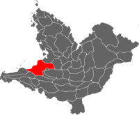
The Yajawil of Kanol is a first-level administrative division in the Mutul located in the western regions of the kingdom. It covers an area considered to be the core of the Tatinak culture and the Tatinak people make up the majority of the Yajawil’s population.
Kanol is bordered by the Makrian Ocean and the Viceroyalties of Yokok'ab, Joychan,Muynal, Nuhmuwitz, and Ochk'inal.
The province can trace its origins back to the “Chik’in Kingdom” mentioned in Chaan Dynasty chronicles (320 BC - 250 CE) which had its political center in the modern city of Danguixh and founded the Kuy Dynasty that went on to conquer all the Mutals that had broken off from the Mutul following a succession crisis. The Kuy would continue to dominate the Mutul until the 10th century, when their rule was ended by a succession crisis and social uprisings. After a century long period of division, its the K’iche people who once again reunited the Divine Kingdom.
Ethnically, Kanol is very diverse. Tatinak may be the main ethnicity of the region, other main groups include the related Tepenek people, but also the N’yuhu, Nuu Davi, Ben Zaa, Teenek, K’iche and Mutun people.
Kanol is generally considered to be the heart of the Western regions, home of major industries and economic activities and with a culture and a diversity generally representative of Western Mutul at large, which explain why the Divine Throne has always kept a watchful eye on the Province, making sure that uniting factors, like the common religion the White Path and the use of the common language Mutli, remain strong to ensure the stability of the social order at large.
Etymology
Kanol is the Mutli tradition of “Tatinak”, which mean “Four Hearts”, a reference to the four main political and ceremonial centers of the Tatinak culture : Danguixh, Tajiin, Puxamchuchut, and Tuzakan. Today, all four of these centers are the capitals of their respective Kuchkabals, with Danguixh being the capital for the Province at large alongside one of the largest city in the country.
History
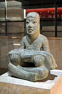
The territory of the Province was first inhabited by humans around 10,000 BCE, with most of the oldest settlements being found in the central valleys or alongside the northern coast. There are more than 500 prehistoric sites in the Valleys alone, with stone tools dating back to between 6500 and 4900 BCE and evidence of agriculture to 3500 and 2000 BCE. The rise of city states came later than in Central Mutul, but started around 900 BCE following modern estimates.
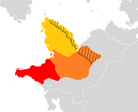
By 300 BCE, four major site had been united, through unknown methods, and formed a state known by the Chaan Dynasty chroniclers as the “Chik’inli Kingdom”, Chik’inli being the name used by the Chaan and the Paol’lunyu before them to refer to people living to their west they considered to be barbarians. These cities were the modern Danguixh, Tajiin, Puxamchuchut, and Tuzakan. The Chik’inli Kingdom blocked the westward expansion of the Mutul and established its own, distinct culture and society. With time, political powers came to be centralized in Danguixh which became the proeminent city of the area.By the time of the Brother War that ended the Chaan Dynasty, the Chik’inli Kingdom was large and powerful enough to intervene in this succession crisis, declaring itself to be the new “Mutul” until its king took for himself the title of K’uhul Ajaw.
Kuy Dynasties

The era of “Chik’inli domination” over the Mutul is generally divided into four dynasties : the Kuy, the Tz’amkuy, the Nehn, and the Chankuy.
The Kuy dynasty took it’s name from Jatz’om Kuy (Spearthrower Owl), the occult and quasi-mythic ruler of Danguixh who was the mastermind and the force behind the reunification of the Mutul. He enthroned his son Yax Nun Ahin as the new K’uhul Ajaw in 301 CE. When Jatz’om Kuy died in 304 CE, both his kingdom and the Mutul were united under the new K’uhul Ajaw. In modern days, Jatz’om Kuy is generally worshipped as an aspect of Itzamna, a creator god and father of Chaak (and thus of the K’uhul Ajaw) in some Sakbe traditions.
In 357 CE, 56 years after Jatz’om Kuy’s conquests, his grandson Siyaj Chan K’awiil, in the 30th year of his rule, moved his capital from Danguixh to the rebuilt city of Yux, the old capital of the Chaan Dynasty that he renamed Uaxakatz’am, thus starting the Tz’amkuy Dynasty. The divide between the “Mutun” aristocracy and their culture that fascinated the higher spheres of the Kuy court, and the traditionalist Tatinak aristocracy that disapproved of the encroaching “Mutulization” reached its paroxism, notably characterized in the cumbersome compromise forced on the Divine lords that they had to move their court between Danguixh and Uaxakatz’am every nine months.
In 515, during the Maize Bread Rebellion, the K’uhul Ajaw was forced to flee Danguixh but was ultimately betrayed and captured by the Mutulese aristocracy who sacrificed and replaced him with his brother, who was a pure product of the Tatinak-Mutulese culture. This event and the following purges against them led to the end of the “pureblood” Tatinak aristocracy as a political forces, despite some attempt to rebel against the K’uhul Ajaw that led to nowhere since they had been too weakened by the Maize Bread Rebellion. This new Chankuy Dynasty settled once and for all in Uaxakatz’am. Even if the western regions continued to be among the most prosperous, privileged and prestigious possessions of the Chankuy, they would nonetheless never find the political reach they once had over the entire Divine Kingdom.
Cousins War
During the succession crisis known in the Mutul as the “Cousins War” (991 - 1090), the territories of modern Kanol and other western Yajawil came under the control of an independent Mutal based in Danguixh. This “Ochk’in Mutal” would become one of the major factions during the war, wrestling control with the Xuman and Olwitz Mutals over the central regions. This constant warfare led to the weakening of these Mutals, who were ultimately all conquered by the K’iche Kingdom.
Geography
Geographically, Kanol is a very diverse province, being delimited to the north by the Makrian Ocean, with its coastal territories extending from the Lankasen river to the east to the Tzini river to the west. It’s inland regions are very mountainous, with deep valleys separated by high volcanic mountains or plateaus. A typical example would be the Xizabi Valley, where the city of Danguixh was built. Thus the climate range from tropical to Oceanic (of the Subtropical Highlands variety) giving the province a great ecologic patrimony.
Natural attractions
Reputed for the beauty of its landscape, Kanol’s natural attractions include the “Western Volcanic Range’s Natural Reserve”, The “Capricious Rocks Valley” named after the odd shapes taken by basalt formations surging from its ground created by millions of years of erosion, and many national parks. Access to these parks, especially to their high peaks, is more restricted than in the past due to past ecological damage. Even further restrictions are put into place when the volcanic belt is active. These parks are generally associated to a large Temple-Monastery or a serie of smaller Calendar Temples, if not both, and thus at the center of local pilgrimages and festivities, using the many small caves that can be found on the slopes of the mountains and volcanoes there.
The center of the state, there is an area filled with lakes, both with water and dry. The dry lakebeds contain water only during the rainy season. The city of Danguixh is built on top of a network of such lakes, which explain the presence of its characteristic dense system of canals and waterways.
In its coastal regions, the Province has one of the most diverse ecosystem of the continent, with an especially rich array of insects, arachnids, and birds, many of which are endemics to Kanol. During the 19th and 20th century, deforestation became a major threat to the biodiversity of the area. With the rise of the “Rezeists” faction, sustainable agricultural methods, like the Milpa system and the Pet Kot were introduced to save endemic species from extinction while allowing farmers to retain their livelihoods. Rainforests and jungles still untouched where then erected as protected areas, under the supervision of local temples with partnerships with various universities and laboratories.
Economy
Agriculture
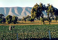
The primary sector of the economy remain important in modern day Kanol. The Yajawil has abundant rainfall and extremely fertile soils, as well as a long coastline and forest containing a wide variety of trees and other plants. The majority of the farmlands are communal and used to raise domestic fowls, from turkeys to Terror Birds and Ostriches, and cultivate crops and other products like chocolate, vanilla, sugarcane, tobacco, bananas, coconuts, citrus fruits, and vegetables, alongside cotton, rubber, and hemp. Kanol’s long coastline support a large fishing industry with most of the Mutul’s oysters and shrimps coming from there. Political support for the initiative since the eighties have led to Kanol’s many rivers to be equipped with water purification plants, many using algaes in their process to clean the water from nutriments in excess like nitrogen from agricultural activities. These algaes are then transformed into dietary supplement, gelatine, or biofuel. Fish farming has also been encouraged by the government.
Natural ressources
Kanol remain one of the most important component of the Mutul’s economy. Through its large coast, it was historically a major salt producer but in modern time, this same coast is more interesting for the access it grant to the Yajawil to oil reserves, both on and offshore. Approximately 6,400,000 cubic meters of oil are produced each year and 3.111×10⁹ cubic meters of natural gas. There are 20 petrochemical plants in total in the Province.
The mountains contain deposits of gold, silver, iron, and coal. Although Kanol is an important source of metals such as iron and copper, a great deal of its mining involves non-metallic minerals as sulfur, silica, feldspar, calcium, kaolin and marble.
60% of the manufacturing industry GDP is generated by the chemical and petrochemical sectors. Other products include metals, processed foods, beverages, printing and publishing, textiles and machinery. Alongside the Yajawils of Yokokal and Teenekab, Kanol is one of the main “door” between the Divine Kingdom and Ochran, their deepwater ports being extensively used for exports and imports with Tsurushima, Pulau Keramat, Tarsas, Tulura, and Benaajab. 25 companies based in Kanol have been classified as high-volume exporters.
Culture
Cuisine
The staple triumvirate of corn, beans, and squash was supplemented by tropical fruits, vanilla beans, and an herbs. Another important native contribution is seafood, which is featured in many dishes. Extensive trade with Ochran between the 17th and 19th century have brought in spices such as cloves, cinnamon, and black pepper alongside new crops like rice.
The Tatinak gastronomy is special in that corn does not traditionally play a very important role compared to other neighboring regions. It notably lacks the flatbreads otherwise characteristic of the Mutulese cuisine. The traditional morning food is corn porridge, while at lunch, the main meal of the day, one of the most eaten dish is a stew of beans and red Terror Bird meat. Other common dishes include rice cooked with seafood and rice with fried bananas, fish soup, and jugged hare or venisons. The deeper into the mountain regions one goes, the less seafood becomes important while corn flatbreads and other kind of cakes makes their apparition. Another characteristic of the region is its many liquors produced both from chocolate and agave.
Clothing
Tatinak are known to dress grandly. Women braid their hairs with feathers and wear long, embroidered skirts and generally a poncho. They often tattoo their face with red inks. Men tend to wear simple white cotton long-sleeved shirts and pants to better contrast with their colorful cloaks and mantles. Both sexes keep their hair longs, sometime with a thick tuft of hair on the top tied up with a ribbon.


