St. Clarke County Route 10: Difference between revisions
Jump to navigation
Jump to search
(Created page with "right|300px {{Infobox road |length_mi=32 |length_ref= |formed=1965 |direction_a=South |terminus_a= File:St. Clarke Co. 5.png|25px|link=St. Cla...") |
No edit summary |
||
| (3 intermediate revisions by the same user not shown) | |||
| Line 10: | Line 10: | ||
*[[File:US 74.svg|25px|link=Ibican Route 74]] | *[[File:US 74.svg|25px|link=Ibican Route 74]] | ||
}} | }} | ||
|direction_b= | |direction_b=North | ||
|terminus_b=[[ | |terminus_b=[[File:AL-118.png|25px|link=Albion State Route 118]][[File:AL-254.png|25px|link=Albion State Route 254]] in [[Cleveland, Albion]] | ||
}} | }} | ||
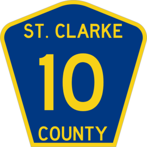
'''St. Clarke County Route 10''' or '''County Route 10''' ('''CR 10''') is an north-south county-maintained highway in the [[St. Clarke Metropolitan Area]]. | '''St. Clarke County Route 10''' or '''County Route 10''' ('''CR 10''') is an north-south county-maintained highway in the [[St. Clarke Metropolitan Area]]. | ||
| Line 36: | Line 36: | ||
|- | |- | ||
| [[Georgetown, Albion|Georgetown]] | | [[Georgetown, Albion|Georgetown]] | ||
| [[File:IR-50- | | [[File:IR-50-Alt.png|25px|link=Ibican Route 50 Alternate]] - [[St. Clarke]], [[Lufkin, Albion|Lufkin]] | ||
|- | |- | ||
| rowspan="3" | [[St. Clarke]] | | rowspan="3" | [[St. Clarke]] | ||
| South [[File:AL-49|25px|link=Albion State Route 49]] - Downtown | | South [[File:AL-49.png|25px|link=Albion State Route 49]] - Downtown | ||
|- | |- | ||
| [[File:St. Clarke Co. 17.png|25px|link=St. Clarke County Route 17]] - [[Camden Park, Albion|Camden Park]] | | [[File:St. Clarke Co. 17.png|25px|link=St. Clarke County Route 17]] - [[Camden Park, Albion|Camden Park]] | ||
|- | |- | ||
| North [[File:AL-49|25px|link=Albion State Route 49]] - [[Port of St. Clarke]] | | North [[File:AL-49.png|25px|link=Albion State Route 49]] - [[Port of St. Clarke]] | ||
|- | |- | ||
| rowspan="2" | [[Cleveland, Albion|Cleveland]] | | rowspan="2" | [[Cleveland, Albion|Cleveland]] | ||
| [[St. Clarke River]] | | [[St. Clarke River]] | ||
|- | |- | ||
| [[File:AL-118|25px|link=Albion State Route 118]] - [[Brampton, Albion|Brampton]], [[Saints Beach, Albion|Saints Beach]] | | [[File:AL-118.png|25px|link=Albion State Route 118]][[File:AL-254.png|25px|link=Albion State Route 254]] - [[Brampton, Albion|Brampton]], [[Saints Beach, Albion|Saints Beach]], [[Roscoe, Albion|Roscoe]] | ||
|} | |} | ||
{{STC Routes}} | {{STC Routes}} | ||
[[Category:St. Clarke County Routes| | [[Category:St. Clarke County Routes|10]] | ||
Latest revision as of 07:06, 4 March 2024

| Route information | |
|---|---|
| Length | 32 mi (51 km) |
| Existed | 1965–present |
| Major junctions | |
| South end | |
| North end | |
St. Clarke County Route 10 or County Route 10 (CR 10) is an north-south county-maintained highway in the St. Clarke Metropolitan Area.
Major intersections
| County | Location | Destination |
|---|---|---|
| St. Clarke | Calgary | |
| Spring County Park | ||
| Springtown | ||
| Richmond | ||
| Georgetown | ||
| St. Clarke | South | |
| North | ||
| Cleveland | St. Clarke River | |