Mangata (Freedonia): Difference between revisions
| (31 intermediate revisions by the same user not shown) | |||
| Line 80: | Line 80: | ||
|subdivision_type3 = | |subdivision_type3 = | ||
|subdivision_name3 = | |subdivision_name3 = | ||
|established_title | |established_title = Founding | ||
|established_date = 1736 | |established_date = 1736 | ||
|founder = James Mangata | |founder = James Mangata | ||
| Line 88: | Line 88: | ||
|leader_party = [[Progressive Democratic Party (Freedonia)|PDP]] | |leader_party = [[Progressive Democratic Party (Freedonia)|PDP]] | ||
|leader_title = Mayor | |leader_title = Mayor | ||
|leader_name = | |leader_name = Ail Nasser | ||
|unit_pref = US<!-- or UK --> | |unit_pref = US<!-- or UK --> | ||
<!-- ALL fields with measurements have automatic unit conversion --> | <!-- ALL fields with measurements have automatic unit conversion --> | ||
| Line 160: | Line 160: | ||
| Mar high F = 75 | | Mar high F = 75 | ||
| Apr high F = 70 | | Apr high F = 70 | ||
| May high F = | | May high F = 64 | ||
| Jun high F = | | Jun high F = 61 | ||
| Jul high F = | | Jul high F = 59 | ||
| Aug high F = | | Aug high F = 60 | ||
| Sep high F = 65 | | Sep high F = 65 | ||
| Oct high F = 69 | | Oct high F = 69 | ||
| Line 185: | Line 185: | ||
| Feb low F = 64 | | Feb low F = 64 | ||
| Mar low F = 61 | | Mar low F = 61 | ||
| Apr low F = | | Apr low F = 55 | ||
| May low F = | | May low F = 51 | ||
| Jun low F = | | Jun low F = 47 | ||
| Jul low F = 45 | | Jul low F = 45 | ||
| Aug low F = 45 | | Aug low F = 45 | ||
| Line 280: | Line 280: | ||
===Parks and Gardens=== | ===Parks and Gardens=== | ||
[[File:Newlands-forest-cape-town-mujahids-photography.jpg|thumb|right|The pine forest pictured here is part of the Mangata Greenbelt Park]] | |||
There are two main parks within the city. The Mangata Greenbelt which separates the city Mangata from other suburbs. It is 15 sq mi in area (1.5 miles north to south and 10 miles east to west. The second main park is South Cape Park, which is at the southern cape of Mangata. It is 5 sq mi in area. There are 16 smaller parks and gardens in the city. The parks and gardens of the city are maintained by the City of Mangta Parks and Gardens Department. | |||
==Demographics== | ==Demographics== | ||
The city Mangata is Freedonia's most populous city and the principal city of Grand Mangata aka Greater Mangata Metropolitan Area. The Grand Mangata Region is the most populous region in the country. Home to 5.6 million people living in a area of 5,300 square miles. Which brings the regional density to the highest in the country at 1,056.6 people per square mile. The Grand Mangata Region has a total of 31 municipalities. 21 are urban municipalities, and 10 are rural municipalities. The population of all urban municipalities reached 5.04 million people living in an area of 2,100 square miles. The urban population density is 2,400 people per square mile. The rural municipalities has a population 560,000 people living in an area of 3,200 square miles. The rural population density is 175 people per square mile. The average age of Mangata is 27.5 years. The average age of Grand Mangata is 31.3 years old. The average age of Freedonia is 33.8 years old. | |||
===Race=== | |||
As of the 2020 census, the city of Mangata is the diverse city in the country. With 46% of the city population being white, 35% of the city population being black, 16% of the city population being Ausianan, and 3% being mixed race. As of the 2020 census, 26% of the population of the city is considered foreign born. With the foreign-born population doubling between 2010 and 2020. | |||
===Religion=== | |||
As of the 2020 census, the city of Mangata had the highest concentration of non- religious people in the country at 33% of the population. 28% of the population considered themselves Christian. 26% of the population considered themselves followers of Islam. 8% considered themselves followers of Ausianan religions. 5% of the population considered themselves Jewish. | |||
===Sexual Orientation=== | |||
There are 224,000 people people who considered themselves LGBTQ in Grand Mangata (4% of the regions population. 112,000 people in the city of Mangata are LGBT (10% of the city's population). | |||
{{Historical populations | {{Historical populations | ||
| 1750 | 1,800 | | 1750 | 1,800 | ||
| Line 305: | Line 321: | ||
==Neighborhoods== | ==Neighborhoods== | ||
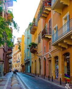
There are 39 neighborhoods in the city Mangata. The neighborhoods are largely residential or mixed use. With a couple neighborhoods being of majority commercial such as Mangata CBD, or majority industrial such as Port Mangata. | |||
The 39 neighborhoods are: | |||
{{div col|colwidth=12em}} | |||
*Marcos | |||
*Mangata CBD | |||
*Decor | |||
*Old Mangata | |||
*Port Mangata | |||
*Dodo | |||
*South Cape Estates | |||
*La Rosa | |||
*Bellevue Beach | |||
*Hookhaven | |||
*Jamerson | |||
*Loft Arts | |||
*Spring City | |||
*Greycott | |||
*Banaster | |||
*Glasener | |||
*Mercer | |||
*Oakland | |||
*Palmdale | |||
*Pine Forest | |||
*Horn Band | |||
*Newlands | |||
*Castle Estates | |||
*Kimberly | |||
*Bossa Nova | |||
*Canwell | |||
*West Greenbelt Gardens | |||
*East Greenbelt Gardens | |||
*Paynestown | |||
*Kerry | |||
*Little San Miguel | |||
*Hartfield | |||
*Barcade | |||
*Peacedale | |||
*White City | |||
*Golden Gables | |||
*Saint Jarvis | |||
*Eastwood | |||
*Bayside | |||
{{div col end}} | |||
[[File:Casablanca.original.9313.jpg|thumb|right|A middle class neighborhood of Marcos]] | |||
[[File:Casablanca street.jpg|thumb|right|The neighborhood of Decor, known for its art deco architecture]] | |||
[[File:City Street.jpg|thumb|right|The neighborhood of Loft Arts, known as bohemian neighborhood]] | |||
[[File:City streets 2.jpg|thumb|right|The neighborhood of Old Mangata]] | |||
==Government and Politics== | ==Government and Politics== | ||
[[File:City Council of Mangata .svg]] | |||
The City Council of Mangata is a 40-member legislative body of city administration. As of 2022, the council is majority controlled by the PDP with 21 seats. The second largest party is FNC (9), followed by third parties of the Greens (5), FFF (3), and NF (2). The current Mayor of Mangta is Ali Nasser (elected in 2018) of the PDP. Each neighborhood as their own city councilor and the city as a whole elect 1 member for city council. The police commissioner is appointed by the mayor with approval via the city council. | |||
There are 10 departments of the city | |||
The Mangata Fire Department | |||
The Mangata Police Department | |||
The Mangata Parks and Gardens Department | |||
The Mangata Health Department | |||
The Mangata Public Works Department | |||
The Mangata Port Authority Department | |||
The Mangata Historical Preservation and Tourist Attraction Department | |||
The Mangata Child and Family Safety Department | |||
The Mangata Housing Department | |||
The Mangata Sewage and Water Department | |||
The city GDP was $14.56 Billion in 2020 with a per capita of $13,000. The city budget stood at $4 Billion in 2020. | |||
==Transportation== | ==Transportation== | ||
===Buses and Bus Rapid Transit=== | ===Buses and Bus Rapid Transit=== | ||
The Grand Mangata Public Transportation Authority or GMPTA runs 170 bus routes. 110 suburban bus routes and 50 city bus routes. There are 10 bus rapid transit routes (5 in the city of Mangata and 5 in the suburbs). The weekday daily ridership reaches 560,000 people per day. Buses run 24/7. There are 4 hubs. The Mangata Bus Terminal is the main hub, North Bay, East Bay, and West Bay sub hubs are all important to the bus system. | |||
===Mangata Metro System=== | ===Mangata Metro System=== | ||
[[File:Kairo Metro 329-1024x681.jpg|thumb|A train arriving at a station in the Mangata Metro System]] | [[File:Kairo Metro 329-1024x681.jpg|thumb|A train arriving at a station in the Mangata Metro System]] | ||
The Mangata Metro System is the only metro system in Freedonia, only serving the city of Mangata. There are 4 lines: A Line, B Line, C Line, and D Line. The weekday daily ridership reaches 400,000 people per day. The subway lines terminate at Maganta Metro Grand Station. The system runs from 6 am to 12 am. The system was opened in 1987. The cost per one way trip is Z$2.50. The Metro System totals 40 miles of track. | |||
===Commuter Rail=== | ===Commuter Rail=== | ||
The Commuter Rail operates over 390 miles of track and 12 lines. The average ridership is nearly 500,000 people per day. The system was established in 1960. The system runs from 5 am to 12 am. There are over 120 stations throughout the system. | |||
===Ferries=== | ===Ferries=== | ||
The Ferry Building at the Port of Mangata operates ferry service across the bay. The ferry cost Z$5 per one way ride. The ferry has been in use as a public service in 1915. The daily ridership is 30,000 people on average during the weekday. | |||
===Urban Tramway=== | ===Urban Tramway=== | ||
The Mangata Tramway runs for 15 miles and has 2 lines. The Tramway was opened in 2012 and sees a daily ridership during the weekday of 100,000 people per day. | |||
===Taxis and Rideshare Services=== | ===Taxis and Rideshare Services=== | ||
Taxis are operated via the Grand Mangata Public Transportation Authority. Taxis are metered at Z$0.50 per 1/4 mile in addition to a Z$2.50 fare. There are a estimated 3,500 taxis within the the Grand Mangata Region. There are ride share services such as Go! This services are highly popular among urbanites and young people as ride-sharing is cheaper on average than a traditional taxi. | |||
===Cycling Network=== | ===Cycling Network=== | ||
There are 187 miles of bike lanes in the city of Mangata. In which 75 miles of bike lanes are protected. As of 2022 there are 1,500 e-bikes and e-scooters scattered around the city. The cost is Z$1 to jump on and Z$0.15 per mile. There are bike/walking paths that are scattered throughout the Grand Mangata Region. | |||
===Streets and Motorways=== | ===Streets and Motorways=== | ||
The Perimeter Motorway (M-14) is a 12 mile Motorway that seperates the city of Mangata from the neighboring Municipalities. The Mangata Greenbelt Park is located south of the Motorway. The M-12 Motorway hugs the bay coast traveling north east to south west, it travels through the greenbelt to turn into Cape Bay Blvd. N-1 is a Motorway that travels out of Grand Mangata Region into the Sutherland Region. It is the longest Motorway in the country. It ends at the intersection of M-14 and Armed Forces Blvd. There are 8 Motorways within the Grand Mangata Region. Another major street in Mangata is White Cape Blvd. The M-6 Motorway connects Mangata and the West bay to the east bay via the San Miguel Bay Bridge which is 11.3 miles long. The M-6 Motorway splits into two streets at a roundabout in South Cape Park. The Bridge carries 160,000 vehicles per day. | |||
===Air=== | ===Air=== | ||
Mangata International Airport is located 30 miles away from Mangata. It is the busiest airport in Freedonia. It is well connected by bus, taxi, commuter rail, and Motorway. There are a few smaller regional airports for smaller plane and private planes. Mangata International Airport is the main hub for Freedonia Airlines. | |||
==Culture== | ==Culture== | ||
[[My Forbidden Love]] | [[My Forbidden Love]] | ||
[[File:View-of-museum-from-the.jpg|thumb|right|The Mangata Art Museum]] | |||
[[File:Mangata Palace.jpg|thumb|right|The Sandoval Library (Main Branch of the Mangata Public Library)]] | |||
[[File:Mangata Palace 2.png|thumb|right|The Mangata Natural History Museum]] | |||
==Economy== | ==Economy== | ||
The unemployment rate of the city of Mangata stood at 4% as of 2022. The city is considered the nation's economic engine. With the headquarters of major companies located in the city. The rise of the tech has transformed the city. The city has seen the rise of massive skyscrapers in the last 15 years in a boom that continues to this day. | |||
[[Category: Freedonia]] | [[Category: Freedonia]] | ||
Latest revision as of 22:36, 20 July 2022
Mangata | |
|---|---|
City | |
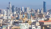
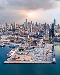
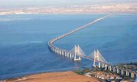
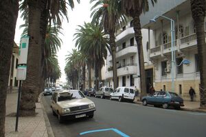
From Top to bottom: Mangata Central City Skyline, Mangata Center City Skyline from the Port of Mangata, The White City of Mangata from above, The White City of Mangata, Armed Forces Blvd, White Cape Blvd, Monent Building (1933), Mangata Hotel (1937), South Cape Park, Bellevue Beach, San Miguel Bay Bridge (2008) | |
| Nickname(s): The White City, City of the South, Cape City | |
| Country | Freedonia |
| Region | Grand Mangata |
| Founding | 1736 |
| Founded by | James Mangata |
| Government | |
| • Mayor | Ail Nasser (PDP) |
| Area | |
| • City | 130 sq mi (300 km2) |
| • Land | 100 sq mi (300 km2) |
| • Water | 30 sq mi (80 km2) |
| • Urban | 80 sq mi (200 km2) |
| • Rural | 20 sq mi (50 km2) |
| Elevation | 337 ft (103 m) |
| Population (2020) | |
| • City | 1,120,000 |
| • Density | 14,000/sq mi (5,000/km2) |
| Population Density based on Municipal Urban Land Area | |
| Demonym | Mangatan |
| Time zone | Freedonia Time |
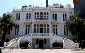
Mangata is the largest city of Freedonia and capital of Grand Mangata. The city is the famous for its architecture. Spanning from Art Deco to Modern to Brutalist. The city originally founded in 1736 by James Mangata was destroyed during the Freedonian Civil War. After its aftermath, the city was rebuilt between 1910 and 1945. Mangata saw a second building boom starting from 2005 to the present. Two major parks flank the city, South Cape Park and Mangta Urban Green Belt. The Grand Mangata Region is the metropolitan surrounding the city of Mangata. There are multiple modes of transportation in and around the city. The city is Freedonia's most diverse city, and the economic engine of the country. The most popular form of Freedonian music is Bossa Nova. Which is commonly played in the city at jazz bars/clubs and cafes.
History
Geography
WIP
Climate
WIP
| Climate data for Mangata, Grand Mangata, Freedonia, 1991–2020 normals, extremes 1944–present | |||||||||||||
|---|---|---|---|---|---|---|---|---|---|---|---|---|---|
| Month | Jan | Feb | Mar | Apr | May | Jun | Jul | Aug | Sep | Oct | Nov | Dec | Year |
| Record high °F (°C) | 101 (38) |
100 (38) |
99 (37) |
95 (35) |
91 (33) |
88 (31) |
82 (28) |
83 (28) |
86 (30) |
90 (32) |
95 (35) |
98 (37) |
101 (38) |
| Average high °F (°C) | 79 (26) |
78 (26) |
75 (24) |
70 (21) |
64 (18) |
61 (16) |
59 (15) |
60 (16) |
65 (18) |
69 (21) |
74 (23) |
77 (25) |
69 (21) |
| Average low °F (°C) | 65 (18) |
64 (18) |
61 (16) |
55 (13) |
51 (11) |
47 (8) |
45 (7) |
45 (7) |
49 (9) |
53 (12) |
59 (15) |
62 (17) |
55 (13) |
| Record low °F (°C) | 52 (11) |
50 (10) |
46 (8) |
42 (6) |
37 (3) |
32 (0) |
27 (−3) |
29 (−2) |
34 (1) |
39 (4) |
45 (7) |
49 (9) |
27 (−3) |
| Average precipitation inches (mm) | 5.51 (140) |
4.54 (115) |
3.58 (91) |
2.78 (71) |
3.34 (85) |
4.28 (109) |
5.65 (144) |
4.31 (109) |
3.43 (87) |
2.48 (63) |
3.19 (81) |
4.69 (119) |
47.78 (1,214) |
| Average precipitation days (≥ 0.01 in) | 11 | 10 | 9 | 7 | 7 | 9 | 12 | 11 | 9 | 7 | 8 | 10 | 110 |
| Source: Freedonia Weather Service | |||||||||||||
Parks and Gardens
There are two main parks within the city. The Mangata Greenbelt which separates the city Mangata from other suburbs. It is 15 sq mi in area (1.5 miles north to south and 10 miles east to west. The second main park is South Cape Park, which is at the southern cape of Mangata. It is 5 sq mi in area. There are 16 smaller parks and gardens in the city. The parks and gardens of the city are maintained by the City of Mangta Parks and Gardens Department.
Demographics
The city Mangata is Freedonia's most populous city and the principal city of Grand Mangata aka Greater Mangata Metropolitan Area. The Grand Mangata Region is the most populous region in the country. Home to 5.6 million people living in a area of 5,300 square miles. Which brings the regional density to the highest in the country at 1,056.6 people per square mile. The Grand Mangata Region has a total of 31 municipalities. 21 are urban municipalities, and 10 are rural municipalities. The population of all urban municipalities reached 5.04 million people living in an area of 2,100 square miles. The urban population density is 2,400 people per square mile. The rural municipalities has a population 560,000 people living in an area of 3,200 square miles. The rural population density is 175 people per square mile. The average age of Mangata is 27.5 years. The average age of Grand Mangata is 31.3 years old. The average age of Freedonia is 33.8 years old.
Race
As of the 2020 census, the city of Mangata is the diverse city in the country. With 46% of the city population being white, 35% of the city population being black, 16% of the city population being Ausianan, and 3% being mixed race. As of the 2020 census, 26% of the population of the city is considered foreign born. With the foreign-born population doubling between 2010 and 2020.
Religion
As of the 2020 census, the city of Mangata had the highest concentration of non- religious people in the country at 33% of the population. 28% of the population considered themselves Christian. 26% of the population considered themselves followers of Islam. 8% considered themselves followers of Ausianan religions. 5% of the population considered themselves Jewish.
Sexual Orientation
There are 224,000 people people who considered themselves LGBTQ in Grand Mangata (4% of the regions population. 112,000 people in the city of Mangata are LGBT (10% of the city's population).
| Historical population | ||
|---|---|---|
| Year | Pop. | ±% |
| 1750 | 1,800 | — |
| 1800 | 10,000 | +455.6% |
| 1820 | 30,000 | +200.0% |
| 1830 | 60,000 | +100.0% |
| 1840 | 96,000 | +60.0% |
| 1850 | 192,000 | +100.0% |
| 1898 | 490,000 | +155.2% |
| 1910 | 194,000 | −60.4% |
| 1920 | 340,000 | +75.3% |
| 1930 | 410,000 | +20.6% |
| 1940 | 470,000 | +14.6% |
| 1950 | 546,000 | +16.2% |
| 1960 | 676,000 | +23.8% |
| 1970 | 730,000 | +8.0% |
| 1980 | 810,000 | +11.0% |
| 1990 | 890,000 | +9.9% |
| 2000 | 960,000 | +7.9% |
| 2010 | 1,048,000 | +9.2% |
| 2020 | 1,120,000 | +6.9% |
Neighborhoods
There are 39 neighborhoods in the city Mangata. The neighborhoods are largely residential or mixed use. With a couple neighborhoods being of majority commercial such as Mangata CBD, or majority industrial such as Port Mangata.
The 39 neighborhoods are:
- Marcos
- Mangata CBD
- Decor
- Old Mangata
- Port Mangata
- Dodo
- South Cape Estates
- La Rosa
- Bellevue Beach
- Hookhaven
- Jamerson
- Loft Arts
- Spring City
- Greycott
- Banaster
- Glasener
- Mercer
- Oakland
- Palmdale
- Pine Forest
- Horn Band
- Newlands
- Castle Estates
- Kimberly
- Bossa Nova
- Canwell
- West Greenbelt Gardens
- East Greenbelt Gardens
- Paynestown
- Kerry
- Little San Miguel
- Hartfield
- Barcade
- Peacedale
- White City
- Golden Gables
- Saint Jarvis
- Eastwood
- Bayside
Government and Politics
The City Council of Mangata is a 40-member legislative body of city administration. As of 2022, the council is majority controlled by the PDP with 21 seats. The second largest party is FNC (9), followed by third parties of the Greens (5), FFF (3), and NF (2). The current Mayor of Mangta is Ali Nasser (elected in 2018) of the PDP. Each neighborhood as their own city councilor and the city as a whole elect 1 member for city council. The police commissioner is appointed by the mayor with approval via the city council.
There are 10 departments of the city The Mangata Fire Department The Mangata Police Department The Mangata Parks and Gardens Department The Mangata Health Department The Mangata Public Works Department The Mangata Port Authority Department The Mangata Historical Preservation and Tourist Attraction Department The Mangata Child and Family Safety Department The Mangata Housing Department The Mangata Sewage and Water Department
The city GDP was $14.56 Billion in 2020 with a per capita of $13,000. The city budget stood at $4 Billion in 2020.
Transportation
Buses and Bus Rapid Transit
The Grand Mangata Public Transportation Authority or GMPTA runs 170 bus routes. 110 suburban bus routes and 50 city bus routes. There are 10 bus rapid transit routes (5 in the city of Mangata and 5 in the suburbs). The weekday daily ridership reaches 560,000 people per day. Buses run 24/7. There are 4 hubs. The Mangata Bus Terminal is the main hub, North Bay, East Bay, and West Bay sub hubs are all important to the bus system.
Mangata Metro System
The Mangata Metro System is the only metro system in Freedonia, only serving the city of Mangata. There are 4 lines: A Line, B Line, C Line, and D Line. The weekday daily ridership reaches 400,000 people per day. The subway lines terminate at Maganta Metro Grand Station. The system runs from 6 am to 12 am. The system was opened in 1987. The cost per one way trip is Z$2.50. The Metro System totals 40 miles of track.
Commuter Rail
The Commuter Rail operates over 390 miles of track and 12 lines. The average ridership is nearly 500,000 people per day. The system was established in 1960. The system runs from 5 am to 12 am. There are over 120 stations throughout the system.
Ferries
The Ferry Building at the Port of Mangata operates ferry service across the bay. The ferry cost Z$5 per one way ride. The ferry has been in use as a public service in 1915. The daily ridership is 30,000 people on average during the weekday.
Urban Tramway
The Mangata Tramway runs for 15 miles and has 2 lines. The Tramway was opened in 2012 and sees a daily ridership during the weekday of 100,000 people per day.
Taxis are operated via the Grand Mangata Public Transportation Authority. Taxis are metered at Z$0.50 per 1/4 mile in addition to a Z$2.50 fare. There are a estimated 3,500 taxis within the the Grand Mangata Region. There are ride share services such as Go! This services are highly popular among urbanites and young people as ride-sharing is cheaper on average than a traditional taxi.
Cycling Network
There are 187 miles of bike lanes in the city of Mangata. In which 75 miles of bike lanes are protected. As of 2022 there are 1,500 e-bikes and e-scooters scattered around the city. The cost is Z$1 to jump on and Z$0.15 per mile. There are bike/walking paths that are scattered throughout the Grand Mangata Region.
Streets and Motorways
The Perimeter Motorway (M-14) is a 12 mile Motorway that seperates the city of Mangata from the neighboring Municipalities. The Mangata Greenbelt Park is located south of the Motorway. The M-12 Motorway hugs the bay coast traveling north east to south west, it travels through the greenbelt to turn into Cape Bay Blvd. N-1 is a Motorway that travels out of Grand Mangata Region into the Sutherland Region. It is the longest Motorway in the country. It ends at the intersection of M-14 and Armed Forces Blvd. There are 8 Motorways within the Grand Mangata Region. Another major street in Mangata is White Cape Blvd. The M-6 Motorway connects Mangata and the West bay to the east bay via the San Miguel Bay Bridge which is 11.3 miles long. The M-6 Motorway splits into two streets at a roundabout in South Cape Park. The Bridge carries 160,000 vehicles per day.
Air
Mangata International Airport is located 30 miles away from Mangata. It is the busiest airport in Freedonia. It is well connected by bus, taxi, commuter rail, and Motorway. There are a few smaller regional airports for smaller plane and private planes. Mangata International Airport is the main hub for Freedonia Airlines.
Culture
Economy
The unemployment rate of the city of Mangata stood at 4% as of 2022. The city is considered the nation's economic engine. With the headquarters of major companies located in the city. The rise of the tech has transformed the city. The city has seen the rise of massive skyscrapers in the last 15 years in a boom that continues to this day.
