Hazala: Difference between revisions
mNo edit summary |
No edit summary |
||
| Line 114: | Line 114: | ||
In 1942, growing tensions with the homeland lead to a full on revolution. With foreign backing, Sáillinnciad recognized Hazala as an independent nation. After several decades of instability and dictatorships, the islands entered an era of relative prosperity in the late 1980’s. Today, the main industries are tourism (mainly the pristine beaches, beautiful coral reefs, and comparatively well preserved forests) and the export of cocoa and sugar. | In 1942, growing tensions with the homeland lead to a full on revolution. With foreign backing, Sáillinnciad recognized Hazala as an independent nation. After several decades of instability and dictatorships, the islands entered an era of relative prosperity in the late 1980’s. Today, the main industries are tourism (mainly the pristine beaches, beautiful coral reefs, and comparatively well preserved forests) and the export of cocoa and sugar. | ||
==Etymology== | |||
==History== | |||
===Kilalurak becomes a monarchy, borders form=== | |||
===Zhenians arrive=== | |||
===Kisil Island=== | |||
===Civil War=== | |||
===Tuktuu Treaty=== | |||
===WWI=== | |||
===WWII=== | |||
==Geography== | |||
===Administrative Divisions=== | |||
===Topography=== | |||
===Climate=== | |||
===Biodiversity=== | |||
====Environmental Issues==== | |||
==Politics and Government== | |||
===Government=== | |||
====Political Parties==== | |||
====Corruption Allegations==== | |||
====Political Rights==== | |||
===Defense=== | |||
===Foreign Relations=== | |||
==Economy & Infrastructure== | |||
===Agriculture=== | |||
===Energy=== | |||
====Oil==== | |||
====Renewable Energy==== | |||
===Industry=== | |||
===Transport=== | |||
====Rail==== | |||
====Road==== | |||
====Air==== | |||
====Water==== | |||
===Mining & Manufacture=== | |||
===Tourism=== | |||
===Healthcare=== | |||
===Education=== | |||
===Science & Tech=== | |||
==Demographics== | |||
===Largest Cities=== | |||
{{Template:Largest cities in Kilalurak}} | |||
===Ethnic Groups=== | |||
===Education=== | |||
====Literacy Rates==== | |||
===Religion=== | |||
==Culture== | |||
===Literature=== | |||
===Media=== | |||
===Music and Art=== | |||
===Cuisine=== | |||
===Sports=== | |||
==Social Issues== | |||
===Human Rights=== | |||
====Gay Rights==== | |||
====Women's Rights==== | |||
{{Template:INWU}} | {{Template:INWU}} | ||
Revision as of 16:51, 2 April 2020
Kilalurak Monarchy ᑭᓚᓗᕋᒃ
(Kilalurian) | |
|---|---|
| Motto: '"ᓄᕙᒨᒃ, ᒉᕉ, ᓇᕘ ᐊᒃᒃᒥᒨᓛᓈᔾ!" To be Free, To be Great, We Will Not Fall! | |
| Anthem: Praise, for us and all. | |
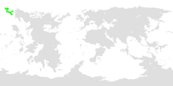
 Kilalurak highlighted in green. | |
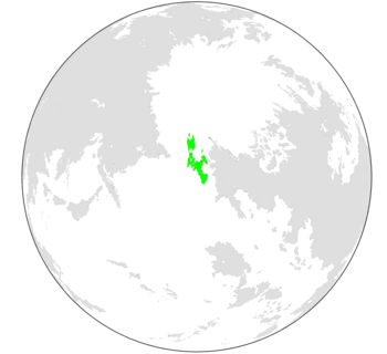
 Kilalurak as seen on a globe. | |
| Capital and largest city | Mianuuva (ᒥᐊᓅᕙ) |
| Official languages | Kilalurian, Zhenian |
| Recognised national languages | Muuvaguiikkian, South Kilalurian |
| Ethnic groups (2014) |
|
| Religion | See Religion in Kilalurak |
| Demonym(s) | Kilalurian |
| Government | Federal Elective Monarchy |
• Nanuuk | Miikijukk J. Ukpak |
| Establishment | |
• First settlers arrive in Kilalurak | 2500 BC |
• Kilalurak establishes borders | 344 AC |
• Zhenians arrive in Kilalurak, Kilalurian civil war begins | 1520-1521 AC |
• Tuktuu treaty signed | 1529 AC |
| Area | |
• | 439,959.92 km2 (169,869.47 sq mi) |
• Water (%) | 6.7% |
| Population | |
• 2020 estimate | 499,531 |
• 2019 census | 500,639 |
| GDP (PPP) | 2016 estimate |
• Total | $2.706 billion |
• Per capita | $48,911 |
| Gini (2015) | 22.1 low |
| HDI (2018) | 0.5512 medium |
| Currency | Kilalurian Sivinik (ᙟ) (KLV) |
| Time zone | UTC-11:00, -10:00 |
| Date format | dd-mm-yyyy |
| Driving side | right |
| Calling code | +474 |
| ISO 3166 code | KL |
| Internet TLD | .kl, .kila, .klrak, .krk |
The Republic of Hazala, (officially Dánila Ripóna gi Hazala), or simply Hazala is an island nation in the Mid-Allonian Ocean. The islands first formed about 70 MYA, caused by subduction of the [X] plate. Many unique endemic flora and fauna have inhabited the islands, including ratites, rails, stem-sirenians, terrestrial crocodilians, and many different groups of birds. About 1,100 years ago, human settlers from western Dihara arrived on the shores of Ulungo, bringing with them dogs, chickens, and yams. Many native species went extinct, including all the massive gharun (giant. Flightless birds), the cattle-sized bout, and all of the terrestrial crocodiles except for the arboreal janjir (also known as the Hazalan tree crocodile).
For about 650 years, Hazala remained isolated from the outside world. Many tribes split off, and farming communities appeared in the highlands of Ulungo. Narcotics played an important part in pre-contact culture, being consumed for religious, casual, ritualistic, and celebratory purposes - some particularly bold and confident warriors would get intoxicated before battle. Speaking of, wars were more ritualistic than the Auroran concept of it, with low casualties and more over minor disputes than major ideological or religious reasons. Chickens served as the main livestock, with dog consumption being considered taboo (except in extreme circumstances).
In 1535, Sáillinnciadi sailors first arrived on Hazalan shores. What began as trade soon became conquest, and by 1570 all of the islands were under colonial rule. Arboran rule caused another wave of extinction, largely due to the introduction of rats, cats, and pigs, as well as habitat destruction. One of the most important events of the colonial period on Hazalan culture was the introduction of Vayonism, specifically Reformed Vayonism, which was hybridised with local beliefs to form a new, uniquely Hazalan form of Vayonism.
In 1942, growing tensions with the homeland lead to a full on revolution. With foreign backing, Sáillinnciad recognized Hazala as an independent nation. After several decades of instability and dictatorships, the islands entered an era of relative prosperity in the late 1980’s. Today, the main industries are tourism (mainly the pristine beaches, beautiful coral reefs, and comparatively well preserved forests) and the export of cocoa and sugar.
Etymology
History
Kilalurak becomes a monarchy, borders form
Zhenians arrive
Kisil Island
Civil War
Tuktuu Treaty
WWI
WWII
Geography
Administrative Divisions
Topography
Climate
Biodiversity
Environmental Issues
Politics and Government
Government
Political Parties
Corruption Allegations
Political Rights
Defense
Foreign Relations
Economy & Infrastructure
Agriculture
Energy
Oil
Renewable Energy
Industry
Transport
Rail
Road
Air
Water
Mining & Manufacture
Tourism
Healthcare
Education
Science & Tech
Demographics
Largest Cities
| Rank | Province-level division | Pop. | |||||||
|---|---|---|---|---|---|---|---|---|---|
 Mianuuva  Subek |
1 | Mianuuva | Mianuuvan | 223,582 |  Iñuk  Sut Paturik | ||||
| 2 | Subek | Kisil Island | 120,133 | ||||||
| 3 | Iñuk | South Kilalurak | 53,543 | ||||||
| 4 | Sut Paturik | Isle of Suukk | 30,004 | ||||||
| 5 | Irakumak | Mianuuvan | 10,995 | ||||||
| 6 | Kakisak | Nauja | 6,112 | ||||||
| 7 | Tiñuk | North Kilalurak | 3,532 | ||||||
| 8 | Pikra | North Kilalurak | 3,103 | ||||||
| 9 | Numajuk | North Kilalurak | 2,963 | ||||||
| 10 | Quiñuk | South Kilalurak | 1,103 | ||||||


