List of Zamastanian Maps: Difference between revisions
Jump to navigation
Jump to search


(Created page with "==Political== frame|center|Blank map of Zamastan. File:ZamastanAdministrativeDistricts.png|frame|center|Map of Zamastan's 15 [[Administrative District...") |
No edit summary |
||
| Line 1: | Line 1: | ||
This page is a collection archive for viewing and usage of variations of [[Zamastan]] maps. | |||
==Political== | ==Political== | ||
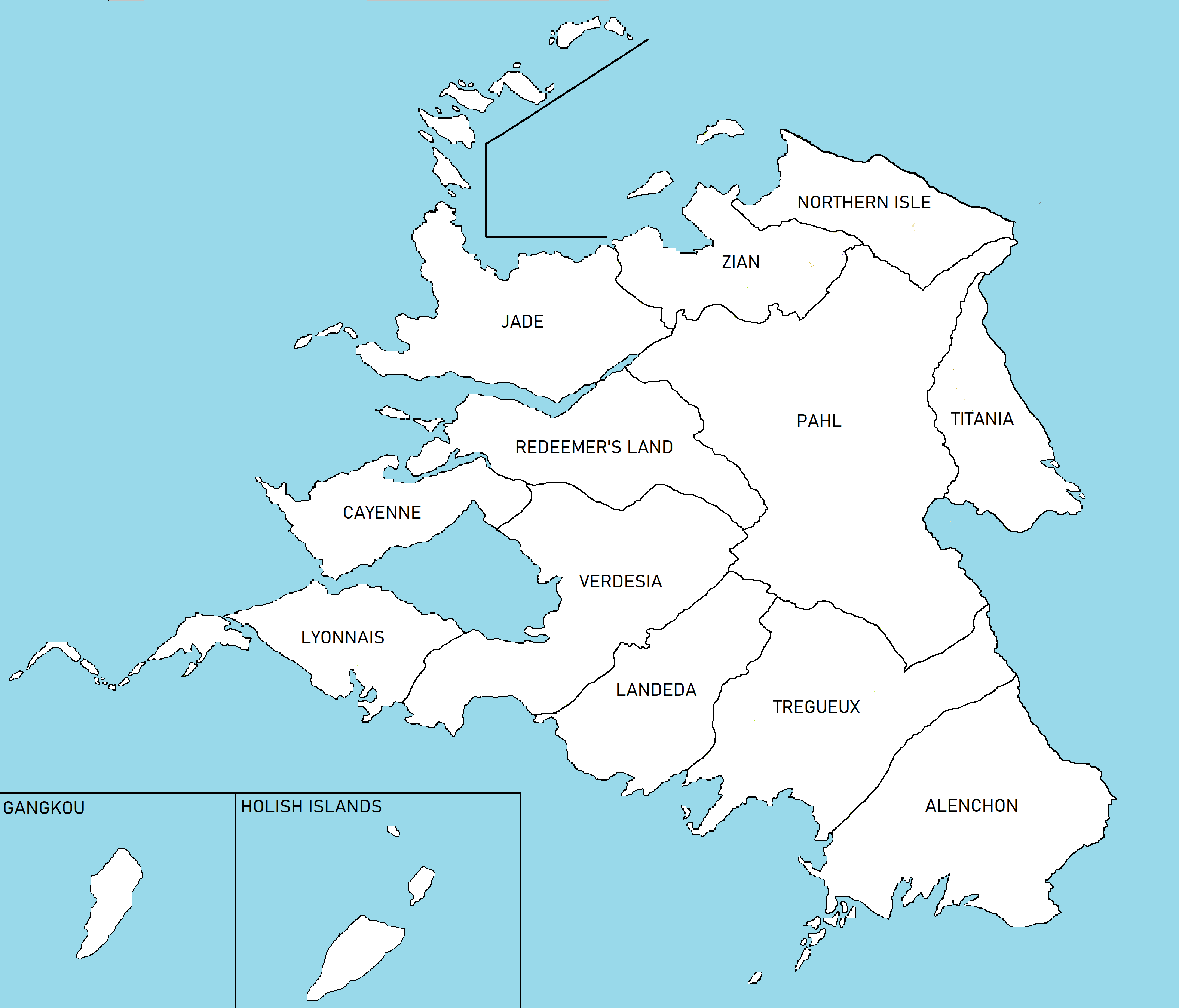
[[File:Zamastan0.png|frame|center|Blank map of Zamastan.]] | [[File:Zamastan0.png|frame|center|Blank map of Zamastan.]] | ||
| Line 5: | Line 6: | ||
==Geographical== | ==Geographical== | ||
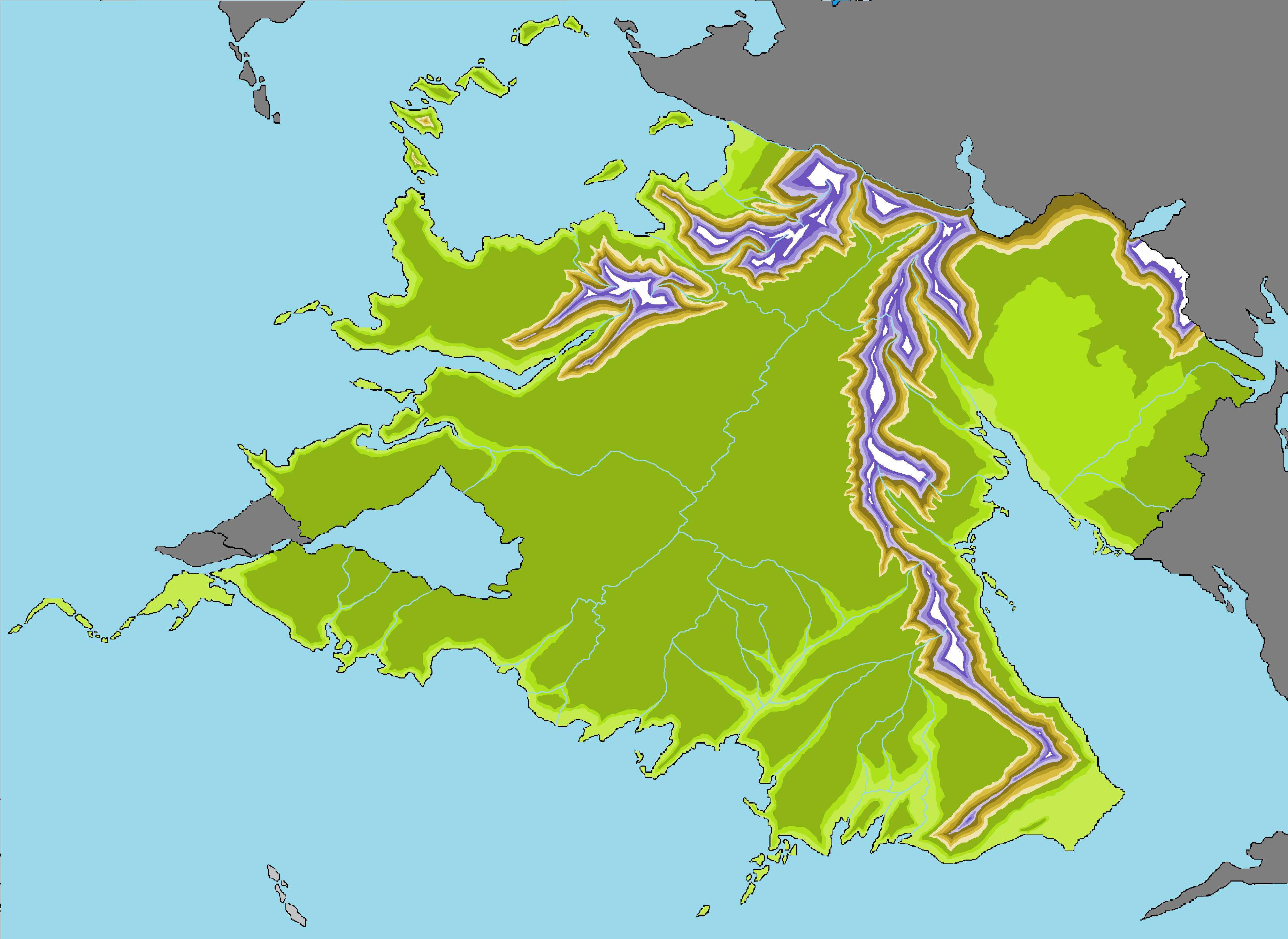
[[File:Zamastantopography.png|frame|center|Topographical Map of Zamastan.]] | [[File:Zamastantopography.png|frame|center|Topographical Map of Zamastan.]] | ||
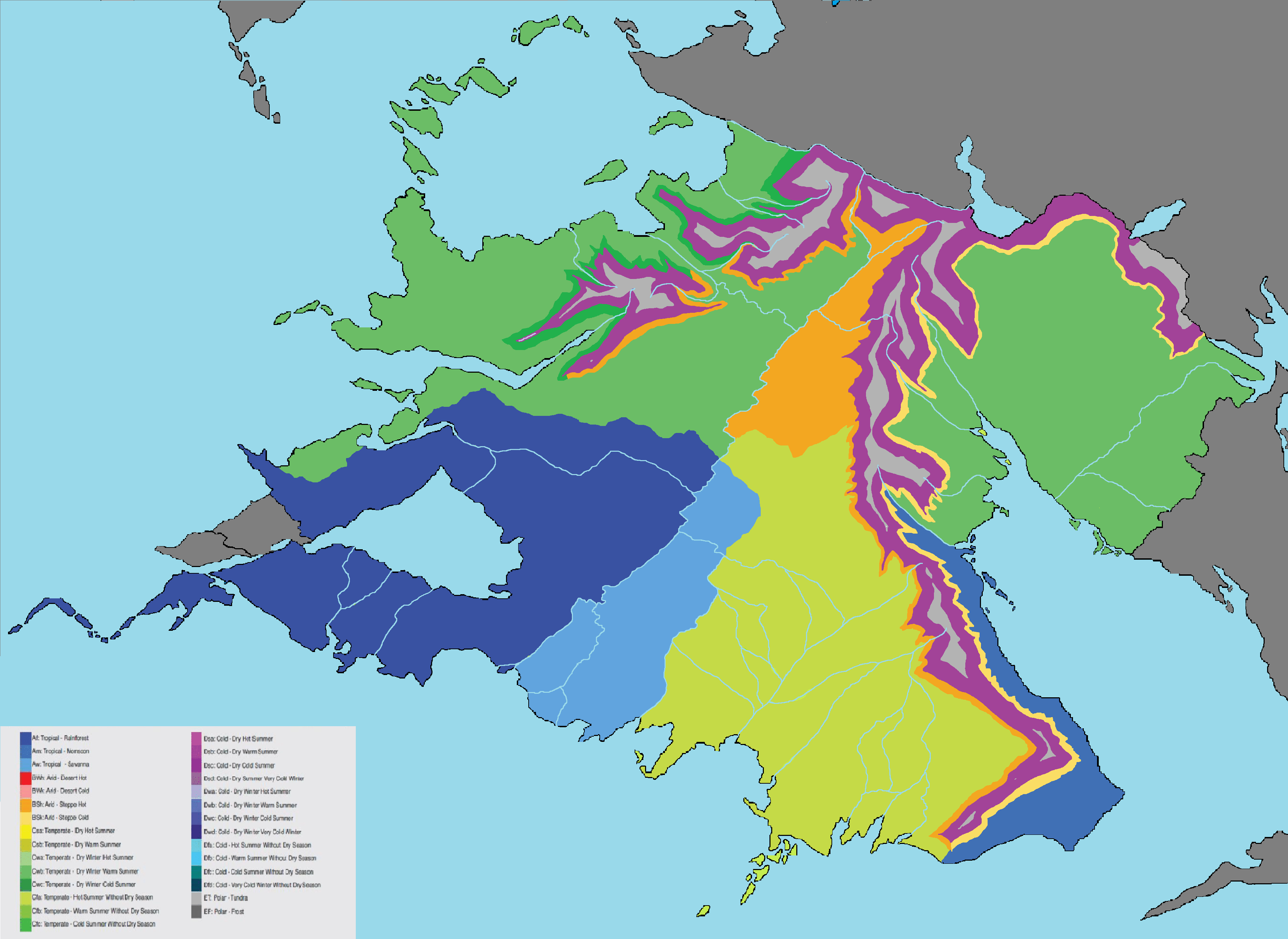
[[File:ZamastanClimate.png|frame|center|[[wikipedia:Köppen climate classification|Köppen climate classification]] Map of Zamastan.]] | |||
[[Category:Zamastan]] | [[Category:Zamastan]] | ||
Revision as of 00:15, 9 April 2020
This page is a collection archive for viewing and usage of variations of Zamastan maps.
Political

Map of Zamastan's 15 Administrative Districts.
Geographical

Köppen climate classification Map of Zamastan.

