West Monroe State Highway 201: Difference between revisions
Jump to navigation
Jump to search
No edit summary |
No edit summary |
||
| Line 32: | Line 32: | ||
|- | |- | ||
| rowspan="2" | [[Abilene, West Monroe|Abilene]] | | rowspan="2" | [[Abilene, West Monroe|Abilene]] | ||
| [[File: | | [[File:UR-7.png|25px|link=West Monroe Urban Road 7]] - [[Mansfield, West Monroe|Mansfield]], [[Jasper, West Monroe|Jasper]] | ||
|- | |- | ||
| [[File:I-30.svg|25px|link=Interstate 30]] - [[Frankfort, West Monroe|Frankfort]], [[Youngstown, West Monroe|Youngstown]] | | [[File:I-30.svg|25px|link=Interstate 30]] - [[Frankfort, West Monroe|Frankfort]], [[Youngstown, West Monroe|Youngstown]] | ||
Latest revision as of 17:19, 13 June 2023

| Route information | |
|---|---|
| Length | 258 mi (415 km) |
| Existed | 1965–present |
| Major junctions | |
| South end | |
| North end | |
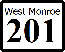
State Highway 201 (SH 201) is a major north-south highway that runs from SH 54 in Avery to SH 125 in Richfield
Major intersections
| County | Location | Destination |
|---|---|---|
| Knox | Avery | |
| Knoxville | ||
| Brooks | ||
| Abilene | ||
| Gladwin | ||
| Richfield |