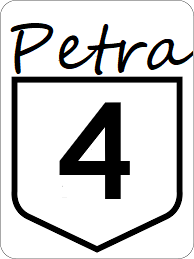
Petra State Highway 4: Difference between revisions
Jump to navigation
Jump to search
No edit summary |
No edit summary |
||
| Line 9: | Line 9: | ||
*[[File:I-50.svg|25px|link=Interstate 25]] | *[[File:I-50.svg|25px|link=Interstate 25]] | ||
*[[File:US 59.svg|25px|link=Ibican Route 59]] | *[[File:US 59.svg|25px|link=Ibican Route 59]] | ||
*[[File:US | *[[File:US 159.svg|25px|link=Ibican Route 159]] | ||
*[[File:I-55.svg|25px|link=Interstate 55]][[File:US 61.svg|25px|link=Ibican Route 61]] | *[[File:I-55.svg|25px|link=Interstate 55]][[File:US 61.svg|25px|link=Ibican Route 61]] | ||
}} | }} | ||
Revision as of 01:53, 13 July 2024
| Route information | |
|---|---|
| Length | 375 mi (604 km) |
| Existed | 1921–present |
| Major junctions | |
| West end | |
| East end | |
Petra State Highway 4 is a major east-west highway crossing the state of Petra, while running along the state's southern border with West and East Monroe. While being one of the longest highways in the system, the highway directly serves no major cities.
Major intersections
| County | Location | Destination |
|---|---|---|
| Farmer | Cooper River, Calahan state line | |
| New Church | ||
| Henrico | ||
| Monroe | Petersburg | |
| Salisbury | ||
| Albany River | ||
| Christianson | Bedair | |
| Aiken | Elizabeth | |
| Legand | Biltmore | |
| Bristol | ||
| Madison River | ||
| Hobbs | Hobbs Ferry | |
| Tucker | Holston | |
