Roca Inlet: Difference between revisions
Jump to navigation
Jump to search
(Created page with "{{Infobox body of water | name = Roca Inlet | image = Akimiski_Island_01.jpg | caption = An aerial image of Roca Inlet | location = Southwestern end of the Vasilin Sea, between Rettoa and North Kandson | rivers = | oceans = | pushpin_map = Ontario | countries = Rettoa, North Kandson | length = {{convert|443|km|abbr=on}} | w...") |
No edit summary |
||
| Line 6: | Line 6: | ||
| rivers = | | rivers = | ||
| oceans = | | oceans = | ||
| countries = [[Rettoa]], [[North Kandson]] | | countries = [[Rettoa]], [[North Kandson]] | ||
| length = {{convert|443|km|abbr=on}} | | length = {{convert|443|km|abbr=on}} | ||
| Line 16: | Line 15: | ||
}} | }} | ||
The '''Roca Inlet''' | The '''Roca Inlet''' is a body of water located at the southwestern end of the [[Vasilin Sea]], between [[Rettoa]] and [[North Kandson]]. | ||
[[Category:Bodies of water on Iearth]][[Category:Coalition of Crown Albatross]][[Category:Rettoa]][[Category:Kandson]] | [[Category:Bodies of water on Iearth]][[Category:Coalition of Crown Albatross]][[Category:Rettoa]][[Category:Kandson]] | ||
Revision as of 04:34, 3 September 2024
| Roca Inlet | |
|---|---|
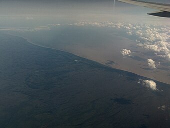
 An aerial image of Roca Inlet | |
| Location | Southwestern end of the Vasilin Sea, between Rettoa and North Kandson |
| Basin countries | Rettoa, North Kandson |
| Max. length | 443 km (275 mi) |
| Max. width | 217 km (135 mi) |
| Surface area | 68,300 km2 (26,400 sq mi) |
| Average depth | 60 m (200 ft) |
| Settlements | Dnesroca, Skarivka, Esaset |
The Roca Inlet is a body of water located at the southwestern end of the Vasilin Sea, between Rettoa and North Kandson.