List of Zamastanian Maps: Difference between revisions
Jump to navigation
Jump to search

(Created page with "==Political== frame|center|Blank map of Zamastan. File:ZamastanAdministrativeDistricts.png|frame|center|Map of Zamastan's 15 [[Administrative District...") |
No edit summary |
||
| Line 1: | Line 1: | ||
This page is a collection archive for viewing and usage of variations of [[Zamastan]] maps. | |||
==Political== | ==Political== | ||
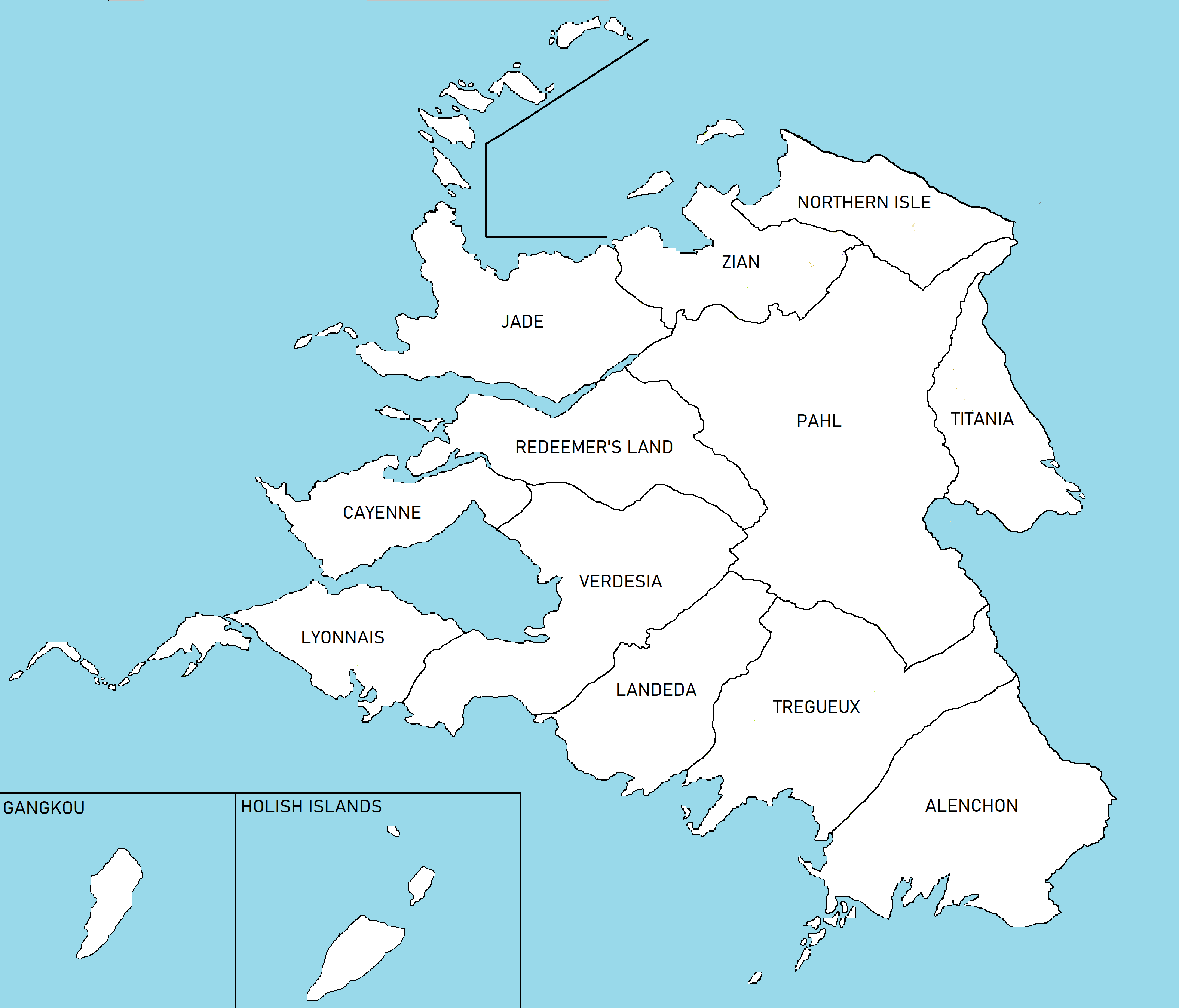
[[File:Zamastan0.png|frame|center|Blank map of Zamastan.]] | [[File:Zamastan0.png|frame|center|Blank map of Zamastan.]] | ||
| Line 5: | Line 6: | ||
==Geographical== | ==Geographical== | ||
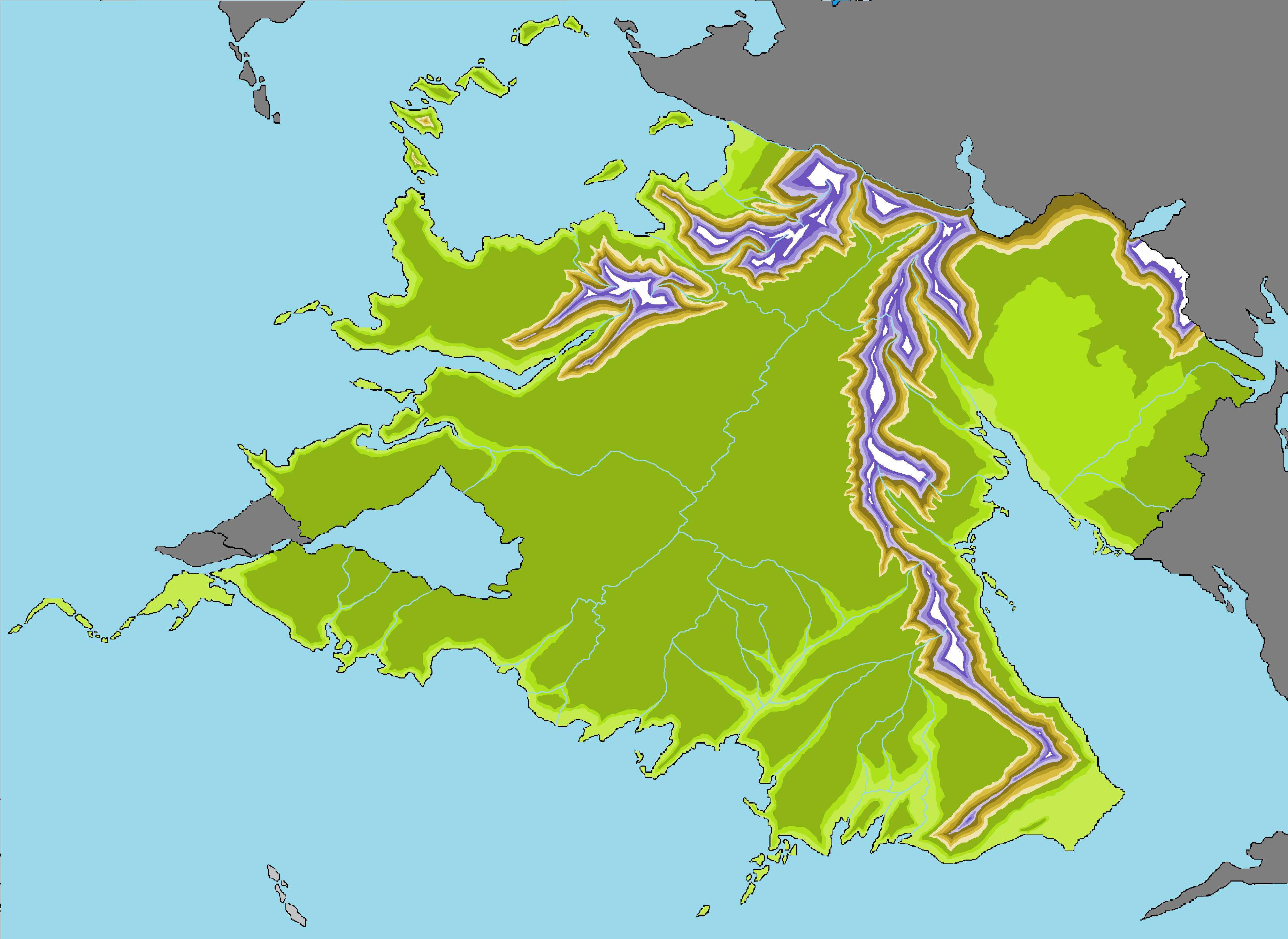
[[File:Zamastantopography.png|frame|center|Topographical Map of Zamastan.]] | [[File:Zamastantopography.png|frame|center|Topographical Map of Zamastan.]] | ||
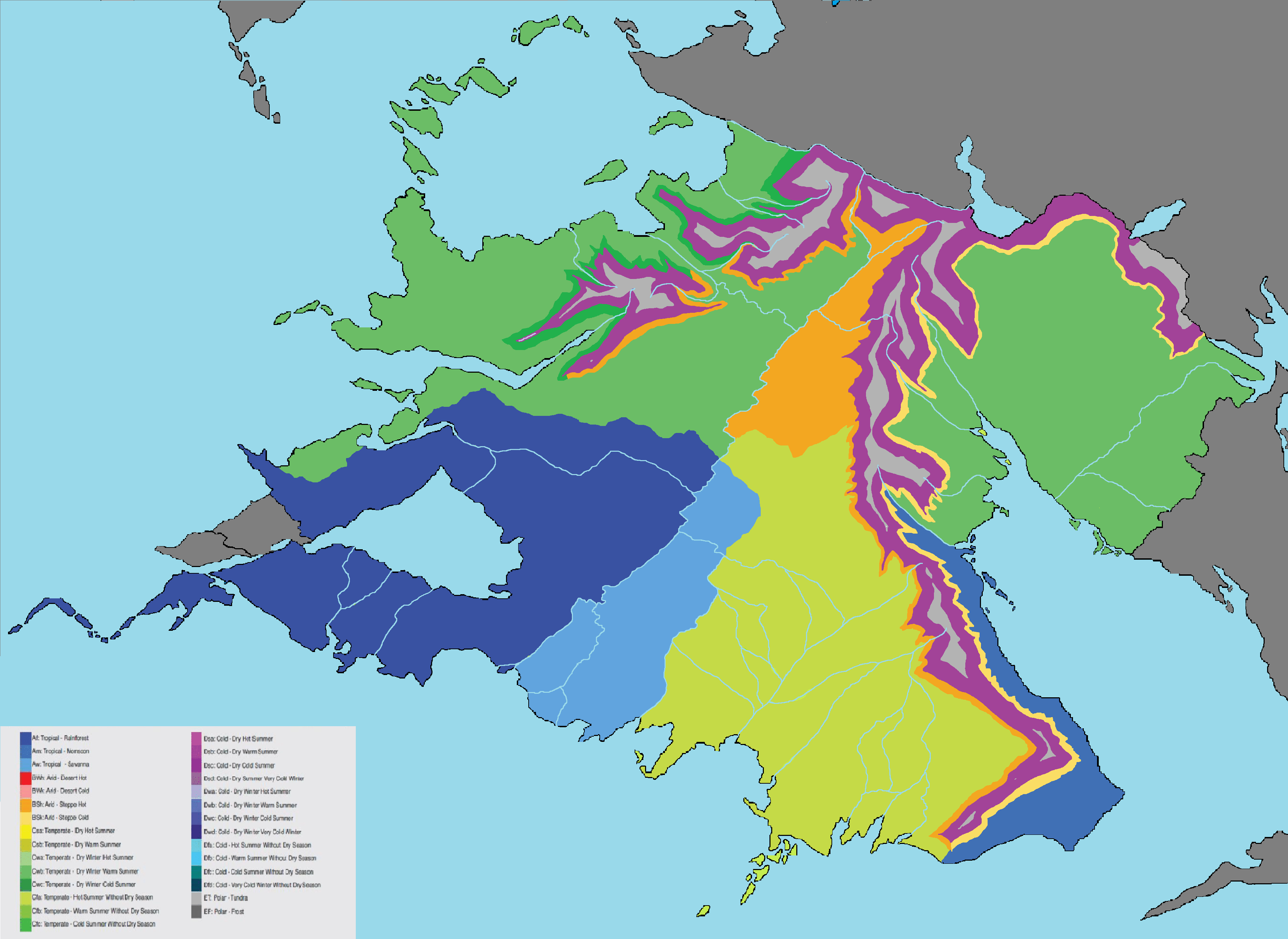
[[File:ZamastanClimate.png|frame|center|[[wikipedia:Köppen climate classification|Köppen climate classification]] Map of Zamastan.]] | |||
[[Category:Zamastan]] | [[Category:Zamastan]] | ||
Revision as of 00:15, 9 April 2020
This page is a collection archive for viewing and usage of variations of Zamastan maps.
Political

Blank map of Zamastan.

Map of Zamastan's 15 Administrative Districts.
Geographical

Topographical Map of Zamastan.

Köppen climate classification Map of Zamastan.