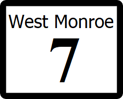
West Monroe State Highway 7: Difference between revisions
| Line 29: | Line 29: | ||
: [[File:WM-116.png|25px|link=West Monroe State Highway 116]] south to [[Union Grove, West Monroe|Union Grove]] | : [[File:WM-116.png|25px|link=West Monroe State Highway 116]] south to [[Union Grove, West Monroe|Union Grove]] | ||
: [[File:LP-55.png|25px|link=West Monroe State Loop 55]] north to [[West Monroe State Highway 105|SH 105]], [[Shelby, West Monroe|Shelby]]; End concurrency with Loop 55. | : [[File:LP-55.png|25px|link=West Monroe State Loop 55]] north to [[West Monroe State Highway 105|SH 105]], [[Shelby, West Monroe|Shelby]]; End concurrency with Loop 55. | ||
===[[Bellevue, West Monroe|Bellevue]], [[ | ===[[Bellevue, West Monroe|Bellevue]], [[Panamor County, West Monroe|Panamor County]]=== | ||
: [[File:WM-106.png|25px|link=West Monroe State Highway 106]] south to [[Union Grove, West Monroe|Union Grove]], north to [[Kimberly, West Monroe|Kimberly]] | : [[File:WM-106.png|25px|link=West Monroe State Highway 106]] south to [[Union Grove, West Monroe|Union Grove]], north to [[Kimberly, West Monroe|Kimberly]] | ||
===[[Preston, West Monroe|Preston]], [[Victoria County, West Monroe|Victoria County]]=== | ===[[Preston, West Monroe|Preston]], [[Victoria County, West Monroe|Victoria County]]=== | ||
: [[File:WM-24.png|25px|link=West Monroe State Highway 24]] south to [[Langdon, West Monroe|Langdon]], [[Austin, West Monroe|Austin]]; north to [[Arlington, West Monroe|Arlington]] | : [[File:WM-24.png|25px|link=West Monroe State Highway 24]] south to [[Langdon, West Monroe|Langdon]], [[Austin, West Monroe|Austin]]; north to [[Arlington, West Monroe|Arlington]] | ||
| Line 41: | Line 40: | ||
===[[Lamar, West Monroe|Lamar]], [[Wood County, West Monroe|Wood County]]=== | ===[[Lamar, West Monroe|Lamar]], [[Wood County, West Monroe|Wood County]]=== | ||
: [[File:WM-50.png|25px|link=West Monroe State Highway 50]] south to [[Victoria, West Monroe|Victoria]]; north to [[Proctor, West Monroe|Proctor]] | : [[File:WM-50.png|25px|link=West Monroe State Highway 50]] south to [[Victoria, West Monroe|Victoria]]; north to [[Proctor, West Monroe|Proctor]] | ||
==See also== | ==See also== | ||
Revision as of 23:46, 20 October 2021
| Route information | |
|---|---|
| Length | 2,150 mi (3,460 km) |
| Existed | 1960–present |
| Major junctions | |
| West end | |
| East end | |
State Highway 7 (SH 7) is a highway that runs from Ibican Route 2 in Willmington to SH 50 in Lamar in southeast West Monroe.
Route description
SH 7 begins at an intersection with IR-2, then runs east through downtown Willmington as a surface street past major buildings such as the Ibican Capitol Building and the National Mall. At an interchange with Interstate 25, the route becomes a controlled access freeway, and continues a such until it intersects with Loop 55 in Appleton. The highway follows the route of Loop 55 around the city, with the original routing through town now serving as a business route. SH 7 continues in a general east/northeast direction from Appleton as a four lane divided highway, passing through the cities of Bellevue, Preston, Stafford, and Baldwin. The highway ends at a traffic light with SH 50 in Lamar
Major intersections
Freemont County
Willmington
 (Independence Avenue)
 north to Toledo, Youngstown
Ferris
Appleton, Shelby County
 north to SH 105, Shelby; Begin concurrency with Loop 55.
 south to Union Grove
 north to SH 105, Shelby; End concurrency with Loop 55.
Bellevue, Panamor County
 south to Union Grove, north to Kimberly
