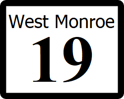
West Monroe State Highway 3: Difference between revisions
No edit summary |
|||
| Line 5: | Line 5: | ||
|formed=1912 | |formed=1912 | ||
|direction_a=South | |direction_a=South | ||
|terminus_a= [[File:US 2. | |terminus_a= [[File:US 2.svg|25px|link=Ibican Route 2]] in [[Sharonville, West Monroe|Sharonville]] | ||
|junction={{plainlist| | |junction={{plainlist| | ||
*[[File:I-10.svg|25px|link=Interstate 10]] | *[[File:I-10.svg|25px|link=Interstate 10]] | ||
Revision as of 02:19, 14 July 2022
| Route information | |
|---|---|
| Length | 418 mi (673 km) |
| Existed | 1912–present |
| Major junctions | |
| South end | |
| North end | |
State Highway 3 (SH 3) is a major highway that runs from Ibican Route 2 in Sharonville to West Monroe State Highway 3 near the Panamor state line.
Route description
SH 19 begins at a surface intersection with IR 2, then runs north through Sharonville and Camden as a 4 lane divided highway. After an intersection with I-10, SH 3 narrows to one lane each way with a center turn lane through northern Camden. After leaving Camden, SH 3 narrows to a rural two lane highway until meeting SH 50 in State Line, where it returns to four lanes with a center turn lane through town. After leaving the city limits, the roadway narrows to two travel lanes with a center turn lane until crossing the Panamor River, where the turn lane ends. The highway continues as a rural two lane road through Bronson. The highway becomes a four lane divided highway through Rodgers. After leaving Rodgers, SH 3 becomes a scenic two lane highway, following the east bank of the Eustice River through Menger Canyon State Park. After passing through the canyon, SH 3 serves as the main road through Huntsville. After leaving Huntsville, SH 3 again becomes a scenic road clinging to the Eustice River through Eustice Valley State Park, where the highway meets its end at SH 5 near the Calahan state line.
Major intersections
| County | Location | Destination |
|---|---|---|
| Moore | Sharonville | |
| Camden | ||
| Roberts | State Line | |
| Panamor River | ||
| Oldham | Bronson | |
| Rodgers | ||
| Rodgers Creek | ||
| Hunt | Menger Canyon Road - Menger Canyon State Park | |
| Huntsville | ||
| State Park Road - Eustice Valley State Park | ||
