Hamilton State Highway 1: Difference between revisions
Jump to navigation
Jump to search
(Created page with "right|300px {{Infobox road |length_mi=153 |length_ref= |formed=1908 |direction_a=South |terminus_a= 25px|link=Ibican Route 27 in Colfax,...") |
|||
| Line 20: | Line 20: | ||
! style="text-align:center; vertical-align:bottom;"| '''Destination''' | ! style="text-align:center; vertical-align:bottom;"| '''Destination''' | ||
|- | |- | ||
| [[ | | [[Willow County, Hamilton|Willow]] | ||
| [[ | | [[Colfax, Hamilton|Colfax]] | ||
| [[File:US 27.svg|25px|link=Ibican Route 27]] - [[Tilford, Hamilton|Tilford]], [[Northgate, Calahan|Northgate]] | | [[File:US 27.svg|25px|link=Ibican Route 27]] - [[Tilford, Hamilton|Tilford]], [[Northgate, Calahan|Northgate]] | ||
|- | |- | ||
Revision as of 15:12, 6 June 2023

| Route information | |
|---|---|
| Length | 153 mi (246 km) |
| Existed | 1908–present |
| Major junctions | |
| South end | |
| North end | |
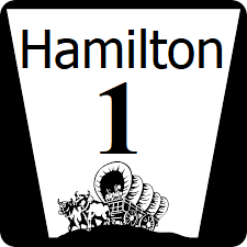
Hamilton State Highway 1 (HA-1) is a major north-south state highway in the southern part of the state, connecting the state capital with the Calahan state line, and the seaside town of Alliance.
Major intersections
| County | Location | Destination |
|---|---|---|
| Willow | Colfax | |
| Platte | Cook | |
| Vermont | ||
| Vermont River | ||
| Union | ||
| Sheridan | Platte | |
| Platte | ||
| Jefferson | Hebron | |
| Choatte National Wildlife Refuge | ||
| Johnson | Colby | |
| Alliance | ||