Hamilton State Highway 25: Difference between revisions
Jump to navigation
Jump to search
(Created page with "right|300px {{Infobox road |length_mi=324 |length_ref= |formed=1948 |direction_a=West |terminus_a= 25px|link=Jefferson State Route 25 in...") |
No edit summary |
||
| Line 34: | Line 34: | ||
|- | |- | ||
| rowspan="3" | [[Pierce County, Hamilton|Pierce]] | | rowspan="3" | [[Pierce County, Hamilton|Pierce]] | ||
| [[Hazelton, Hamilton|Hazelton]] | | rowspan="2" | [[Hazelton, Hamilton|Hazelton]] | ||
| [[File:I-5.svg|25px|link=Interstate 5]] - [[Vermont, Hamilton|Vermont]], [[Underwood, Hamilton|Underwood]] | | [[File:I-5.svg|25px|link=Interstate 5]] - [[Vermont, Hamilton|Vermont]], [[Underwood, Hamilton|Underwood]] | ||
|- | |||
| [[File:HA-32.png|25px|link=Hamilton State Highway 32]] - [[Hastings, Hamilton|Hastings]], [[Gilead, Hamilton|Gilead]] | |||
|- | |- | ||
| rowspan="2" | [[Norton, Hamilton|Norton]] | | rowspan="2" | [[Norton, Hamilton|Norton]] | ||
Revision as of 06:24, 12 June 2023
| Route information | |
|---|---|
| Length | 324 mi (521 km) |
| Existed | 1948–present |
| Major junctions | |
| West end | |
| East end | |
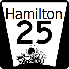
Hamilton State Highway 25 (HA-25) is a major east-west state highway cutting across the state from Denver on the Bay of Albion to Brewster on the Pherigo Border.
Major intersections
| County | Location | Destination |
|---|---|---|
| Gage | Brewster | |
| Arthur | ||
| Highland River | ||
| Pierce | Hazelton | |
| Norton | West | |
| South | ||
| Jefferson | Hebron | |
| Thayer | Lockhart | |
| Vermont River | ||
| Lander | ||
| Kimball | Denver | |
