Eastarland
Kingdom of Eastarland Eastarlandischen Kōninrīek | |
|---|---|
| Motto: "Loyalty to the Crown and Fatherland" ("Loyalitot zu der Kronen und den Vaterland") | |
| Anthem: "Forward and only forward, Eastarland!" ("Vorwērte und nur vorwērte, Eastarland!") | |
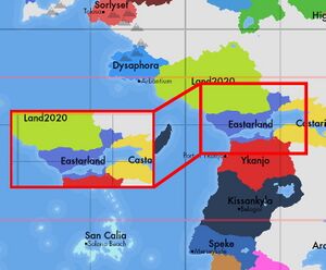
The Location of the Eastarland. | |
| Capital | Phanuburg |
| Largest city | Fedderg |
| Official languages | Eastarlandic |
| Recognised national languages | Eastarlandic |
| Ethnic groups (2020) | Eastarishmen (91%) Ykanjoans (3.1%) Castarilians (2.7%) Scousers (2.4%) Other (0.8%) |
| Demonym(s) | Eastarlandian |
| Government | Unitary Constitutional Parliamentary Monarchy |
• King | Edward XI |
• Prime Minister | Josef Kalter |
• Сhairman of the Senate | Herbert Speer |
• Сhairman of the Kōninstag | Emilia Orenstein |
• Chief of Justice | Friedrich Weiß |
| Legislature | States General |
| Senate | |
| Kōninstag | |
| Foundation | |
• The beginning of the statehood of the Union of Provinces of Eastarland | 1579 |
• Unification of the Kingdom of Eastarland | 1827 |
• Constitution | May 17, 1853 |
| Area | |
• Total | 612,097 km2 (236,332 sq mi) |
• Water (%) | 2.1% |
| Population | |
• 2020 estimate | 97,428,353 |
• 2015 census | 95,117,901 |
• Density | 159.2/km2 (412.3/sq mi) |
| GDP (PPP) | 2020 estimate |
• Total | 4.971 trillion |
• Per capita | 51,022 |
| GDP (nominal) | 2020 estimate |
• Total | 3.783 trillion |
• Per capita | 38,829 |
| Gini (2020) | 29.6 low |
| HDI (2020) | 0.934 very high |
| Currency | Ducat (D) (EAD) |
| Time zone | UTC+2 (East Time) |
| Date format | yyyy,dd,mm |
| Driving side | right |
| Calling code | +370 |
| ISO 3166 code | ETL |
| Internet TLD | .etl |
Eastarland [əistarlant], officially the Kingdom of Eastarland (Eastarlandischen Kōninrīek [əistarlandiʃen kœninri: k]) is a country on the eastern continent of Anteria. The area of the territory is 612,097 km2. The population as of December 31, 2020 is 97,428,353.
Located in the center of the eastern continent, it is washed by the waters of the World Ocean and the Amber Strait in the west. It shares borders with Land2020 in the north, Castarilia in the east, Ykanjo in the south.
According to the state structure, it is a unitary state, it consists of 10 regions (Lōwien, Frieschern, Astravia, Paringien, Kliben-Maaste, Braite, Zūdderland, Nitzervesch, Klūbinhen, Dortenshoff). The form of government is a constitutional parliamentary monarchy. The King of Eastarland since 3 August 2016 is Edward XI from the Kataringen-Faerzollen dynasty, since 26 April 2017 Josef Kalter has been the Prime Minister and Head of Government.
The capital is Phanuburg. The largest city is Fedderg. The state language is Eastarlandian.
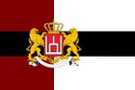
The national flag is a 2:3 canvas. The canvas is vertically divided into dark red and white parts with an aspect ratio of 2:3. The black stripe runs horizontally in the center, which corresponds to the vertical side as 2:5. Dark red symbolizes the spilled blood for liberation of Eastarland, white symbolizes hope and black stripe symbolizes endurance. The national emblem is located in the center of the vertical stripe dividing the flag into dark red and white. The design of the flag was proposed by the artist Markus Star in 1855, it was timed to coincide with the adoption of the first constitution and the transition to a constitutional monarchy.
Coat of arms .There are two heraldic golden lions holding a red shield that depicts "Perkonas", the national symbol of Eastarland. At the top of the shield is the royal crown of Eastarland. The coat of arms was adopted as the coat of arms of the Kingdom of Eastarland in 1682, based on the family coat of arms of the Kataringen-Faerzollen dynasty. Has not changed since then.
Anthem - "Forward and only forward, Eastarland!" . The Kingdom's Anthem was composed by Adam Henkil in 1884.
Eastarland is a country with a dynamically developing economy. GDP for 2020 was 4.971 trillion ducats (about 51.022 ducats per capita). The monetary unit is the Eastarlandian ducat.
Etymology
History
Geografy
Relief
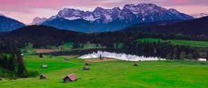
The northern part of Eastarland is a low-lying plain formed during the Ice Age (North Eastarland Plain, lowest point Neuen Saffen, 6.31 m below sea level). The surface of the lowland has preserved traces of ancient glaciation - chains of low moraine ridges and hills. The western part of the lowland is occupied by swampy lowlands, the formation of which is caused by the subsidence of the platform. In the central part of the country, forest-covered foothills adjoin the lowlands from the south. The highest point is Jōrwin Mountain, 3243 m.
Rivers and lakes
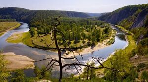
A large number of rivers flow through the territory of Eastarland, the largest of which are: Osterkat, Killien, Goder. The largest lake in Eastarland is Gōeldehir, with an area of 1140 km² and a depth of 630 m. The lake is connected by a narrow Astiel strait in the west with the Amber Sea, and in the east with the Stober strait with the Castarilian Bay.
Climate
In general, the climate is temperate, maritime, characterized by cool summers and rather warm winters. The average temperature in July is + 16 ... + 17 ° C, in January - about + 2 ° C on the coast and slightly colder inland. The absolute maximum air temperature (+ 38.6 ° C) was recorded on August 10, 1954 in Drasau, the absolute minimum (−27.4 ° C) was recorded on January 29, 1962 in Litburg. In winter, when anticyclones arrive, the temperature drops below 0 ° C, snow falls, and channels and lakes are covered with ice. Although there is an average of 650 to 750 mm of precipitation per year, rarely a day goes by without rain. There are often fogs, sometimes it snows in winter. Truly extreme natural events (severe droughts, tornadoes, storms, severe frost or heat) are relatively rare.
Environment
Demographics
Religion
Religion
According to the 2011 census, 34.5% of citizens do not identify themselves as belonging to any religion or church. In a 2019 survey, only 27% of respondents said they believe in God, 50% said they believe in some kind of natural or spiritual power, and 30% that they don't believe in any of this. The largest number of believers are Catholics (but only 17.4% of the total population as of 2019), the next largest group is Protestants (6.3%).
According to the amendment to the Constitution of the Kingdom of Eastarland, the Kingdom of Eastarland is a secular state with secular values and views. The church is separated from the state, and the schools from the church. There is also a ban on secondary education in parish schools.
According to universal law, any kind of discrimination based on affiliation with any religion, incitement to wrongdoing, incitement to hatred, causing physical, psychological or financial harm is prohibited to freedom of religion, and is punishable.
Ethnicity
Ethnicity
The population for 2020 is 97,428,353 people. The largest cities are Copenhagen (6,036,187 people), Aarhus (5,870,613 people), Odense (4,699,700 people), Aalborg (4,120,059 people). The average life expectancy is 78 years for men, 86 for women. Age composition: from 1 to 17 years old - 21.1%, from 18 to 66 - 65.2%, over 67 - 13.7%. 20 million students. More than 40 million families. 55 out of 100 families own their own houses. Eastarlandic is spoken throughout the country, although a small proportion of the population living on the border with neighboring countries also speaks German. Many Eastarlanders are also fluent in English, especially in large cities and young people who are learning English in schools.
With an area of 612,097 km², according to data for 2020, Eastarland has a population density of 159.2 people per square kilometer. The most densely populated are 3 western provinces: Lōwien, Zūdderland and Braite (the average population density is 440 people / km2 and more; the maximum indicators are observed in urbanized areas - over 600 people / km2). Largely due to this, Eastarland is one of the countries with the most developed transport and information infrastructure. 90.5 million people, or 93% of the country's population, use the Internet. Eastarland had over 10 million fixed telephones and 12.5 million mobile telephones in 2002-2003. More than 320 radio stations and 37 television stations (as well as 31 repeaters) operate in the country.
Language
Health
Education
Largest Cities
State structure
Administrative division
Government
Executive power
Legislature
Judicial branch
Political parties
Migration policy
After a series of terrorist acts in the world, the government has consistently tightened immigration laws. Anti-immigration measures have significantly reduced the inflow of certain categories of migrants to Eastarland. In particular, in 2018, 4198 entry permits for family reunification were issued, which is 70% less than in 2013, and 1038 people were granted political asylum (82.5% less). At the same time, over the period 2013-2018, the number of those who received a study visa increased from 10 to 28.4 thousand people (an increase of 2.8 times), and those who entered on a work visa - from 5.9 to 12.8 thousand people (an increase 100%). In 2019, the measures were further tightened - in particular, a point system was introduced for spouses of immigrants wishing to enter the country.
Economy
Industry
Agriculture
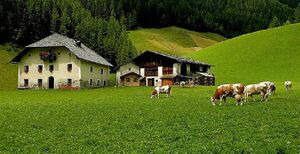
Eastarland has a highly productive agriculture. It occupies a leading position in the world in terms of agricultural production, grain production, livestock products and milk. Eastarland is a land of predominantly small family farms. Agricultural production efficiency is very high. At the same time Eastarland lags behind in the average yield of corn and sugar beet. In the agro-industrial complex, agriculture plays a subordinate role.
Livestock breeding provides about 70% of marketable agricultural products. Cattle breeding is the main branch of animal husbandry, it provides more than 2/5 of all marketable agricultural products, with the main part being milk (about ¼). Pig breeding is in second place. The country's self-sufficiency in milk and beef systematically exceeds 100%, but in pork it is less than 4/5.
Dairy and beef cattle breeding is most typical for well-moistened coastal areas, rich in meadows and pastures, as well as for the periphery of urban agglomerations. Due to the rather cold winter, stall keeping is common. Pig breeding is developed everywhere, but especially in areas close to the ports of import of imported feed, areas of sugar beet, potato and fodder root crops cultivation. Broiler production, production of eggs, veal, and pig breeding are concentrated in large livestock farms, the location of which depends little on natural factors. There are much more fodder crops than food crops, since a large amount of fodder grains, especially corn, are imported. However, the country ranked (2014) seventh in the world in terms of wheat exports (8.2 million tons). Of great importance is the cultivation of fodder root crops (fodder beets, etc.), corn for green fodder and silage, alfalfa, clover and other fodder grasses. Of the oilseeds, the most important is rapeseed, the crops of which are more than 10 times higher than those of sunflower.
In areas with high natural soil fertility, the main crops are wheat, barley, maize and sugar beets. The poorer soils of the Northern Lowland and the middle-altitude mountains are traditionally used for sowing rye, oats, potatoes and natural forage crops. The traditional nature of Eastarlandian agriculture has significantly changed technological progress. Today, the so-called light soils are valued more, due to their suitability for machine cultivation, using artificial fertilizers; for example, corn is now widely cultivated in the Northern Lowlands, where it replaces potatoes.
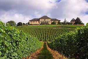
Viticulture surpasses, in marketable products, fruit growing and vegetable growing combined. Vineyards are located mainly in the valleys of Osterkat, Godera and other rivers.
Tourism
Extractive industry
Transport and Energy
Transport
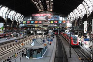
Railway transport Eastarland rail transport is highly developed. Local and overnight trains, including high-speed trains, connect the capital with all major cities in the country, as well as with neighboring countries. The speed of these trains is 320 km / h. The railway network is 51,850 km long and is one of the longest railway networks. Rail links exist with all neighboring countries. Metro is available in Phanuburg, Fedderg, Litburg, Ūstimaa, Pilsava. In Feriar - partly underground light rail.
Automobile transport
After winning the 2016 elections in Koninstag, and forming a majority coalition with the Peasant Union, the Green Party banned all non-electric cars. Also, the cost of roads was reduced, but more attention was paid to public transport, railways, etc. The road network does not cover the entire territory of the country. The total length of highways is 610,500 km.
The main roads are divided into the following groups:
Motorways - The name of the road is made up of the letter A followed by the road number. Permissible speed - 130 km / h, obligatory filling stations every 50 km, concrete dividing strip, absence of traffic lights, pedestrian crossings. National roads - prefix N. Permissible speed - 90 km / h (if there is a concrete dividing strip - 110 km / h). Department roads - prefix D. Permissible speed - 90 km / h. In cities, the permissible speed is 50 km / h. The use of seat belts is mandatory. Children under 10 years old must be transported in special seats.
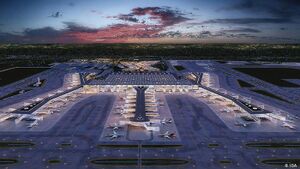
Air transport Eastarland has about 475 airports. 325 of them have asphalt or concrete runways, and the remaining 150 are unpaved (data for 2017). The largest airport is the «Phanuburg» located in the suburbs of Phanuburg. The national Eastarlandian airline «EastarAir» operates flights to almost every country in the world.
