Angvar
This article is incomplete because it is pending further input from participants, or it is a work-in-progress by one author. Please comment on this article's talk page to share your input, comments and questions. Note: To contribute to this article, you may need to seek help from the author(s) of this page. |
Imperial State of the Crown of Angvar | |
|---|---|
 | |
| Capital and largest city | Mordegard |
| Official and national language | Angvarian |
| Recognized regional languages |
|
| Ethnic groups (2026) |
|
| Religion (2035) |
|
| Demonym(s) |
|
| Government | Unitary absolute monarchy under a totalitarian dictatorship |
• Monarch | Katharina XI |
• Grand Chancellor | The Duke of Doth |
• Magister-in-Chief | Jacques Belmont |
| Formation | |
• Duchy of Angvar | c. 966 CE |
• Crown of Angvar | 1251 |
• Unification | 21 October 1455 |
• Mordegard seized | 6 June 1496 |
• Treaty of Oseborg | 4 April 1506 |
• Sebastople seized | 9 June 1509 |
• Empire proclaimed | 16 December 1510 |
• November Revolt | 16 December 1891 |
• Monarchy abolished | 13 February 1935 |
• Social Republic | 15 June 1940 |
• Monarchy restored | 20 April 1945 |
• Current Basic Law | 11 March 1993 |
• Union State formed | 20 January 2016 |
• Last polity annexed | 18 October 2028 |
| Area | |
• Total | 246,988,552 km2 (95,362,813 sq mi) (2nd) |
• Water (%) | 15.7 (including swamps) |
| Population | |
• 2027 estimate | |
• 2018 census | |
• Density | 5.321/km2 (13.8/sq mi) (2nd) |
| GDP (PPP) | 2023 estimate |
• Total | |
• Per capita | |
| GDP (nominal) | 2028 estimate |
• Total | |
• Per capita | |
| Gini (2033) | medium |
| HDI (2035) | high |
| Currency | Angvarian pound (£) (AVP) |
| Time zone | UTC +4 to UTC +12 (AST) |
| Date format | Short formats (CE)
|
| Driving side | right |
| Calling code | +504 |
| Internet TLD | .av |
Website www.angvar.gov | |
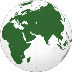
Angvar (/ˈɒŋvɒr/ or commonly /ˈɑːŋvɑːr/), also called Eisenheim (/ʌɪsɛnhʌɪm/) and officially styled the Imperial State of the Crown of Angvar, (Angvarian: Dagh-gimbarathâz Snâgul Ôngvótar; Nemedian: Kaisertum der Krone des Eisenheims; Latin: Status Caesarea Corona Angevaricae) is a sovereign state composed of the mainland of the Cimmerian continent, the adjacent subcontinent of Acheron, the archipelago of Alarica in Middle Brenonnia, and numerous semi-autonomous overseas dependencies. With 246,988,552 square kilometres (95,362,813 square miles) spanning one-sixth of Earth's inhabitable landmass, Angvar is the second-largest country in the world by area. It is bound by the Boreal Sea on the north, the Obrisian Sea to the south, the Sea of Imuchakk to the east, and the Gulf of Utgard to the west. It borders Ostenia to the west, the Rendusian Monarchy to the southwest, Sylvania to the south, and Seria to the southeast and east, while sharing maritime borders with Utgard in the northwest and Obristan to the south. Through its overseas holdings, it borders Ankin, Fúbù, Kongzhi and Jianqíng, the latter by way of the International Legation Zones in Seria; Baqet, Ngubu, Lozi, Kikuvu and Haziri in Maura; Pregonia and Wingchun in Middle Brenonnia; and New Tilgard, Dunfork, and Grame in Upper Brenonnia. In addition to its 69 governorates, 33 overseas dependencies, thirteen unincorporated territories and one capital city, there are two associated states, Infernia and Lower Totenheim. The westernmost and easternmost governorates of mainland Angvar are Weißheldenmark and Vladivoyna, respectively; whereas the overall northernmost point is Kaiser-Friedrich-Stadt and the southernmost being Los Island in the Australian Ocean. Angvar boasts an estimated population of 1.314 billion, making it the second-largest country in the world in terms of population behind Seria. Its capital and largest city, Mordegard, is approximately 1,020 kilometres inland area, harboring a growing population of 442.5 million; the majority of which reside in the Greater Mordegard Area. Other major urban areas include Valenborg, the largest port city serving as the Empire's chief commercial and shipwrighting centre; Sebastople, a tourist spot and financial centre known for being the summer capital of the Angvarian sovereigns; Friedrichsdorf, Balzhed, Drestholm and Altdorf.
By circa 2600 BCE, a confederation of semi-nomadic peoples known as the Iron Horde arrived in the mainland after migrating from Outer Cimmeria, and having crossed the Udel mountain range, settled the Hyborian part of the continent. From the Late Iron Age, the Iron Horde were organized into various petty-kingdoms spanning between the Gulf of Utgard and the Lapetan Basin. They were encountered by Argosian merchant-traders who established colonies along the northern coast of the Lapetan Sea, and by the 4th century CE various kingdoms such as Kalagurz came under the control of the Aurean Empire before being driven out by the invading Wendol in 500 CE.


