Karukera Confederacy
Islands of Beautiful Waters Karukera | |||||||||
|---|---|---|---|---|---|---|---|---|---|
| 1388–1533 | |||||||||
|
Symbol of the Confederacy | |||||||||
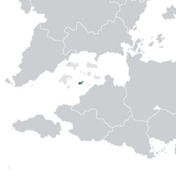
 Location of Carucere | |||||||||
| Capital | None | ||||||||
| Official languages | Nati language | ||||||||
| Common languages | Runanca | ||||||||
| Religion | Nati religion | ||||||||
| Government | Tribal confederation | ||||||||
| History | |||||||||
• Formation of the Confederacy | 1388 | ||||||||
| 1528 | |||||||||
• Conquest by Estmere | 1533 | ||||||||
| Area | |||||||||
| 1527 | 8,165.51 km2 (3,152.72 sq mi) | ||||||||
| |||||||||
The Karukera Confederacy was a pre-colonial confederation of chiefdoms on the islands of Carucere that existed from 1388 until its conquest by Estmerish Captain James Edwards in 1533. The confederacy had no official name; the name "Karukera Confederacy" was first used from academic papers in the 1960s. The native Nati used Karukera or the "The Island of Beautiful Waters" to refer to the land itself.
The Confederacy was formed in 1388 by Kasike Agüeybaná of the Aymanco chiefdom, after he convinced the other three tribal chiefs of Carucere to agree to a set of principles and agreements to conduct oceanic trade. The Confederacy was not a state in the traditional sense, but rather a strong network of alliances and agreements between the chiefdoms. The Aymanco chiefdom eventually grew to dominate the Confederacy through familial, matrimonial, and ceremonial ties that established a system of mutual obligations that encompassed the entire Confederacy.
While the society of the Confederacy remained largely agricultural, due to its geographical localization and the massive natural harbor between Carucere's main islands, it was a central part of the Arucian trade network. The Confederation grew prosperous from trading with Cutinsua and other chiefdoms on neighboring islands, bartering goods such as pumice for food, metals, and other luxury goods. Their trade combined with very efficient nature harvesting and agricultural production system, allowed the Confederacy to support a relatively high population density for the time period.
The confederacy initially attempted to cooperate with the first Euclean explorers in the 16th century, but after the destruction of Cutinsua and the collapse of Arucian oceanic trade, it was heavily weakened from famine. The confederacy was destroyed in 1533 by an military expedition commanded by Captain James Edwards of Estmere, who established the Colony of St John on the island. The native population subsequently collapsed and were further diminished by war, slavery, and famine. The remaining survivors were forced to flee into the interior of Marien, where they intermingled with run away slaves and formed the Carucerean Maroons.
The Confederacy continues to have major influence in contemporary Carucere, especially in Carucerean culture. Artifacts from the Confederacy continue to be found all over Carucere. Iconography purportedly used by the Confederacy are widely used in Carucerean culture; the most prominent example is the Aymanco crown used on Carucere's coat of arms. The Maroon community in Carucere is partially descended from the Nati population and some Nati traditions survive in Maroon culture and religious practices today.