Njullávarri
| Njullávarri | |
|---|---|
 | |
| Highest point | |
| Elevation | 2,402 m (7,881 ft) |
| Prominence | 912 m (2,992 ft) |
| Listing | Country high point |
| Geography | |
| Location | Varddi |
| Parent range | Mat-várit Guoskat Almmi |
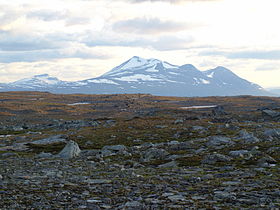
Njullávarri is a massif in the Western Tundra of northern Lorecia, near to the territory's border with Caledonia. It is part of the Mat-várit Guoskat Almmi range. The lowest point of the pass between Njullávarri and Beinnmhòr Bhàn, known as Shale Pass (Čeabet Geđggiid Duolbaid, or Làirig Cloiche-guail), forms part of this frontier. Its main, most westerly peak is the highest point in Varddi, with an elevation of 2,402 m (7,881 ft). Its subsidiary peaks reach heights of up to 2,340 m (7,677 ft).
Njullávarri is a remote mountain, not visible from any permanent settlements and with no permanent roadways passing through the sweeping Eresleahki valley beneath its southern slopes. Even so, it is an important landmark for the Varddic people, with ancient mythological associations. It was once known as Nápi Máilmmi, meaning "world's navel," in Varddic folklore, as it lay close to the centre of their nomadic range. In the late medieval period, Shale Pass to the north became fixed as the southern frontier of the Caledonian kingdom, with the Battle of the Bear's Cave in 1412 marking an end to Caledonia's efforts to subjugate the territory and its people.