Roca Inlet
| Roca Inlet | |
|---|---|
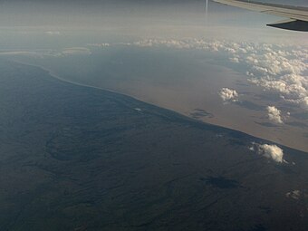
 An aerial image of Roca Inlet | |
| Location | Southwestern end of the Vasilin Sea, between Rettoa and North Kandson |
| Basin countries | Rettoa, North Kandson |
| Max. length | 323 km (201 mi) |
| Max. width | 117 km (73 mi) |
| Surface area | 68,300 km2 (26,400 sq mi) |
| Average depth | 60 m (200 ft) |
| Settlements | Dnesroca, Skarivka, Esaset |
The Roca Inlet, also known as Roca Bay, is a body of water located at the southwestern end of the Vasilin Sea, between Rettoa and North Kandson. Numerous waterways of the Roca Bay watershed have been modified with dams or diversion for several major hydroelectric projects. These waterways are also destinations for river-based recreation. Several prominent cities are located along the Roca Bay, including Dnesroca, Skarivka, and Esaset.
The Roca Inlet is a source of contention between its basin countries. During the Vasilin Sea crisis, Rettoa and North Kandson were in heated tensions over the inlet's natural resources, including extensive seafloor oil and gas fields and rare mineral deposits. The 1988 Treaty of Myrance resulted in the equal share of the inlet, though prohibited the extraction of resources from the seafloor. Tensions were reignited in 2024 when Ivan Tonovich ordered the Rettoan navy to seize the inlet.
As with the rest of the Vasilin Sea, the waters of James Bay often freeze over in winter. It is the last part of sea to freeze over in winter, and the first to thaw in summer. However due to climate change the Inlet rarely sees complete ice cover.