Maktarim: Difference between revisions
mNo edit summary |
mNo edit summary |
||
| Line 8: | Line 8: | ||
| border = infobox | | border = infobox | ||
| total_width = 333 | | total_width = 333 | ||
| perrow = 2/2 | | perrow = 2/2/2 | ||
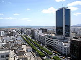
| image1 = TunisAveHabibBourguiba.jpg | | image1 = TunisAveHabibBourguiba.jpg | ||
| alt1 = Downtown at the Waterfront | | alt1 = Downtown at the Waterfront | ||
| Line 17: | Line 17: | ||
| image4 = Jmaalfnaa.jpg | | image4 = Jmaalfnaa.jpg | ||
| alt4 = Night market in Tetsouiq Garden | | alt4 = Night market in Tetsouiq Garden | ||
| image5 = Sidi Chebaan.jpg | |||
| alt5 = Beach in the Laɣrab Quarter | |||
| image6 = BHNSMarrakech.jpg | |||
| alt6 = Electric bus rapid transit lanes in the Laqbilt Quarter | |||
}} | }} | ||
| image_alt = | | image_alt = | ||
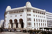
| image_caption = Clockwise from top left: Downtown at the Waterfront, preserved ruins in Old Aɣmat, ''Place Messidor''/''Adɣar Mgrawi'' in Murabbaɣ Centre | | image_caption = Clockwise from top left: Downtown at the Waterfront, preserved ruins in Old Aɣmat, a night market in Tetsouiq Garden, electric bus rapid transit lanes in the Laqbilt Quarter, a beach in the Laɣrab Quarter, and ''Place Messidor''/''Adɣar Mgrawi'' in Murabbaɣ Centre | ||
| image_flag = New Aɣmat flag.png | | image_flag = New Aɣmat flag.png | ||
| flag_alt = | | flag_alt = | ||
| Line 141: | Line 145: | ||
===Old Aɣmat=== | ===Old Aɣmat=== | ||
The site of Old Aɣmat is one of the oldest urban centres in the Messidor Union. Signs of nomadic life in present-day Aɣmatia date to the sixth millennium BCE. Permanent settlements and small villages appeared in the hills in the fifth millennium, centred on fresh water rivers. The population of desert-dwelling peoples began to settle upon the coasts by the beggining of the fourth millennium. The date of Old Aɣmat's founding is uncertain and there are no definitive contemporary accounts. The records of the third millennium, mostly through the religious texts and histories of [[Itmassan-ddin]] already regarded the settlement as an ancient city. | |||
Major upheavals in the city's history included its annexation by the ancient Aradians in the second millennium BCE. The Kel Adrar tribes that were settled in the old city became a client state of the mercantile empire and flourished while preserving their culture and religion. While the Aradians began to decline, Old Aɣmat remained a vital trade gateway after emerging from its client state status and confederating with the [[Tamazgha|Tamazɣa]] in the early fifth century BCE. Trade goods and luxuries were routed from souther Scipia up through the Ninva desert in what is modern-day [[Charnea]] and were diffused through the Periclean via the port of Old Aɣmat. | |||
===New Aɣmat=== | ===New Aɣmat=== | ||
Revision as of 17:05, 5 September 2021
This article is incomplete because it is pending further input from participants, or it is a work-in-progress by one author. Please comment on this article's talk page to share your input, comments and questions. Note: To contribute to this article, you may need to seek help from the author(s) of this page. |
New Aɣmat City
Azaɣar Aɣmat n Assa | |
|---|---|
Capital | |
Clockwise from top left: Downtown at the Waterfront, preserved ruins in Old Aɣmat, a night market in Tetsouiq Garden, electric bus rapid transit lanes in the Laqbilt Quarter, a beach in the Laɣrab Quarter, and Place Messidor/Adɣar Mgrawi in Murabbaɣ Centre | |
| Country | Messidor Union |
| Nation | Aɣmatia |
| Province | New Aɣmat |
| Neighbourhoods: | List
|
| Founded | c. 3800 BCE (Old Aɣmat) 1441 CE (New Aɣmat) |
| Government | |
| • Type | City council |
| • Body | New Aɣmat City Workers' Council |
| Area | |
| • Capital | 823 km2 (318 sq mi) |
| • Metro | 16,618 km2 (6,416 sq mi) |
| Highest elevation | 375 m (1,230 ft) |
| Lowest elevation | 0 m (0 ft) |
| Population (2018) | |
| • Capital | 8,873,785 |
| • Density | 11,000/km2 (28,000/sq mi) |
| Demonym | New Aɣmatian |
| Postal code | AAM-1000 to AAM-1499 |
| Area code(s) | 318 and 429 |
New Aɣmat City (Tamaziɣt: Azaɣar Aɣmat n Assa, Audonic: Cité de Nouveau Aɣmat) is the capital and largest city of the Messidor Union. It is located in the constituent nation of Aɣmatia on the coast of Aɣmat Bay in the Periclean sea.
The city proper extends 823 km2 (318 sq mi) but its metropolitan area extends approximately 16,618 km2 (6,416 sq mi). Density outside the city centre is relatively low, however, the metropolitan area is served by one of the most efficient intra-city transit systems in the Messidor Union.
New Aɣmat City is a transportation and service hub. It is often considered the economic core of the Messidor Union. In addition, it is home to a number of culturally significant monuments and festivals.
History
New Aɣmat City has a history that stretches millennia, generally divided into two eras. The first era stretches from the city's founding in the early fourth millennium BCE until its destruction following the Great Earthquake of Gran Aligonia in 1440. The second era began with the reconstruction and founding of "New Aɣmat" to the present day.
Old Aɣmat
The site of Old Aɣmat is one of the oldest urban centres in the Messidor Union. Signs of nomadic life in present-day Aɣmatia date to the sixth millennium BCE. Permanent settlements and small villages appeared in the hills in the fifth millennium, centred on fresh water rivers. The population of desert-dwelling peoples began to settle upon the coasts by the beggining of the fourth millennium. The date of Old Aɣmat's founding is uncertain and there are no definitive contemporary accounts. The records of the third millennium, mostly through the religious texts and histories of Itmassan-ddin already regarded the settlement as an ancient city.
Major upheavals in the city's history included its annexation by the ancient Aradians in the second millennium BCE. The Kel Adrar tribes that were settled in the old city became a client state of the mercantile empire and flourished while preserving their culture and religion. While the Aradians began to decline, Old Aɣmat remained a vital trade gateway after emerging from its client state status and confederating with the Tamazɣa in the early fifth century BCE. Trade goods and luxuries were routed from souther Scipia up through the Ninva desert in what is modern-day Charnea and were diffused through the Periclean via the port of Old Aɣmat.


