Category:Maps of Trellin
Jump to navigation
Jump to search
Media in category "Maps of Trellin"
The following 52 files are in this category, out of 52 total.
- Asketon location map.png 1,152 × 860; 25 KB
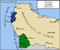
- Azmir 1300.png 684 × 572; 53 KB
- Bal Emrith location map.png 1,152 × 860; 26 KB
- Battle of the Plain of Marúna 1770 map.png 1,494 × 842; 260 KB
- Cadenza orth.png 1,152 × 860; 25 KB
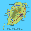
- Cadenza roads.png 250 × 250; 11 KB
- Cadenzan Kamalbia orthographic.png 1,000 × 1,000; 13 KB
- Dazya location map.png 1,152 × 860; 26 KB
- Fymona location map.png 1,152 × 860; 26 KB
- Hysera map peak.png 545 × 493; 7 KB
- Hysera provincial location map.png 1,152 × 860; 26 KB
- Idisamo in Trellin.png 1,152 × 860; 26 KB
- Isles of Velar orth.png 1,174 × 895; 27 KB
- Ja'ekha location map.png 1,152 × 860; 26 KB
- Jajich location map.png 1,152 × 860; 26 KB
- Khatax location map.png 1,152 × 860; 26 KB
- Kur'mala location map.png 1,152 × 860; 26 KB
- Kur'zhet orth.png 1,152 × 860; 25 KB
- Ledh ti'Gara map.png 304 × 163; 2 KB
- Map of legal systems in Trellin.png 1,174 × 895; 44 KB
- Lekhmir location map.png 1,152 × 860; 26 KB
- Map of districts of Arimathea.png 454 × 307; 6 KB
- Map of the Ahéri-Ethlorek states, c. 900.png 1,152 × 860; 68 KB
- Mevirin location map.png 1,152 × 860; 26 KB
- Morikz map.png 552 × 720; 42 KB
- Mëhidan location map.png 1,152 × 860; 26 KB
- Namija in Trellin.png 1,174 × 895; 27 KB
- Nersikan kingdom 1200s.png 461 × 355; 7 KB
- Northeast Velar 1200.png 832 × 730; 77 KB
- Parthenope location map.png 1,152 × 860; 26 KB
- Pelna location map.png 1,152 × 860; 26 KB
- Principality of Namija 1100s.png 1,152 × 860; 25 KB
- Qúnoi location map.png 1,152 × 860; 26 KB
- Retikh location map.png 1,152 × 860; 26 KB
- Rezat location map.png 1,174 × 895; 42 KB
- Royal Society of Medics, Disaster Relief units.png 1,152 × 860; 43 KB
- Saheri location map.png 1,152 × 860; 26 KB
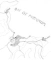
- Sketch map of the Bay of Parthenope.jpg 1,344 × 1,578; 186 KB
- Tavlar location map.png 1,152 × 860; 26 KB
- Tenedos location map.png 1,152 × 860; 25 KB
- Tenedos provincial map.png 656 × 960; 50 KB
- Ternos location map.png 1,152 × 860; 26 KB
- Trellin definitions.png 1,152 × 860; 26 KB
- Trellin interactive map base.png 1,174 × 895; 57 KB
- Trellin orthographic 2.png 806 × 899; 26 KB
- Trellinese telephonic area codes.png 1,152 × 860; 46 KB
- Trelum location map.png 1,152 × 860; 26 KB
- Trophy Ports location map.png 1,152 × 860; 26 KB
- Txekrikar orth.png 1,174 × 895; 41 KB
- Usmalím map.png 416 × 344; 31 KB
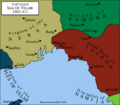
- Vekaran despotate 1300s.png 503 × 355; 7 KB
- Zha'tar location map.png 1,152 × 860; 25 KB

