Demeria
This article is incomplete because it is pending further input from participants, or it is a work-in-progress by one author. Please comment on this article's talk page to share your input, comments and questions. Note: To contribute to this article, you may need to seek help from the author(s) of this page. |
Kingdom of Demeria | |
|---|---|
|
Flag | |
| Capital | Revenes |
| Official languages | Zagornian |
| Ethnic groups | Demerian, Scarien, Athrynian, Zolfenric |
| Demonym(s) | Demerian |
| Government | Parliamentary Absolute Monarchy |
• King | William Athr |
• Queen | Nightingale Athr |
• Head of the House of Lords | Lefric Halehmer |
• Head of the House of Commons | Oben Sozory |
| Establishment | |
• Foundation | ??? |
• Athrynian Civil War | ??? |
• Independence | ??? |
| Population | |
• Estimate | 35,100,000 |
| GDP (nominal) | estimate |
• Total | 4.8 billion |
• Per capita | 113 |
| HDI | 0.43 low |
| Currency | Athrynian Shilling (G) |
| Time zone | UTCUTC+2 (NAT) |
| Date format | dd-mm-yyyy |
Demeria, also known as the Kingdom of Demeria, is a fledgeling state located within the former Nordlands region of the Athrynian Empire. It is bordered by Athryn to the south, east and west, and Zolfenrue to the north. Founded nearly two hundred years prior to its independence from the Athryn Empire, the former duchy was ruled by a long chain of Nordlandic grand dukes, and was frequently ravaged by war and instability. Following the general period of peace the Empire enjoyed after the Athr War in ???, the duchy went into a period of disunity known as the Brittle Wars. This lasted for a period of fifty years, before the ascension of the present Empress' youngest brother, William Athr. William would go on to unify the state under his rule, and under pressure from his personal ambitions and the sentiment of his council, declare a war for independence against his eldest sister, starting the Athryn Civil War. Demeria is only recognized as a state by the Kingdom of Zolfenrue, which has also intervened into the civil war on behalf of the fledgeling kingdom.
History
Early History
Kabir Athr's Invasion
The Troubling Years
The Pax Athryn
The Brittle War
William's Ascension
The Athryn Civil War
Geography
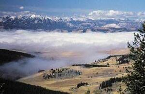
The geography of the Kingdom of Demeria is largely characterized by deep mountain ranges surrounding wide, commanding valleys with dense urban zones dotting them. In the central and southern portions of Demeria, the harsh and mountainous terrain gives way to rolling hills and massive forests, with lattices of many small rivers covering the mostly flat ground. Several larger rivers cut through the harsh northern terrain to create passes and areas of flat, forested terrain, such as the Marnec River and the surrounding Ceoswyth Valley. These geographical features have made Demeria a poor agricultural region, but a terrific place to defend, and a major focus for fishing and trade lanes. The Demerian crown sections the geographical regions of the state officially into three zones, named for the most major valley within that particular zone.
The Ceoswythland
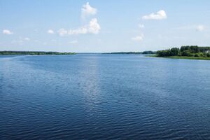
Known affectionately by the population of the region as the 'Gold Line', the Ceoswythland holds over 55& of the total population of Demeria, with an abnormally concentrated line of dense, urban population centers following along the Marnec River towards the northern half of the region. Recongnized by wide, flat fields, sprawling cities, wide rivers and dense forested hillsides, the region is the most densely populated and most intensely farmed region in all of Demeria, providing a large majority of the kingdom's agricultural needs.


