Diagbon
This article is incomplete because it is pending further input from participants, or it is a work-in-progress by one author. Please comment on this article's talk page to share your input, comments and questions. Note: To contribute to this article, you may need to seek help from the author(s) of this page. |
Republic of Diagbon | |
|---|---|
| Motto: Freedom and Justice | |
| Anthem: Song of the Marabouts | |
| Capital and largest city | Compaore |
| Official languages | English |
| Recognised regional languages | Siafo, Maale, Bwaa |
| Ethnic groups (2019) |
|
| Demonym(s) | Diagbonese |
| Government | Unitary Presidential constitutional republic |
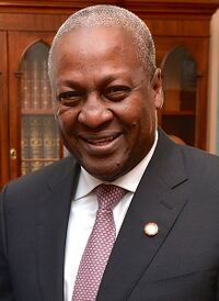
• President | John Kabore |
• Prime Minister | Yvonne Ayi Wei |
| Legislature | National Assembly |
| Independence from United Kingdom | |
• Dominion | October 1, 1959 |
• Republic | June 10, 1961 |
| Area | |
• Total | 408,256 km2 (157,629 sq mi) |
| Population | |
• 2019 estimate | 65,202,969 |
• Density | 159.71/km2 (413.6/sq mi) |
| GDP (nominal) | 2019 estimate |
• Total | $458.9 billion |
• Per capita | $7,038 |
| HDI (2019) | 0.714 high |
| Currency | Diagbonese Pound |
| Time zone | UTC+0 (WAT) |
| Driving side | right |
| Calling code | +412 |
| Internet TLD | .di |
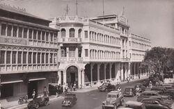
Diagbon (pronounced dia-bun), officially the Republic of Diagbon, is a country located along the Gulf of Guinea and Atlantic Ocean, in the sub region of West Africa. Spanning a land mass of 408,256 km2 (157,629 sq. mi), Diagbon is bordered by French speaking countries to the west, north and east; and the Gulf of Guinea and Atlantic Ocean in the south. The country's official language of government and business is English. Roughly 90% of the population speaks one of three widely spoken native languages: Siafo, Maale, and Bwaa. Formerly called the Republic of Volta (1959–1961), the country was renamed "Diagbon" on 10 June 1961 by erstwhile President Thomas Hayes Sangoule. Its citizens are known as Diagbonese. Its capital is Compaore. Diagbon’s population of approximately 65 million spans a variety of ethnic, linguistic and religious groups. According to the 2015 census, 77% of the population was Christian, 17% was Muslim, and 5% practiced traditional faiths. Its diverse geography and ecology ranges from coastal savannas to tropical rain forests.
The first permanent state in the territory of present-day Diagbon dates back to the 8th century. Numerous kingdoms and empires emerged over the centuries, of which the most powerful were the Da-Maale kingdom of Yameogo and the Mamprudu kingdom of Ahantana. Beginning in the 15th century, the Portuguese Empire, followed by numerous other European powers, contested the area for trading rights, until the British ultimately established control of the coast by the late 19th century. Following over a century of native resistance, Diagbon’s current borders were established by the 1900s as the British Volta. It became independent from the United Kingdom on 1 October 1959.
Diagbon is a unitary constitutional democracy led by a president who is both head of state and head of the government. Diagbon‘s growing economic prosperity and democratic political system have made it a regional power in West Africa. It is a member of the Non-Aligned Movement, the African Union, the Economic Community of West African States (ECOWAS), and the Commonwealth of Nations
History
Early History
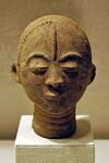
The northeastern part of present-day Diagbon was populated by hunter-gatherers from 5750 BC to 1500 BC. Their tools, including scrapers, chisels and arrowheads, were discovered in 1968 through archaeological excavations. Agricultural settlements were established between 500 BC and 500 AD. The Bursa culture was an Iron-Age civilization centered in the northwest portion of modern-day Diagbon from the 3rd to the 7th centuries AD. Various ethnic groups of present-day Diagbon, such as the Da-Maale, Wala and Mamprudu, arrived in successive waves between the 6th and 16th centuries.
Medieval kingdoms
Although the area of present-day Diagbon in West Africa has experienced many population movements, the Wala were firmly settled by the 6th century CE whilst the Gurni people splinter from the Wala migrating south in 10th century. By the early 11th century, the Akwande were firmly established in their state called Kwando. Throughout the middle Ages and the Age of Discovery, a number of ancient predominantly Buan and Mamprudu kingdoms in the Southern and Central territories rose to prominence, mainly based on gold trading. This included the Ahantana, the Bakessim and the Farrah Kingdoms.
By the 19th century, the territory of the southern part of Diagbon was included in the kingdom of Ahantana, one of the most influential states in sub Saharan Africa prior to the onset of colonialism. Ahantana’s government operated first as a loose network, and eventually as a centralized kingdom with an advanced, highly specialized bureaucracy centered in the capital city of Kasem. Prior to contact with Europeans, the Ahantana people created an advanced economy based on principally gold and gold bar commodities they traded with the other states of Africa.
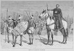
The most powerful kingdom to emerge in northern Diagbon were the Da-Maale kingdom of Yameogo. The Da-Maale came on horseback from the north in the 13th century under a single leader, Werodrogo. With their advanced weapons and centralized authority, they easily invaded and occupied the lands of the local people ruled by the Furma, established themselves as the rulers, and made Bambaga their capital. Yameogo would later split up into numerous smaller kingdoms such as Sindu, Senubu and Labe.
European Contact and Colonialism
Coastal trade with European states began after contact with the Portuguese in the 15th century. Early European contact by the Portuguese people, who came focused on the extensive availability of gold. Other European traders had joined in gold trading by the mid-17th century, most notably the Swedes, Dutch, Danish, French and British. Also beginning in the 17th century — in addition to the gold trade — Portuguese, Dutch, English, and French traders also participated in the Atlantic slave trade in this area. More than thirty forts and castles were built by the Portuguese, Swedish, Danish, Dutch and German merchants. A changing legal imperative (transatlantic slave trade outlawed by Britain in 1807) and economic imperative (a desire for political and social stability) led most European powers to support widespread cultivation of agricultural products, such as the palm, for use in European industry. In 1874 Great Britain established control over some parts of the country, assigning these areas the status of British Gold Coast. Many military engagements occurred between the British colonial powers and the various African nation-states. The Mamprudu Kingdom of Ahantana defeated the British a few times in the century long conflict but eventually lost in the early 1900s. Christian missions established Western educational institutions in the territory.
The language of colonial administration and schooling became English. Children of the elite often went to Great Britain to pursue higher education. Draftees from the colony participated in the European fronts of World War I in Diagbonese Regiment. Between 1915 and 1916, the districts in the northern part of the territory became the stage of one of the most important armed oppositions to colonial government: the Wala uprising. The British government finally suppressed the movement but only after suffering minor defeats. British Volta was established on 1 March 1919. The British feared a recurrence of armed uprising and had related economic considerations. The colonial government initiated an ambitious infrastructure-building and education program to improve infrastructure and promoted the growth of cash-crop for export. Following World War II, in response to the growth of Diagbonese nationalism and demands for independence, successive constitutions legislated by the British government moved Diagbon toward self-government. On 1 October 1959 the colony achieved self-government as the Republic of Volta.
Post Independence
In 1946, the newly formed Convention for the Liberation of Volta (CLV) led by Thomas Hayes Sangoule called for "self-government within the shortest possible time" following the Volta legislative election of 1945. Sangoule won a majority in the legislative election for the Volta Legislative Assembly in 1950 under the slogan of “Independence now”. The British Volta region became self-governing on 1 October 1959 and Sangoule its first Prime Minister. On 10 June 1961, following the Voltan constitutional referendum and Voltan presidential election, Sangoule changed the nation’s name from Volta to Diagbon and severed its last colonial ties with Great Britain, becoming the first President of Diagbon. 1 October is the nation's Independence Day and 10 June is now celebrated as Republic Day.
At the time of independence Sangoule declared, "My first objective is to abolish from Diagbon poverty, ignorance, and disease. We shall measure our progress by the improvement in the health of our people; by the number of children in school, and by the quality of their education; by the availability of water and electricity in our towns and villages; and by the happiness which our people take in being able to manage their own affairs. The welfare of our people is our chief pride, and it is by this that the government will ask to be judged.". An avid pro-African, he was also a strong proponent of African socialism.
Sangoule won the presidential elections of 1966 and 1971, before retiring from politics in 1976. Patrice Konadu, Sangoule's Prime minister since 1969, would succeed him in 1976 but only serve as a single-term president. Konadu was defeated by Dada Abdoulaye of the center-leaning National Democratic Convention in 1981. Dada's administration from 1981 to 1996 marked the beginning broader political participation, reduced government involvement in the economy, and widening of Diagbon's diplomatic engagements, particularly with other developing nations. Domestic politics on occasion spilled over into street violence, nevertheless, Diagbon's commitment to democracy and human rights strengthened. His domestic policies included a nationwide literacy campaign, railway and road construction and the outlawing of female genital mutilation, forced marriages and polygamy. A military coup against his government led by Lt. Col. Isaac Kanafodo was thwarted in 1985. Abdoulaye handed over power to his Foreign minister, Marc Taylor Diabre in 1996. Diagbon saw its worst economic recession since independence in 2000. The People's Progressive Party (the successor to the defunct CLV) would emerge victorious in the elections of 2001, marking their return to power after 20 years. Nana Christian Adiof led Diagbon as president from 2001 to 2011. In the 2011 elections, Adiof and the PPP would be defeated by a coalition of center-leaning parties under the umbrella of the "United Front" and their leader John Kabore. Following a series of terrorist attacks by local West African jihadists in 2011, Diagbon has been involved in low intensity conflict in the Sahel regions to its north. In 2015, Diagbon joined a coalition of Western countries and African countries in the Sahel to combat the extremists. Offshore Petroleum deposits were discovered in 2012 and production began in 2016. Kabore and the UF won the 2016 elections with 68.5% of the valid votes cast, remaining president till 2021.
Geography and Climate
Diagbon is located on the Gulf of Guinea, only a few degrees north of the Equator, therefore giving it a warm climate. Ghana spans an area of 408,256 km2 (157,629 sq mi), and has an Atlantic coastline that stretches 635 kilometres (395 miles) on the Gulf of Guinea in Atlantic Ocean to its south. It lies between latitudes 4°N and 15°N, and longitudes 2°E and 4°30'W. The Prime Meridian passes through Diagbon. Grasslands mixed with south coastal shrub lands and forests dominate Diagbon, with forest extending northward from the south-west coast of Diagbon and eastward. Diagbon encompasses plains, waterfalls, low hills, rivers, Lake Volta, the country's largest lake in the southeast. The northern part of the country comprises gently undulating landscape with a few isolated hills in some areas. The country's former name, Volta, is derived from the Blue and White Volta rivers.
Climate
The climate of Diagbon is tropical. The eastern coastal belt is warm and comparatively dry, the south-west corner of Diagbon is hot and humid, and the north of Diagbon is hot and dry. Diagbon is located on the Gulf of Guinea, only a few degrees north of the Equator, giving it a warm climate. Hence, two main seasons: the wet and the dry seasons. North Diagbon experiences its rainy season from April to mid-October while South Diagbon experiences its rainy season from March to mid-November. The tropical climate of Diagbon is relatively mild for its latitude. The harmattan, a dry desert wind, blows in north-east Diagbon from December to March, lowering the humidity and causing hotter days and cooler nights in northern part of Diagbon. Average daily temperatures range from 30°C (86°F) during the day to 24°C (75°F) at night with a relative humidity between 77 percent and 85 percent.In the southern part of Diagbon, there is a bi-modal season rainy seasons: April through June and September through November. Squalls occur in the northern part of Diagbon during March and April, followed by occasional rain until August and September, when the rainfall reaches its peak. Rainfall ranges from 78 to 216 centimetres (31 to 85 inches) a year. A relatively dry tropical savanna, the Sahel extends beyond the borders of Diagbon, from the Horn of Africa to the Atlantic Ocean, and borders the Sahara to its north and the fertile region of the Sudan to the south.
Wildlife and Environment
Fauna, one of the most diverse in West Africa, includes the elephant, cheetahs, hippopotamus, buffalo, monkey, lions, leopards, crocodile, giraffe, the spotted hyena and the African wild dog, various types of antelope, and a vast variety of bird and insect life. The country has 147 mammal species, 330 aquatic species including 121 species of fish and 2067 different plant species. Of the plant species, the dominant endemic species are shea tree and the baobab, the former plant species has immense economic value to the country.There are four important National Parks in Diagbon namely, the Bissau National Park, the Hayes Sangoule Nature Reserve, Atambi National Park and Lake Volta National Park. However, according to conservation classification conducted in 2017, the country has 78 protected areas that cover 57,156 km2 (22,068 sq mi), which accounts to about 14% of the area of the country.
Politics and Government
Diagbon is a unitary presidential constitutional democracy with a multi-party system. Currently, Diagbon has a quasi-democratic political culture, one of the more successful post-colonial democratic transitions in Africa. The executive branch is led by a President, who is elected by universal suffrage for five years. Presidential terms has no term limits according to the constitution, although parliamentary deliberation to introduce term limits in 2009 were discussed, but this was ultimately defeated. Presidents appoint a Prime minister to head his/her Cabinet (Council of Ministers) to run the day-to-day business of government. Local administrators are appointed and held accountable by the president. The National Assembly is the national legislature of Diagbon. The 325-member National Assembly is a unicameral body, whose representatives represent single-member constituencies and are elected for five-year terms. The People's Progressive Party and United Front, are the two major political parties in modern times, with the former leaning towards the left and the latter being more center-right in its policies. An independent judiciary exists in Diagbon. Judges are appointed by the president with approval from the National Assembly, interpret laws and overturn those they find unconstitutional. The Supreme Court is vested with the power of judicial review by the constitution.
Law and Law Enforcement
Diagbon uses a common law legal system. Basic principles of the rule of law were laid in the constitution of Diagbon, which was influenced by the American, British and French legal codes and traditions. The courts of Diagbon are headed by the Senior Courts, consisting of the Court of Appeal, the High Court of Justice (for civil cases) and the Magistrate Court (for criminal cases). The Supreme Court is the highest court in the land for both criminal and civil appeal cases and any decision it makes is binding on every other court in the same jurisdiction, often having a persuasive effect in other jurisdictions.
The National Police Service (NPS) and the Criminal Investigation Bureau (CIB) are the main law enforcement agencies of the Republic of Diagbon, and are responsible for the detection of crime, maintenance of law and order and the maintenance of internal peace and security. The National Police Service has specialized police units including a militarized police Rapid Intervention Force (RDF) and Marine Police Unit (MPU). The National Anti-Corruption Commission (NACC) is an executive agency created to combat corruption, embezzlement of public funds and fraud. The Diagbonese Prisons Service administers incarceration in Diagbon. Diagbon retains and exercises the death penalty for treason, corruption, robbery, piracy, drug trafficking, rape, and homicide.
Administrative divisions
Diagbon is divided into 11 administrative regions, subdivided into 325 districts:
| Regions of Diagbon | Regional capitals | Area (km2) |
|---|---|---|
| Greater Compaore | Compaore | 8,165 |
| West Senubu | Cambara | 32,661 |
| East Senubu | Bissau | 28,578 |
| Bambaga | Bambaga | 57,156 |
| Central | Nuni | 36,743 |
| Dioubo | Koussasse | 48,991 |
| Ahantana | Kasem | 65,321 |
| Kwando | Kwando | 28,578 |
| North Bakessim | Welma | 44,908 |
| South Bakessim | Tardi | 32,661 |
| south East | Kwane | 24,495 |
Military
The Diagbonese Defense Forces are the military forces of Diagbon, under the President of the Republic as supreme commander. They consist of the Diagbonese Army, Diagbonese Navy and the Diagbonese Air Force. The Special Parachute Intervention Group is a special operations unit drawn from the best of all three branches, tasked mainly with counter terrorism operations. As far as the Diagbonese intelligence units are concerned, the Central Directorate for External Security (CDES) is considered to be a component of the Defense Forces under the authority of the Ministry of Defense. The National Police Service have their own intelligence apparatus tasked mainly with domestically intelligence gathering and are under the purview of the Ministry of interior. The Diagbonese military receives Significant amount of its training, equipment, and support from Britain and the United States. Since the early 2000s, Diagbon have made strides to develop its own defense industry. Military noninterference in political affairs has contributed to Diagbon's stability since independence. Diagbon has participated in many international and regional peacekeeping missions. In 2011, Diagbon signed the UN treaty on the Prohibition of Nuclear Weapons.
