This file is from Wikimedia Commons and may be used by other projects.
The description on its file description page there is shown below.
Summary
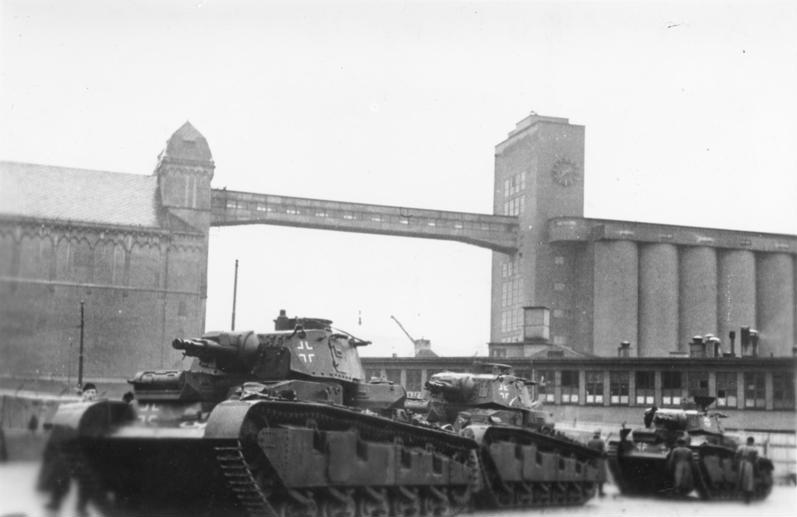
Norwegen, Oslo, Deutsche Panzer im Hafen
()
Photographer
Unknown authorUnknown author
Title
Norwegen, Oslo, Deutsche Panzer im Hafen
Original caption
For documentary purposes the German Federal Archive often retained the original image captions, which may be erroneous, biased, obsolete or politically extreme.
ADN-ZB/Archiv, II. Weltkrieg 1939-45
Nach dem Überfall des faschistischen Deutschlands auf Norwegen am 9. April 1940
Deutsche Panzer ["Neubaufahrzeug"] im Hafen von Oslo, unmittelbar nach dem Entladen der Transportschiffe, aufgenommen Mitte April 1940.
This image was provided to Wikimedia Commons by the German Federal Archive (Deutsches Bundesarchiv) as part of a cooperation project. The German Federal Archive guarantees an authentic representation only using the originals (negative and/or positive), resp. the digitalization of the originals as provided by the Digital Image Archive.
to share – to copy, distribute and transmit the work
to remix – to adapt the work
Under the following conditions:
attribution – You must give appropriate credit, provide a link to the license, and indicate if changes were made. You may do so in any reasonable manner, but not in any way that suggests the licensor endorses you or your use.
share alike – If you remix, transform, or build upon the material, you must distribute your contributions under the same or compatible license as the original.


