File:Cassier 1710.jpg
Jump to navigation
Jump to search

Size of this preview: 699 × 600 pixels. Other resolution: 1,162 × 997 pixels.
Original file (1,162 × 997 pixels, file size: 534 KB, MIME type: image/jpeg)
Summary
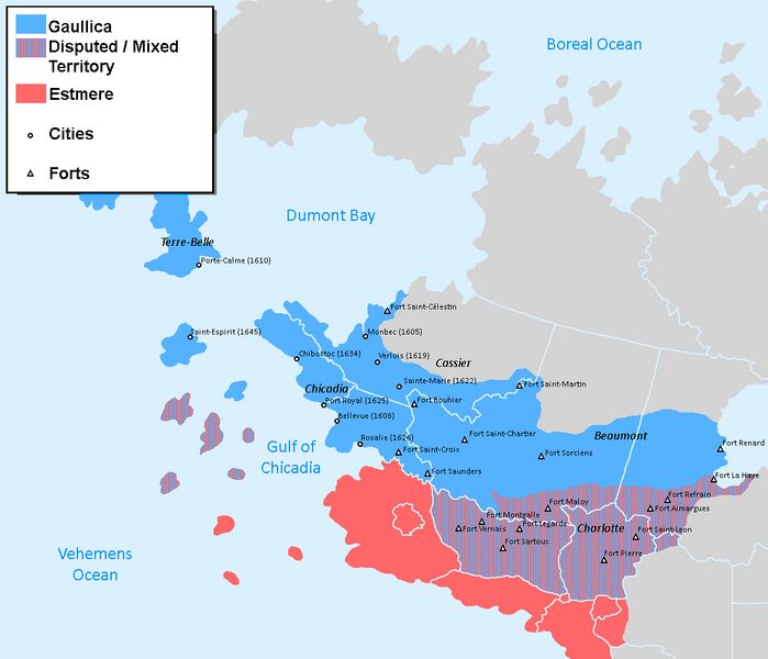
Map of Gaullican territorial claims in Asteria Superior in 1710
File history
Click on a date/time to view the file as it appeared at that time.
| Date/Time | Thumbnail | Dimensions | User | Comment | |
|---|---|---|---|---|---|
| current | 15:45, 6 October 2021 | | 1,162 × 997 (534 KB) | MajorMal (talk | contribs) | |
| 15:22, 3 June 2021 | 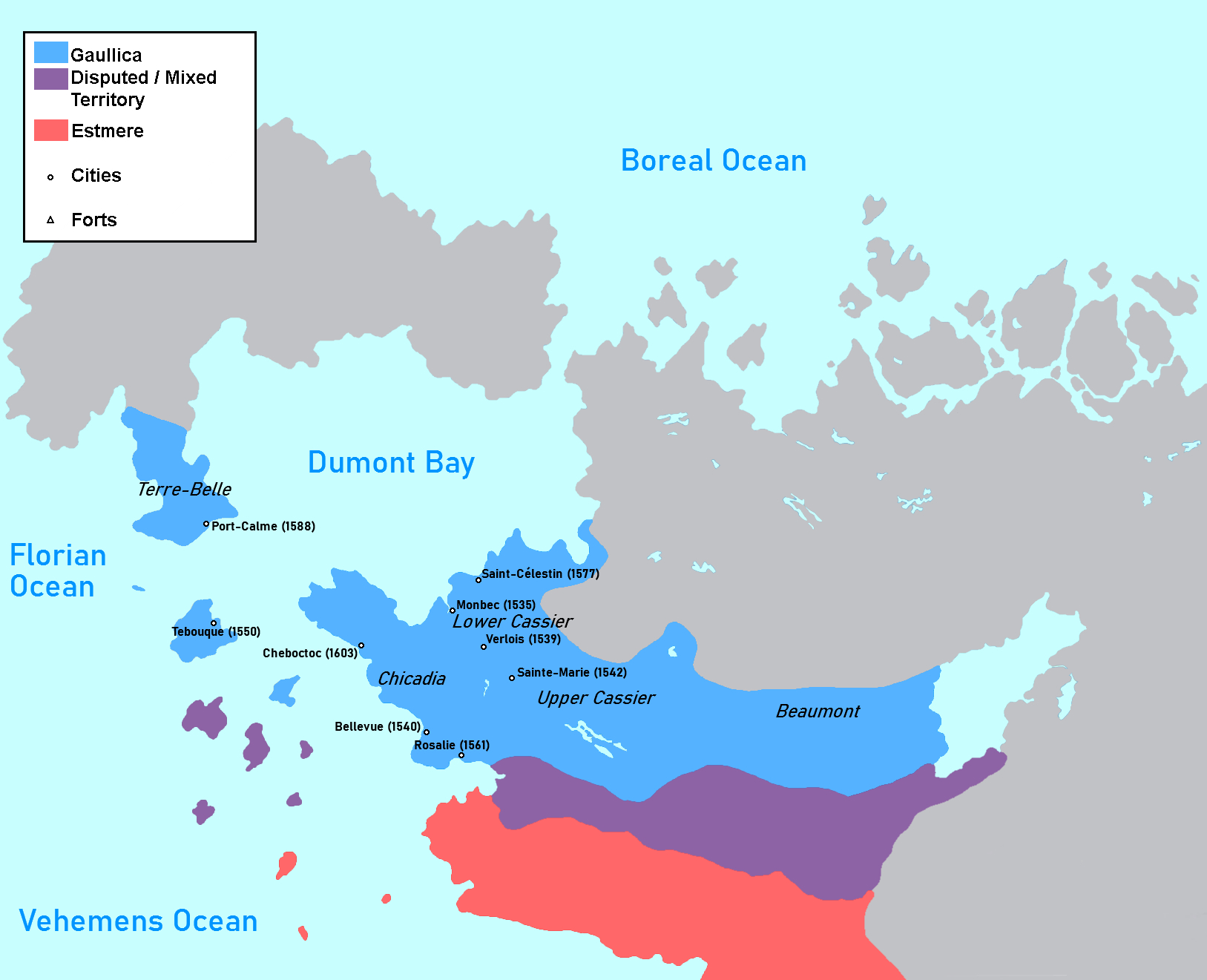 | 1,627 × 1,321 (566 KB) | MajorMal (talk | contribs) | Map of Gaullican territorial claims in Asteria Superior in 1710 |
You cannot overwrite this file.
File usage
The following page uses this file: