File:Chonsan Expedition.png
Jump to navigation
Jump to search

Size of this preview: 444 × 599 pixels. Other resolution: 1,072 × 1,447 pixels.
Original file (1,072 × 1,447 pixels, file size: 126 KB, MIME type: image/png)
Summary
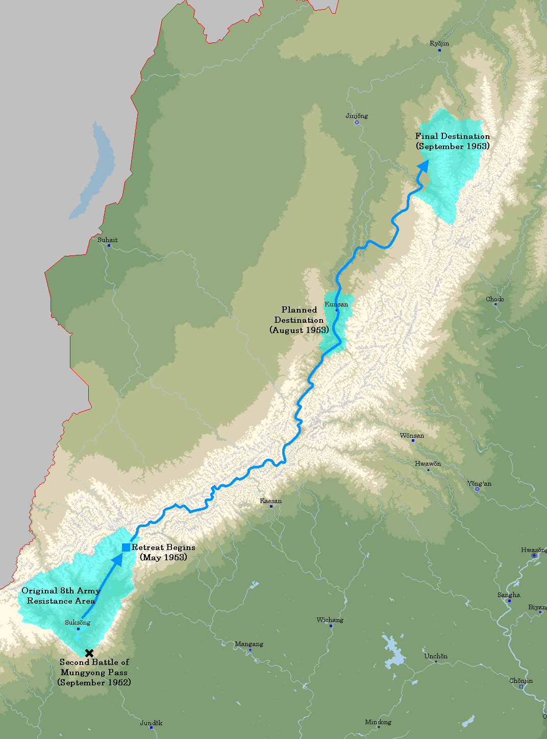
A map of General Yang Tae-sŏng's retreat through the Chŏnsan Mountains during the Menghean War of Liberation.
File history
Click on a date/time to view the file as it appeared at that time.
| Date/Time | Thumbnail | Dimensions | User | Comment | |
|---|---|---|---|---|---|
| current | 19:50, 20 July 2019 | | 1,072 × 1,447 (126 KB) | Soode (talk | contribs) | A map of General Yang Tae-sŏng's retreat through the Chŏnsan Mountains during the Menghean War of Liberation. |
You cannot overwrite this file.
File usage
The following page uses this file: