File:RoInn Main Map.png
Jump to navigation
Jump to search

No higher resolution available.
RoInn_Main_Map.png (545 × 426 pixels, file size: 59 KB, MIME type: image/png)
Summary
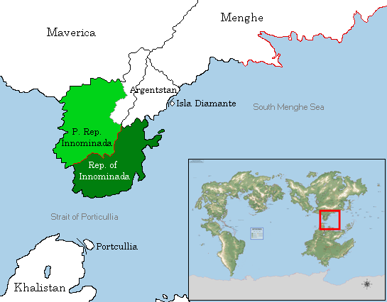
Map showing the location of the Republic of Innominada in Septentrion. Dark green: controlled areas. Light green: claimed areas. Red: demilitarized zone. Borders follow their de facto extent as of 6 June 2018. When Argentstan gained independence, the Republic of Innominada withdrew its claim to the PRI provinces of Mojana and Cauca, which are claimed by Argentstan.
File history
Click on a date/time to view the file as it appeared at that time.
| Date/Time | Thumbnail | Dimensions | User | Comment | |
|---|---|---|---|---|---|
| current | 19:39, 24 November 2019 | | 545 × 426 (59 KB) | Soode (talk | contribs) | Map showing the location of the Republic of Innominada in Septentrion. Dark green: controlled areas. Light green: claimed areas. Red: demilitarized zone. Borders follow their de facto extent as of 6 June 2018. When Argentstan gained indepen... |
You cannot overwrite this file.
File usage
The following page uses this file: