Lo Lanno
This article is incomplete because it is pending further input from participants, or it is a work-in-progress by one author. Please comment on this article's talk page to share your input, comments and questions. Note: To contribute to this article, you may need to seek help from the author(s) of this page. |
Lo Lanno
Λο Λαννο | |
|---|---|
Capital City | |
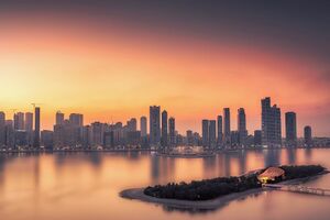
Image of downtown Lo Lanno | |
| Nickname: Lo City | |
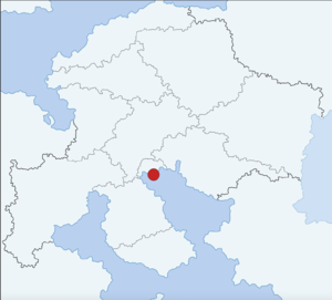
Lo Lanno, marked on a map of The Cape Bay | |
| Country | The Cape Bay |
| Territory | Lo Lanno Metro |
| First Established | ~3,000BCE |
| Founded by | Unknown |
| Capital | Bajing |
| Government | |
| • Body | Council of Lo Lanno |
| • Mayor | Tara Chal-Seng-Hweon (Green - Urban) |
| Area | |
| • Capital City | 6,123 km2 (2,364 sq mi) |
| • Urban | 2,342 km2 (904 sq mi) |
| • Rural | 3,781 km2 (1,460 sq mi) |
| • Metro | 6,123 km2 (2,364 sq mi) |
| Elevation | 9 m (30 ft) |
| Population (2022) | |
| • Capital City | 29,837,815 |
| • Density | 4,900/km2 (13,000/sq mi) |
| Demonym | Lannon |
| Time zone | -2 |
| City Code | 1L-1H-1L |
| Website | www |
Lo Lanno is the biggest and most important city in The Cape Bay. It is the capital of the nation as well as where tourists and immigrants flock to to enjoy the hot summers, beautiful cityscape and stunning beaches and nature. The city is also home to countless skyscrapers with over 170 completed buildings, however it is still second to Port Adela just in The Cape Bay, which has over 300. Lo Lanno is the seat of government as well as home to the main palace of the Cape Royal Family, Lo Lanno palace.
History
Founding History ~3000BCE
Lo Lanno was first founded around the year 3000BCE by the Katao tribe. The tribe had recently left from the Aljian peninsula for unknown reasons and arrived in the site that is now known as Lo Lanno. This, and much of the other information abotu the early city, is according to stone tablets and rock evidence found in remains of early libraries in the centre of the city. The primary economy in the city seemed to be based off basic agriculture and fishing, due to the advantageous geographic location of the area for growing crops due to nutrient rich soil from the Semãe river. The economy remained self contained and isolated for a number of years, until 'small boats' from up the Semãe river arrived in the village. This was documented by the supposed leader of the village, who noted the complex design of the boats and quickly welcomed the visitors to the village. These visitors connected the village to the conneced towns and trade routes to the north, and spread the word of the new port leading into the Madak sea.
Over the coming years the village would expand itself and its port to make room for the way of trade coming down the river, forever changing the fate of the city. Also notable, is the fact that the village was likely called Haneõ according to translations of some texts from this era, but it is difficult to transcribe the writing system used back then into modern characters.
Expansionist Era - 2500BCE - 1200BCE
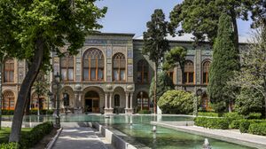
The village sustained itself on being a gradually expanding trade hub without conforming to central larger government, however word from the south spoke of forming larger states between two or even three villages. For this reason the town, and a few others surrounding it, founded the Hinata Kingdom. This started the 1st Dynasty of Tuseõ, which ruled out of Lo Lanno. This is when the city likely got its name, allegdly meaning 'Place of Palaces', as many palaces began construction to house the king and a now larger government. The Hinata Kingdom expanded outwards for centuries but kept Lo Lanno as its capital and hub, exporting its culture and power across the north coast of the Madak Sea. In this era too was the city first mentioned in religious texts and the like, with it being mentioned in some texts as the birthplace of Byengjin, a the protecting guard of Sahaja, the goddess of the sea, and described as the 'jewel of wealth' in the isthmus.
The first large scale temples in the city were also constructed in this time, dedicated mostly to deities controlling wealth, weather and the sea. The Kingdom collapsed in around 1500BCE which created smaller petty states around the city. Due to this the city maintained its power and instead expanded north as the Holy State of Lanno, still lead by the Tuseõ Dynasty. However the kingdom only survived in that state for another 300 years, when a coup overthrew the dynasty and brought back a more democratic system, however this coup also dismantled the kingdom and left the town as its own city state, rather than a larger entity. Despite this, the city still heavily intertwined itself with its neighbours for military protection over larger threats.
Around this time the town developed its architecture into a distinct variation of the larger culture, making it more apt for exquisite visits and extravagance in wealth. Palaces and plazas became common place and people were drawn to the area to experience
Early Colonial Times
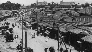
In 1550 the southern island of Al Siyara was officially colonised by the Riamese Empire, giving them a strategic point to launch an invasion of the southern peninsula, belonging to the Chushga Empire. An invasion was launched in 1599 and the Riamese took full control of the lands and Lo Lanno by 1652AD. Lo Lanno was set as the new capital for the colony, seemingly due to its size and defensive position. They called their new colony 'The Royal Cape Lo Lanno stayed an important point, likely the most important point in throughout colonial history in The Cap Bay, not only due to its size and position as a geographical centre, but also as it became a meeting point for locals to interact with their government and empire at a larger scale.
However, in 1794 growing discontent with inequality and a non-representative government led to the people of the city throwing out the royal family, whom fled to the Northern Saho Islands. At this time anti-riamese sentiments also grew leading to locals burning down and destroying riamese neighbourhoods, the riamese retaliated by burning down many historical districts of the city which only caused more tensions. In the following year a mass revolution took place in the eastern colony as the provinces declared independence from the Riamese Empire. Half of the city seceded into The Free Territory of Deljuna, while the other half stayed in the Riamese Empire. The split took place along the Kajasimi river which flowed through the city, and it stood as the official mark of separation for the remainder of the time the colony was split. Both sides took part in tearing down large swaths of buildings and replacing them with ones that fit with the dominating culture, giving the city two very different looking sides. The Free Territory of Deljuna only last another 71 years before collapsing in 1865 due to food shortages, where it then fell back into the hands of the Riamese Empire. The east controlled side of the city came out significantly poorer than the west due to the mismanagement of resources which made the territory extremely poor, to this day there remains a large class divide and wealth disparity between the poorer east and a richer west of the city.


