List of West Monroe Urban/Rural Roads 1-99: Difference between revisions
Jump to navigation
Jump to search
(→RR 3) |
No edit summary |
||
| Line 125: | Line 125: | ||
==RR 3== | ==RR 3== | ||
[[File:RR-3.png|right|300px]] | [[File:RR-3.png|right|300px]] | ||
| Line 213: | Line 212: | ||
|} | |} | ||
{{clear}} | {{clear}} | ||
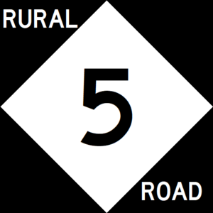
==RR 5== | |||
[[File:RR-5.png|right|300px]] | |||
{{Infobox road | |||
|length_mi=53 | |||
|length_ref= | |||
|formed=1934 | |||
|direction_a=East | |||
|terminus_a= [[File:WM-6.png|25px|link=West Monroe State Highway 6]] in [[Talpa, West Monroe|Talpa]] | |||
|junction= | |||
|direction_b=West | |||
|terminus_b=[[File:WM-45.png|25px|link=West Monroe State Highway 45]] near [[Austwell, West Monroe|Austwell]] | |||
}} | |||
Rural Road 5 serves south Kennedy and central Wilkinson counties, and marks the northern end of the Rhone urban area. | |||
{| class=wikitable | |||
|- | |||
! style="text-align:center; vertical-align:bottom;"| '''County''' | |||
! style="text-align:center; vertical-align:bottom;"| '''Location''' | |||
! style="text-align:center; vertical-align:bottom;"| '''Destination''' | |||
|- | |||
| rowspan="6" | [[Kennedy County, West Monroe|Kennedy]] | |||
| | |||
| [[File:WM-45.png|25px|link=West Monroe State Highway 45]] - [[Oceanview, West Monroe|Oceanview]], [[Austwell, West Monroe|Austwell]] | |||
|- | |||
| | |||
| [[File:US 2.svg|25px|link=Ibican Route 2]] - [[Austwell, West Monroe|Austwell]], [[Orlando, West Monroe|Orlando]] | |||
|- | |||
| | |||
| [[File:I-10.svg|25px|link=Interstate 10]] - [[Barton, West Monroe|Barton]], [[Rhone, West Monroe|Rhone]] | |||
|- | |||
| colspan="2" | [[Amity River]] | |||
|- | |||
| rowspan="2" | [[Lynwood, West Monroe|Lynwood]] | |||
| [[File:US 2.svg|25px|link=Ibican Route 2]] - [[Addison, West Monroe|Addison]], [[Norwood, West Monroe|Norwood]] | |||
|- | |||
| [[File:WM-2.png|25px|link=West Monroe State Highway 2]] - [[Orlando, West Monroe|Orlando]], [[Belton, West Monroe|Belton]] | |||
|- | |||
| rowspan="6" | [[Wilkinson County, West Monroe|Wilkinson]] | |||
| [[Belton, West Monroe|Belton]] | |||
| [[File:North Park Toll Road.png|25px|link=North Park Toll Road]] - [[Castor, West Monroe|Castor]] | |||
|- | |||
| [[May, West Monroe|May]] | |||
| [[File:WM-11.png|25px|link=West Monroe State Highway 11]] - [[Cleveland, West Monroe|Cleveland]], [[Cisco, West Monroe|Cisco]] | |||
|- | |||
| | |||
| [[File:UR-16.png|25px|link=West Monroe Urban Road 16]] - [[Allison, West Monroe|Allison]] | |||
|- | |||
| rowspan="2" | [[Brownwood, West Monroe|Brownwood]] | |||
| [[File:I-30.svg|25px|link=Interstate 30]] - [[Toledo, West Monroe|Toledo]], [[Rhone, West Monroe|Rhone]] | |||
|- | |||
| [[File:UR-65.png|25px|link=West Monroe Urban Road 65]] - [[University of Rhone at Brownwood]] | |||
|- | |||
| [[Talpa, West Monroe|Talpa]] | |||
| [[File:WM-6.png|25px|link=West Monroe State Highway 6]] - [[Glass, West Monroe|Glass]], [[Miles, West Monroe|Miles]] | |||
|} | |||
{{clear}} | |||
[[Category:Urban/Rural Roads in West Monroe|+00]] | [[Category:Urban/Rural Roads in West Monroe|+00]] | ||
[[Category:Lists of roads in West Monroe|Urban/Rural roads 0001]] | [[Category:Lists of roads in West Monroe|Urban/Rural roads 0001]] | ||
[[Category:State highways in West Monroe|Urban/Rural Roads 0001]] | [[Category:State highways in West Monroe|Urban/Rural Roads 0001]] | ||
Revision as of 02:35, 20 June 2023
West Monroe Rural Road and Urban Road markers | |
| Highway names | |
|---|---|
| Interstates | Interstate Highway X (IH-X, I-X) |
| Ibican Route: | Ibican Route X (IR X) |
| Loops: | Loop X |
| Spurs: | Spur X |
| Rural or Urban Roads: | Rural Road X (RR X) Urban Road X (UR X) |
| Park Roads: | Park Road X (PR X) |
Urban and Rural Roads in West Monroe are owned and maintained by the West Monroe Department of Transportation (WMDOT).
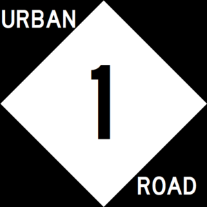
UR 1

| Route information | |
|---|---|
| Length | 41 mi (66 km) |
| Existed | 1934–present |
| Major junctions | |
| South end | |
| North end | |
| County | Location | Destination |
|---|---|---|
| Freemont | Bishop | |
| Cooper River | ||
| Willmington | ||
| East | ||
| West | ||
| Calahan | ||
| Chilton | ||
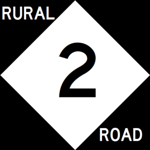
RR 2

| Route information | |
|---|---|
| Length | 25 mi (40 km) |
| Existed | 1934–present |
| Major junctions | |
| South end | |
| North end | |
Rural Road 2 was originally built to serve logging and agricultural interests in Hopkins County, but today is mostly used by people seeking recreation on Lake Hopkins.
| County | Location | Destination |
|---|---|---|
| Hopkins | ||
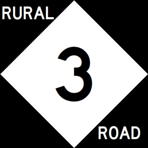
RR 3

| Route information | |
|---|---|
| Length | 22 mi (35 km) |
| Existed | 1934–present |
| Major junctions | |
| East end | |
| West end | |
Rural Road 3 serves the rural areas of central western Kennedy County, connection Addison with Lexington, in Archer County.
| County | Location | Destination |
|---|---|---|
| Archer | Lexington | |
| Kennedy | ||
| Amity River | ||
| Addison | ||
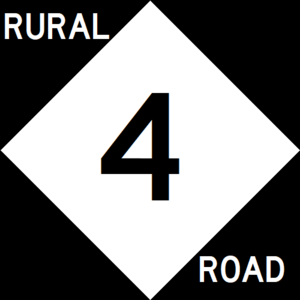
RR 4

| Route information | |
|---|---|
| Length | 42 mi (68 km) |
| Existed | 1934–1965 |
| Major junctions | |
| South end | |
| North end | |
Rural Road 4 formerly served as a connection between Glass, Denton, and Holgate. Its milage was transfered to SH 49 in 1965 to extend that highway south to Glass.
| County | Location | Destination |
|---|---|---|
| Wilinson | Glass | |
| Denton | ||
| Denton | ||
| Fayette | ||
| Holgate |
RR 5

| Route information | |
|---|---|
| Length | 53 mi (85 km) |
| Existed | 1934–present |
| Major junctions | |
| East end | |
| West end | |
Rural Road 5 serves south Kennedy and central Wilkinson counties, and marks the northern end of the Rhone urban area.
| County | Location | Destination |
|---|---|---|
| Kennedy | ||
| Amity River | ||
| Lynwood | ||
| Wilkinson | Belton | |
| May | ||
| Brownwood | ||
| File:UR-65.png - University of Rhone at Brownwood | ||
| Talpa | ||