Alabaster Gulf: Difference between revisions
Jump to navigation
Jump to search
No edit summary |
mNo edit summary |
||
| Line 21: | Line 21: | ||
| rivers = Ashjker River <br> Antin River <br> Lew <br> Wágh <br> Morrawian <br> Tähjahr <br> | | rivers = Ashjker River <br> Antin River <br> Lew <br> Wágh <br> Morrawian <br> Tähjahr <br> | ||
| outflow = | | outflow = | ||
| oceans = Sunadic Ocean | | oceans = [[Sunadic Ocean]] | ||
| catchment = <!-- {{convert|VALUE|UNITS}} must be used --> | | catchment = <!-- {{convert|VALUE|UNITS}} must be used --> | ||
| basin_countries = [[Kakosian Basin]] | | basin_countries = [[Kakosian Basin]] | ||
Revision as of 05:09, 22 June 2023
| Alabaster Gulf | |
|---|---|
 Alabaster Gulf | |
| Location | Eastern Thrismari, Southern Sunadic |
| Type | Gulf |
| Part of | Sunadic Ocean Thrismari |
| River sources | Ashjker River Antin River Lew Wágh Morrawian Tähjahr |
| Ocean/sea sources | Sunadic Ocean |
| Basin countries | Kakosian Basin |
| Islands | Gotos Islands Various other smaller islands |
| Settlements | Khaygavar Jāk Gotos City Veligrad Králowec |
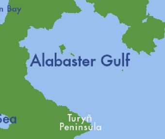
The Alabaster Gulf (Kakish: Camas ej Alabastar; Khaygic: Muras ehj Alabastar; Tahjahrki: Gyry i Alabastry; Häyän: Alabast’ris Q’ure; Morrawian: Alabastrový Záliv; Abyghe: Askaluu khy Aushu) is a gulf located in the Southern Sunadic Ocean in Eastern Thrismari. It borders the nations of Kakland, Morrawia, Barceria, Zepherin. and New Greenia. It is one of the most important bodies of water in terms of trading. Historically it was dominated by the Ahian Empire, the Kingdom of Kysxka, Riamo, Morrawia, Barceria, and Kakland since the 300s BCE to modern day. Though nautical borders only reach twelve miles from the coastline, Kakland claims most of the gulf with the existence of the Gotos Islands resting in the middle of the gulf.